 |
|
Location & QuickFacts
| FAA Information Effective: | 2008-09-25 |
| Airport Identifier: | 79MO |
| Airport Status: | Operational |
| Longitude/Latitude: | 090-32-36.0000W/36-59-12.0000N
-90.543333/36.986667 (Estimated) |
| Elevation: | 450 ft / 137.16 m (Estimated) |
| Land: | 40 acres |
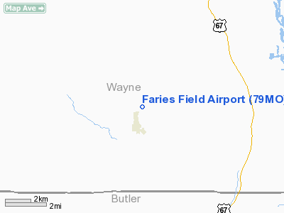
| From nearest city: | 1 nautical miles N of Williamsville, MO |
| Location: | Wayne County, MO |
| Magnetic Variation: | 02E (1990) |
Owner & Manager
| Ownership: | Privately owned |
| Owner: | Joseph G Faries |
| Address: | Hcr 1 Box 42
Williamsville, MO 63967 |
| Phone number: | 573-998-2538 |
| Manager: | Joseph G Faries |
| Address: | Hcr 1 Box 42
Williamsville, MO 63967 |
| Phone number: | 314-998-2538 |
Airport Operations and Facilities
| Airport Use: | Private |
| Wind indicator: | Yes |
| Segmented Circle: | No |
| Control Tower: | No |
| Sectional chart: | St Louis |
| Region: | ACE - Central |
| Boundary ARTCC: | ZME - Memphis |
| Tie-in FSS: | STL - Saint Louis |
| FSS on Airport: | No |
| FSS Toll Free: | 1-800-WX-BRIEF |
Runway Information
Runway 06/24
| Dimension: | 3000 x 75 ft / 914.4 x 22.9 m |
| Surface: | TURF, |
| |
Runway 06 |
Runway 24 |
| Traffic Pattern: | Left | Right |
| Obstruction: | 488 ft tower, 5280.0 ft from runway | 30 ft trees, 1320.0 ft from runway |
|
Runway 17/35
| Dimension: | 2000 x 50 ft / 609.6 x 15.2 m |
| Surface: | TURF, |
| |
Runway 17 |
Runway 35 |
| Traffic Pattern: | Left | Left |
| Obstruction: | 20 ft plines | |
|
Radio Navigation Aids
| ID |
Type |
Name |
Ch |
Freq |
Var |
Dist |
| FD | NDB | Earli | | 278.00 | 03E | 21.7 nm |
| DXE | NDB | Dexter | | 423.00 | 00E | 31.3 nm |
| PRI | NDB | Perrine | | 367.00 | 02E | 47.1 nm |
| CGI | VOR/DME | Cape Girardeau | 076X | 112.90 | 01E | 48.7 nm |
| MAW | VORTAC | Malden | 049X | 111.20 | 03E | 40.0 nm |
| FAM | VORTAC | Farmington | 104X | 115.70 | 01E | 43.8 nm |
Remarks
- PRVDD CLEAR APCH TO EACH RY FOR A 20:1 GLIDE SLOPE AND A CLEAR TRANSITIONAL SFC FOR A 7:1 SLOPE.
Images and information placed above are from
http://www.airport-data.com/airport/79MO/
We thank them for the data!
| General Info
|
| Country |
United States
|
| State |
MISSOURI
|
| FAA ID |
79MO
|
| Latitude |
36-59-12.000N
|
| Longitude |
090-32-36.000W
|
| Elevation |
450 feet
|
| Near City |
WILLIAMSVILLE
|
We don't guarantee the information is fresh and accurate. The data may
be wrong or outdated.
For more up-to-date information please refer to other sources.
|
|


