 |
|
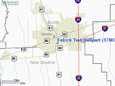
Location & QuickFacts
| FAA Information Effective: | 2008-09-25 |
| Airport Identifier: | 57MO |
| Airport Status: | Operational |
| Longitude/Latitude: | 089-34-42.2870W/36-52-07.1890N
-89.578413/36.868664 (Estimated) |
| Elevation: | 325 ft / 99.06 m (Estimated) |
| Land: | 0 acres |
| From nearest city: | 0 nautical miles N of Sikeston, MO |
| Location: | New Madrid County, MO |
| Magnetic Variation: | 01E (1990) |
Owner & Manager
| Ownership: | Privately owned |
| Owner: | Fabick Brothers Equipment Co. |
| Address: | 912 S. Main St, Po Box 310
Sikeston, MO 63801 |
| Phone number: | 573-471-5941 |
| Manager: | Jerry Kaemmer |
| Address: | 1 Fabick Drive
Fenton, MO 63026 |
| Phone number: | 573-343-5900 |
Airport Operations and Facilities
| Airport Use: | Private |
| Segmented Circle: | No |
| Control Tower: | No |
| Sectional chart: | St Louis |
| Region: | ACE - Central |
| Boundary ARTCC: | ZME - Memphis |
| Tie-in FSS: | STL - Saint Louis |
| FSS on Airport: | No |
| FSS Toll Free: | 1-800-WX-BRIEF |
Runway Information
Helipad H1
| Dimension: | 120 x 95 ft / 36.6 x 29.0 m |
| Surface: | ASPH, |
| |
Runway H1 |
Runway |
| Traffic Pattern: | Left | Left |
|
Radio Navigation Aids
| ID |
Type |
Name |
Ch |
Freq |
Var |
Dist |
| CHQ | NDB | Charleston | | 208.00 | 01E | 10.8 nm |
| DXE | NDB | Dexter | | 423.00 | 00E | 18.1 nm |
| CIR | NDB | Cairo | | 397.00 | 00E | 20.6 nm |
| FD | NDB | Earli | | 278.00 | 03E | 38.1 nm |
| UC | NDB | Obion | | 212.00 | 00E | 44.4 nm |
| TKX | NDB | Kennett | | 358.00 | 00E | 44.4 nm |
| BDD | NDB | Bellgrade | | 254.00 | 00E | 46.6 nm |
| GGK | NDB | Mayfield | | 401.00 | 00E | 48.7 nm |
| CGI | VOR/DME | Cape Girardeau | 076X | 112.90 | 01E | 21.6 nm |
| MAW | VORTAC | Malden | 049X | 111.20 | 03E | 24.8 nm |
| CNG | VORTAC | Cunningham | 078X | 113.10 | 03E | 36.6 nm |
Remarks
- OWNER DESIRES ARPT NOT BE CHARTED.
- APCH/DEP PATHS ARE CLEAR FOR AN 8:1 SLOPE & TRANSITIONAL SURFACE FOR A 2:1 SLOPE.
Images and information placed above are from
http://www.airport-data.com/airport/57MO/
We thank them for the data!
| General Info
|
| Country |
United States
|
| State |
MISSOURI
|
| FAA ID |
57MO
|
| Latitude |
36-52-07.189N
|
| Longitude |
089-34-42.287W
|
| Elevation |
325 feet
|
| Near City |
SIKESTON
|
We don't guarantee the information is fresh and accurate. The data may
be wrong or outdated.
For more up-to-date information please refer to other sources.
|
|


