 |
|
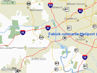
Fabick-colmarile Heliport |
Location & QuickFacts
| FAA Information Effective: | 2008-09-25 |
| Airport Identifier: | MU99 |
| Airport Status: | Operational |
| Longitude/Latitude: | 090-27-14.0000W/38-31-30.0000N
-90.453889/38.525000 (Estimated) |
| Elevation: | 530 ft / 161.54 m (Estimated) |
| Land: | 0 acres |
| From nearest city: | 0 nautical miles N of Fenton, MO |
| Location: | St Louis County, MO |
| Magnetic Variation: | 02E (1990) |
Owner & Manager
| Ownership: | Privately owned |
| Owner: | John Fabick Sr |
| Address: | 1 Fabick Drive
Fenton, MO 63026 |
| Phone number: | 314-343-5900 |
| Manager: | Gerald A Kaemmer |
| Address: | 1 Fabick Drive
Fenton, MO 63026 |
| Phone number: | 573-343-5900 |
Airport Operations and Facilities
| Airport Use: | Private |
| Wind indicator: | Yes |
| Segmented Circle: | No |
| Control Tower: | No |
| Sectional chart: | St Louis |
| Region: | ACE - Central |
| Boundary ARTCC: | ZKC - Kansas City |
| Tie-in FSS: | STL - Saint Louis |
| FSS on Airport: | No |
| FSS Toll Free: | 1-800-WX-BRIEF |
Runway Information
Helipad H1
| Dimension: | 27 x 27 ft / 8.2 x 8.2 m |
| Surface: | TURF, |
| |
Runway H1 |
Runway |
| Traffic Pattern: | Left | Left |
|
Radio Navigation Aids
| ID |
Type |
Name |
Ch |
Freq |
Var |
Dist |
| LM | NDB | Oblio | | 338.00 | 00E | 16.6 nm |
| FES | NDB | Festus | | 269.00 | 01E | 20.0 nm |
| CVM | NDB | Civic Memorial | | 263.00 | 02E | 28.9 nm |
| BL | NDB | Belleville | | 362.00 | 02E | 33.0 nm |
| UUV | NDB | Sullivan | | 356.00 | 02E | 37.7 nm |
| SAR | NDB | Sparta | | 239.00 | 01E | 42.1 nm |
| PRI | NDB | Perrine | | 367.00 | 02E | 45.7 nm |
| SKE | TACAN | Scott | 059X | | 02E | 28.3 nm |
| CSX | VOR/DME | Cardinal | 111Y | 116.45 | 00E | 14.4 nm |
| STL | VORTAC | St Louis | 121X | 117.40 | 01E | 20.2 nm |
| FTZ | VORTAC | Foristell | 045X | 110.80 | 05E | 26.3 nm |
| TOY | VORTAC | Troy | 107X | 116.00 | 04E | 28.2 nm |
| SUS | VOT | Spirit Of St Louis | | 112.20 | | 12.4 nm |
| STL | VOT | St Louis Lambert | | 111.00 | | 14.1 nm |
Remarks
- PROVIDED CLEAR APCH/DEP PATHS FOR A MINIMUM 8:1 GLIDE SLOPE AND A CLEAR TRANSITIONAL SFC FOR A MINIMUM 2:1 SLOPE.
Images and information placed above are from
http://www.airport-data.com/airport/MU99/
We thank them for the data!
| General Info
|
| Country |
United States
|
| State |
MISSOURI
|
| FAA ID |
MU99
|
| Latitude |
38-31-30.000N
|
| Longitude |
090-27-14.000W
|
| Elevation |
530 feet
|
| Near City |
FENTON
|
We don't guarantee the information is fresh and accurate. The data may
be wrong or outdated.
For more up-to-date information please refer to other sources.
|
|


