 |
|
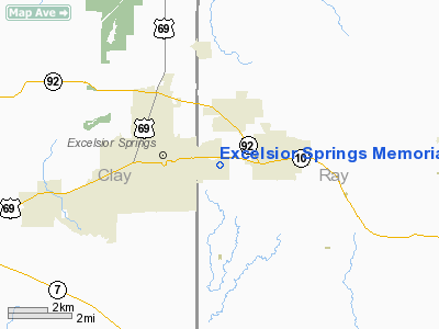
Excelsior Springs Memorial Airport |
Location & QuickFacts
| FAA Information Effective: | 2008-09-25 |
| Airport Identifier: | 3EX |
| Airport Status: | Operational |
| Longitude/Latitude: | 094-11-51.8000W/39-20-14.0180N
-94.197722/39.337227 (Estimated) |
| Elevation: | 997 ft / 303.89 m (Estimated) |
| Land: | 53 acres |
| From nearest city: | 1 nautical miles E of Excelsior Springs, MO |
| Location: | Ray County, MO |
| Magnetic Variation: | 07E (1965) |
Owner & Manager
| Ownership: | Publicly owned |
| Owner: | City Of Excelsior Springs |
| Address: | 201 E Broadway
Excelsior Springs, MO 64024 |
| Phone number: | 816-630-0750 |
| Manager: | Art Gentry |
| Address: | 1203 E Golf Hill
Excelsior Springs, MO 64024 |
| Phone number: | 816-630-9570
ALTERNATE PHONE NMBRS (816)-630-4182, (816)-630-3444, (816)-510-9922, OR (816)-630-1503. |
Airport Operations and Facilities
| Airport Use: | Open to public |
| Wind indicator: | Yes |
| Segmented Circle: | Yes |
| Control Tower: | No |
| Lighting Schedule: | DUSK-DAWN |
| Beacon Color: | Clear-Green (lighted land airport) |
| Landing fee charge: | No |
| Sectional chart: | Kansas City |
| Region: | ACE - Central |
| Boundary ARTCC: | ZKC - Kansas City |
| Tie-in FSS: | COU - Columbia |
| FSS on Airport: | No |
| FSS Toll Free: | 1-800-WX-BRIEF |
| NOTAMs Facility: | COU (NOTAM-d service avaliable) |
| Federal Agreements: | 1 |
Airport Communications
| CTAF: | 122.700 |
| Unicom: | 122.700 |
Airport Services
| Fuel available: | 100LLMOGAS
FOR FUEL AFTER HOURS CALL (816) 510-9922 OR (816)-630-4182. |
| Airframe Repair: | MAJOR |
| Power Plant Repair: | MAJOR |
| Bottled Oxygen: | NONE |
| Bulk Oxygen: | NONE |
Runway Information
Runway 01/19
| Dimension: | 2000 x 47 ft / 609.6 x 14.3 m |
| Surface: | ASPH, Fair Condition |
| Surface Treatment: | Aggregate Friction Seal Coat |
| Weight Limit: | Single wheel: 4000 lbs. |
| Edge Lights: | Non-standard lighting system
RWY 01/19 NSTD LIRL; INCORRECT SPACING OF THLD LGTS. |
| |
Runway 01 |
Runway 19 |
| Longitude: | 094-11-55.5800W | 094-11-44.1800W |
| Latitude: | 39-20-06.9000N | 39-20-24.5800N |
| Alignment: | 27 | 127 |
| Traffic Pattern: | Left | Left |
| Markings: | Nonstandard, Poor Condition
MARKINGS FADED. | Nonstandard, Poor Condition
MARKINGS FADED. |
| Obstruction: | 53 ft tree, 382.0 ft from runway, 159 ft left of centerline, 3:1 slope to clear
RWY 01 +1-3 FT GND; 125-200 FT FM RY END L & R; +39 FT TREE 170 FT FM RY END 165 FT L & +21 FT TREE 200 FT FM RY END 245 FT L. | 74 ft trees, 806.0 ft from runway, 212 ft left of centerline, 8:1 slope to clear
+1-10 FT ROAD 0-200 FT FM RY END 120-160 FT R. |
|
Radio Navigation Aids
| ID |
Type |
Name |
Ch |
Freq |
Var |
Dist |
| GPH | NDB | Mosby | | 284.00 | 03E | 5.1 nm |
| EZZ | NDB | Cameron | | 394.00 | 03E | 23.8 nm |
| LXT | NDB | Lesumit | | 263.00 | 04E | 24.0 nm |
| DO | NDB | Dotte | | 359.00 | 05E | 26.6 nm |
| GQ | NDB | Norge | | 517.00 | 05E | 27.0 nm |
| GKB | NDB | Norge | | 517.00 | 05E | 27.0 nm |
| CHT | NDB | Chillicothe | | 375.00 | 03E | 42.0 nm |
| AZN | NDB | Amazon | | 233.00 | 06E | 46.5 nm |
| PUR | NDB | Marshall | | 371.00 | 03E | 49.9 nm |
| SZL | TACAN | Whiteman | 035X | | 04E | 47.1 nm |
| RIS | VOR/DME | Riverside | 051X | 111.40 | 05E | 22.7 nm |
| BQS | VOR/DME | Braymer | 049X | 111.20 | 03E | 23.1 nm |
| OJC | VOR/DME | Johnson County | 077X | 113.00 | 06E | 39.0 nm |
| ANX | VORTAC | Napoleon | 087X | 114.00 | 07E | 14.9 nm |
| MCI | VORTAC | Kansas City | 079Y | 113.25 | 05E | 25.3 nm |
| MKC | VOT | Kansas City Downtown | | 108.60 | | 22.6 nm |
Remarks
- WILDLIFE ON & INVOF ARPT.
- INSUFFICIENT RWY SAFETY AREA AT RWY 01 END. TREES, BRUSH, FENCE, NTSD GRADE, GOLF COURSE.
- EXISTED PRIOR TO 1959.
Images and information placed above are from
http://www.airport-data.com/airport/3EX/
We thank them for the data!
| General Info
|
| Country |
United States
|
| State |
MISSOURI
|
| FAA ID |
3EX
|
| Latitude |
39-20-14.018N
|
| Longitude |
094-11-51.800W
|
| Elevation |
997 feet
|
| Near City |
EXCELSIOR SPRINGS
|
We don't guarantee the information is fresh and accurate. The data may
be wrong or outdated.
For more up-to-date information please refer to other sources.
|
|


