 |
|
Location & QuickFacts
| FAA Information Effective: | 2008-09-25 |
| Airport Identifier: | MU68 |
| Airport Status: | Operational |
| Longitude/Latitude: | 091-32-09.5960W/38-40-08.1610N
-91.535999/38.668934 (Estimated) |
| Elevation: | 920 ft / 280.42 m (Estimated) |
| Land: | 6 acres |
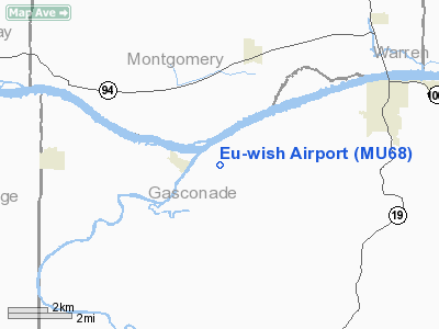
| From nearest city: | 4 nautical miles W of Hermann, MO |
| Location: | Gasconade County, MO |
| Magnetic Variation: | 03E (1985) |
Owner & Manager
| Ownership: | Privately owned |
| Owner: | Eu-wish Inc. |
| Address: | Rt 2
Hermann, MO 65041 |
| Phone number: | 314-486-3215 |
| Manager: | Karl H. Paubel |
| Address: | Rt 2 Box 147b
Hermann, MO 65041 |
| Phone number: | 314-486-3215 |
Airport Operations and Facilities
| Airport Use: | Private |
| Wind indicator: | Yes
WIND CONE & WIND TEE. |
| Segmented Circle: | No |
| Control Tower: | No |
| Lighting Schedule: | PHONE REQ
FOR MIRL RY 18/36 CALL 314-486-3215. |
| Sectional chart: | Kansas City |
| Region: | ACE - Central |
| Boundary ARTCC: | ZKC - Kansas City |
| Tie-in FSS: | STL - Saint Louis |
| FSS Toll Free: | 1-800-WX-BRIEF |
Runway Information
Runway 18/36
| Dimension: | 1700 x 75 ft / 518.2 x 22.9 m |
| Surface: | TURF, |
| Edge Lights: | Medium |
| |
Runway 18 |
Runway 36 |
| Traffic Pattern: | Left | Left |
| Obstruction: | 50 ft trees, 200.0 ft from runway | 320 ft tower, 1100.0 ft from runway |
|
Radio Navigation Aids
| ID |
Type |
Name |
Ch |
Freq |
Var |
Dist |
| FTT | NDB | Guthrie | | 317.00 | 03E | 24.3 nm |
| JE | NDB | Algoa | | 397.00 | 03E | 26.2 nm |
| UUV | NDB | Sullivan | | 356.00 | 02E | 31.4 nm |
| ONH | NDB | Noah | | 515.00 | 03E | 33.3 nm |
| UBX | NDB | Cuba | | 380.00 | 01E | 36.6 nm |
| VIH | VOR/DME | Vichy | 124X | 117.70 | 06E | 32.0 nm |
| COU | VOR/DME | Columbia | 039X | 110.20 | 03E | 33.1 nm |
| FTZ | VORTAC | Foristell | 045X | 110.80 | 05E | 26.5 nm |
| HLV | VORTAC | Hallsville | 089X | 114.20 | 06E | 38.5 nm |
| JEF | VOT | Jefferson City | | 112.00 | | 29.2 nm |
| SUS | VOT | Spirit Of St Louis | | 112.20 | | 41.5 nm |
Remarks
- PROVIDED APCHSARE MAINTAINED FOR A 20:1 GLIDE SLOPE;TRANSITIONAL SURFACE FOR A 7:1 SLOPE.
Images and information placed above are from
http://www.airport-data.com/airport/MU68/
We thank them for the data!
| General Info
|
| Country |
United States
|
| State |
MISSOURI
|
| FAA ID |
MU68
|
| Latitude |
38-40-08.161N
|
| Longitude |
091-32-09.596W
|
| Elevation |
920 feet
|
| Near City |
HERMANN
|
We don't guarantee the information is fresh and accurate. The data may
be wrong or outdated.
For more up-to-date information please refer to other sources.
|
|


