 |
|
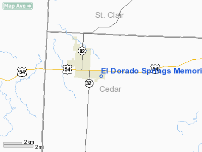
El Dorado Springs Memorial Airport |
Location & QuickFacts
| FAA Information Effective: | 2008-09-25 |
| Airport Identifier: | 87K |
| Airport Status: | Operational |
| Longitude/Latitude: | 093-59-51.5000W/37-51-25.7000N
-93.997639/37.857139 (Estimated) |
| Elevation: | 931 ft / 283.77 m (Estimated) |
| Land: | 70 acres |
| From nearest city: | 2 nautical miles SE of El Dorado Springs, MO |
| Location: | Cedar County, MO |
| Magnetic Variation: | 05E (1985) |
Owner & Manager
| Ownership: | Publicly owned |
| Owner: | City Of El Dorado Springs |
| Address: | 127 W Spring
El Dorado Springs, MO 64744 |
| Phone number: | 417-876-2521 |
| Manager: | Jerry Shilt |
| Address: | 3665 E. 320 Rd.
El Dorado Springs, MO 64744 |
| Phone number: | 417-876-4370 |
Airport Operations and Facilities
| Airport Use: | Open to public |
| Wind indicator: | Yes |
| Segmented Circle: | No |
| Control Tower: | No |
| Lighting Schedule: | DUSK-DAWN
ACTVT MIRL RY 04/22 - CTAF. |
| Beacon Color: | Clear-Green (lighted land airport) |
| Landing fee charge: | No |
| Sectional chart: | Kansas City |
| Region: | ACE - Central |
| Boundary ARTCC: | ZKC - Kansas City |
| Tie-in FSS: | COU - Columbia |
| FSS on Airport: | No |
| FSS Toll Free: | 1-800-WX-BRIEF |
| NOTAMs Facility: | COU (NOTAM-d service avaliable) |
Airport Communications
| CTAF: | 122.800 |
| Unicom: | 122.800 |
Airport Services
| Bottled Oxygen: | NONE |
| Bulk Oxygen: | NONE |
Runway Information
Runway 04/22
| Dimension: | 3295 x 50 ft / 1004.3 x 15.2 m |
| Surface: | ASPH, Good Condition |
| Edge Lights: | Medium |
| |
Runway 04 |
Runway 22 |
| Longitude: | 094-00-11.9800W | 093-59-41.6400W |
| Latitude: | 37-51-13.0300N | 37-51-35.0000N |
| Traffic Pattern: | Left | Left |
| Markings: | Basic, Good Condition | Basic, Good Condition |
| Obstruction: | 27 ft trees, 229.0 ft from runway, 117 ft right of centerline, 1:1 slope to clear | 47 ft trees, 605.0 ft from runway, 95 ft right of centerline, 8:1 slope to clear |
|
Runway 18/36
| Dimension: | 2430 x 50 ft / 740.7 x 15.2 m |
| Surface: | TURF, Good Condition |
| |
Runway 18 |
Runway 36 |
| Longitude: | 093-59-43.5300W | 093-59-44.9700W |
| Latitude: | 37-51-40.0000N | 37-51-16.0000N |
| Traffic Pattern: | Left | Left |
| Obstruction: | 20 ft trees, 33.0 ft from runway, 71 ft left of centerline, 1:1 slope to clear | 29 ft trees, 69.0 ft from runway, 97 ft left of centerline, 2:1 slope to clear |
|
Radio Navigation Aids
| ID |
Type |
Name |
Ch |
Freq |
Var |
Dist |
| EAD | NDB | Nevada | | 209.00 | 06E | 14.5 nm |
| LLU | NDB | Spring River | | 356.00 | 05E | 26.8 nm |
| GLY | NDB | Golden Valley | | 388.00 | 04E | 33.6 nm |
| FSK | NDB | Fort Scott | | 379.00 | 05E | 36.6 nm |
| PTS | NDB | Pittsburg | | 365.00 | 05E | 42.7 nm |
| ILJ | NDB | Willard | | 254.00 | 03E | 42.8 nm |
| BUM | VORTAC | Butler | 106X | 115.90 | 07E | 34.1 nm |
| SGF | VORTAC | Springfield | 116X | 116.90 | 04E | 43.7 nm |
Remarks
- WILDLIFE ON & INVOF ARPT.
- INSUF RWY SAFETY AREA LENGTH BYND EACH END OF RWY 18/36. TREES WITHIN RWY SAFETY AREA AT EACH END OF RWY 18/36.
Images and information placed above are from
http://www.airport-data.com/airport/87K/
We thank them for the data!
| General Info
|
| Country |
United States
|
| State |
MISSOURI
|
| FAA ID |
87K
|
| Latitude |
37-51-24.017N
|
| Longitude |
093-59-56.812W
|
| Elevation |
931 feet
|
| Near City |
EL DORADO SPRINGS
|
We don't guarantee the information is fresh and accurate. The data may
be wrong or outdated.
For more up-to-date information please refer to other sources.
|
|


