 |
|
Location & QuickFacts
| FAA Information Effective: | 2008-09-25 |
| Airport Identifier: | MU36 |
| Airport Status: | Operational |
| Longitude/Latitude: | 092-41-45.6710W/38-11-06.1150N
-92.696020/38.185032 (Estimated) |
| Elevation: | 729 ft / 222.20 m (Estimated) |
| Land: | 0 acres |
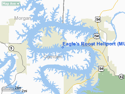
| From nearest city: | 5 nautical miles NE of Bagnel, MO |
| Location: | Camden County, MO |
| Magnetic Variation: | 04E (1985) |
Owner & Manager
| Ownership: | Privately owned |
| Owner: | Anheuser-busch Companies Inc. |
| Address: | P.o. Box 3139
Chesterfield, MO 63006 |
| Phone number: | 314-577-2000 |
| Manager: | Carl E. Henke |
| Address: | P.o. Box 3139
Chesterfield, MO 63006 |
| Phone number: | 314-532-2448 |
Airport Operations and Facilities
| Airport Use: | Private |
| Wind indicator: | Yes |
| Segmented Circle: | No |
| Control Tower: | No |
| Lighting Schedule: | RDO-CTL
ACTVT PERIMETER LGTS - 122.75 OR CALL 314-532-2448. |
| Landing fee charge: | No |
| Sectional chart: | Kansas City |
| Region: | ACE - Central |
| Boundary ARTCC: | ZKC - Kansas City |
| Tie-in FSS: | COU - Columbia |
| FSS on Airport: | No |
| FSS Toll Free: | 1-800-WX-BRIEF |
Airport Communications
Runway Information
Helipad H1
| Dimension: | 65 x 65 ft / 19.8 x 19.8 m |
| Surface: | CONC, |
| |
Runway H1 |
Runway |
| Traffic Pattern: | Left | Left |
|
Radio Navigation Aids
| ID |
Type |
Name |
Ch |
Freq |
Var |
Dist |
| AIZ | NDB | Kaiser | | 377.00 | 05E | 8.6 nm |
| ONH | NDB | Noah | | 515.00 | 03E | 34.5 nm |
| JE | NDB | Algoa | | 397.00 | 03E | 36.6 nm |
| IEB | NDB | Lebanon | | 414.00 | 03E | 36.9 nm |
| DMO | NDB | Sedalia | | 281.00 | 03E | 38.6 nm |
| BHN | NDB | Buckhorn | | 391.00 | 03E | 40.6 nm |
| VER | NDB | Viertel | | 347.00 | 02E | 46.0 nm |
| GLY | NDB | Golden Valley | | 388.00 | 04E | 47.8 nm |
| HCK | NDB | Hawks | | 296.00 | 04E | 49.1 nm |
| TBN | VOR | Forney | | 110.00 | 03E | 37.5 nm |
| SHY | VOR/DME | Sunshine | 021X | 108.40 | 05E | 9.7 nm |
| COU | VOR/DME | Columbia | 039X | 110.20 | 03E | 43.8 nm |
| VIH | VOR/DME | Vichy | 124X | 117.70 | 06E | 46.8 nm |
| JEF | VOT | Jefferson City | | 112.00 | | 35.4 nm |
Remarks
- APCH/DEP PATHES ARE MAINTAINED FOR AN 8:1 GLIDE SLOPE AND TRANSITIONAL SURFACES 2:1 SLOPE.
Images and information placed above are from
http://www.airport-data.com/airport/MU36/
We thank them for the data!
| General Info
|
| Country |
United States
|
| State |
MISSOURI
|
| FAA ID |
MU36
|
| Latitude |
38-11-06.115N
|
| Longitude |
092-41-45.671W
|
| Elevation |
729 feet
|
| Near City |
BAGNEL
|
We don't guarantee the information is fresh and accurate. The data may
be wrong or outdated.
For more up-to-date information please refer to other sources.
|
|


