 |
|
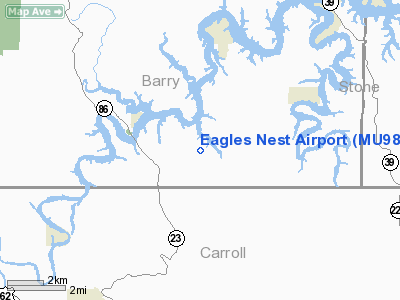
Location & QuickFacts
| FAA Information Effective: | 2008-09-25 |
| Airport Identifier: | MU98 |
| Airport Status: | Operational |
| Longitude/Latitude: | 093-41-01.0000W/36-31-05.0000N
-93.683611/36.518056 (Estimated) |
| Elevation: | 1000 ft / 304.80 m (Estimated) |
| Land: | 0 acres |
| From nearest city: | 1 nautical miles SW of Golden, MO |
| Location: | Barry County, MO |
| Magnetic Variation: | 04E (1990) |
Owner & Manager
| Ownership: | Privately owned |
| Owner: | Joel Frana |
| Address: | H C Route 1 Box 1312
Eagle Rock, MO 65641 |
| Phone number: | 417-271-0399 |
| Manager: | Joel Frana |
| Address: | H C Route 1 Box 1312
Eagle Rock, MO 65641 |
| Phone number: | 417-271-0399 |
Airport Operations and Facilities
| Airport Use: | Private |
| Segmented Circle: | No |
| Control Tower: | No |
| Sectional chart: | Kansas City |
| Region: | ACE - Central |
| Boundary ARTCC: | ZME - Memphis |
| Tie-in FSS: | COU - Columbia |
| FSS on Airport: | No |
| FSS Toll Free: | 1-800-WX-BRIEF |
Runway Information
Runway 02/20
| Dimension: | 3100 x 40 ft / 944.9 x 12.2 m |
| Surface: | TURF, |
| |
Runway 02 |
Runway 20 |
| Traffic Pattern: | Left | Left |
|
Radio Navigation Aids
| ID |
Type |
Name |
Ch |
Freq |
Var |
Dist |
| PLK | NDB | Point Lookout/dcmsnd | | 204.00 | 03E | 22.9 nm |
| SLG | NDB | Siloam Springs | | 284.00 | 04E | 43.7 nm |
| ILJ | NDB | Willard | | 254.00 | 03E | 48.4 nm |
| HRO | VOR/DME | Harrison | 072X | 112.50 | 04E | 25.7 nm |
| DAK | VOR/DME | Drake | 025X | 108.80 | 07E | 37.9 nm |
| EOS | VOR/DME | Neosho | 120X | 117.30 | 07E | 41.2 nm |
| RZC | VORTAC | Razorback | 111X | 116.40 | 04E | 26.7 nm |
| DGD | VORTAC | Dogwood | 031X | 109.40 | 06E | 49.3 nm |
Remarks
- PROVIDED APCH TO EACH RY MNTND FOR A MINIMUM 20:1 GLIDE SLOPE AND THE TRANSITIONAL SFC MNTND FOR A 7:1 SLOPE.
Images and information placed above are from
http://www.airport-data.com/airport/MU98/
We thank them for the data!
| General Info
|
| Country |
United States
|
| State |
MISSOURI
|
| FAA ID |
MU98
|
| Latitude |
36-31-05.000N
|
| Longitude |
093-41-01.000W
|
| Elevation |
1000 feet
|
| Near City |
GOLDEN
|
We don't guarantee the information is fresh and accurate. The data may
be wrong or outdated.
For more up-to-date information please refer to other sources.
|
|


