 |
|
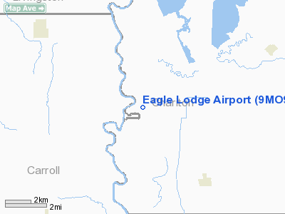
Location & QuickFacts
| FAA Information Effective: | 2008-09-25 |
| Airport Identifier: | 9MO9 |
| Airport Status: | Operational |
| Longitude/Latitude: | 093-15-00.7410W/39-33-00.0850N
-93.250206/39.550024 (Estimated) |
| Elevation: | 650 ft / 198.12 m (Estimated) |
| Land: | 0 acres |
| From nearest city: | 6 nautical miles S of Sumner, MO |
| Location: | Livingston County, MO |
| Magnetic Variation: | 04E (1985) |
Owner & Manager
| Ownership: | Privately owned |
| Owner: | John C Collet |
| Address: | P.o. Box 10280
Kansas City, MO 64111
COLLET VENTURES. |
| Phone number: | 816-931-3520 |
| Address: |
|
Airport Operations and Facilities
| Airport Use: | Private |
| Wind indicator: | Yes |
| Segmented Circle: | No |
| Control Tower: | No |
| Lighting Schedule: | PHONE REQ
FOR ROTG BCN PHONE 816-931-3520. |
| Beacon Color: | Clear-Green (lighted land airport) |
| Landing fee charge: | No |
| Sectional chart: | Kansas City |
| Region: | ACE - Central |
| Boundary ARTCC: | ZKC - Kansas City |
| Tie-in FSS: | COU - Columbia |
| FSS on Airport: | No |
| FSS Toll Free: | 1-800-WX-BRIEF |
Runway Information
Runway 08/26
| Dimension: | 2800 x 40 ft / 853.4 x 12.2 m |
| Surface: | GRAVEL, |
| |
Runway 08 |
Runway 26 |
| Traffic Pattern: | Left | Left |
| Obstruction: | 50 ft trees, 2000.0 ft from runway | 50 ft trees, 2000.0 ft from runway |
|
Radio Navigation Aids
| ID |
Type |
Name |
Ch |
Freq |
Var |
Dist |
| BZK | NDB | Brookfield | | 383.00 | 03E | 14.4 nm |
| CHT | NDB | Chillicothe | | 375.00 | 03E | 17.7 nm |
| PUR | NDB | Marshall | | 371.00 | 03E | 30.6 nm |
| TRX | NDB | Trenton | | 400.00 | 03E | 35.6 nm |
| VER | NDB | Viertel | | 347.00 | 02E | 44.7 nm |
| EZZ | NDB | Cameron | | 394.00 | 03E | 48.5 nm |
| BQS | VOR/DME | Braymer | 049X | 111.20 | 03E | 29.4 nm |
| MCM | VOR/DME | Macon | 076X | 112.90 | 06E | 36.1 nm |
| IRK | VORTAC | Kirksville | 093X | 114.60 | 06E | 46.5 nm |
| ANX | VORTAC | Napoleon | 087X | 114.00 | 07E | 49.2 nm |
Images and information placed above are from
http://www.airport-data.com/airport/9MO9/
We thank them for the data!
| General Info
|
| Country |
United States
|
| State |
MISSOURI
|
| FAA ID |
9MO9
|
| Latitude |
39-33-00.085N
|
| Longitude |
093-15-00.741W
|
| Elevation |
650 feet
|
| Near City |
SUMNER
|
We don't guarantee the information is fresh and accurate. The data may
be wrong or outdated.
For more up-to-date information please refer to other sources.
|
|


