 |
|
Location & QuickFacts
| FAA Information Effective: | 2008-09-25 |
| Airport Identifier: | MO68 |
| Airport Status: | Operational |
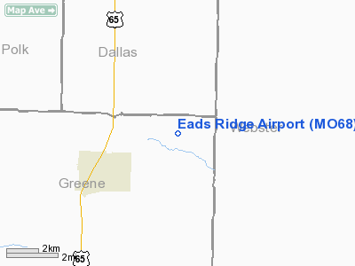
| Longitude/Latitude: | 093-05-58.6600W/37-24-19.1600N
-93.099628/37.405322 (Estimated) |
| Elevation: | 1310 ft / 399.29 m (Estimated) |
| Land: | 5 acres |
| From nearest city: | 3 nautical miles EN of Fair Grove, MO |
| Location: | Greene County, MO |
| Magnetic Variation: | 04E (1985) |
Owner & Manager
| Ownership: | Privately owned |
| Owner: | Arthur H. Eads, Jr. |
| Address: | Rt 3, Box 420
Fair Grove, MO 65648 |
| Phone number: | 417-759-7727 |
| Manager: | Arthur H. Eads, Jr. |
| Address: | Rt 3, Box 420
Fair Grove, MO 65648 |
| Phone number: | 417-759-7727 |
Airport Operations and Facilities
| Airport Use: | Private |
| Wind indicator: | Yes |
| Segmented Circle: | No |
| Control Tower: | No |
| Sectional chart: | Kansas City |
| Region: | ACE - Central |
| Boundary ARTCC: | ZKC - Kansas City |
| Tie-in FSS: | COU - Columbia |
| FSS on Airport: | No |
| FSS Toll Free: | 1-800-WX-BRIEF |
Runway Information
Runway 08/26
| Dimension: | 1000 x 60 ft / 304.8 x 18.3 m |
| Surface: | TURF, |
| |
Runway 08 |
Runway 26 |
| Traffic Pattern: | Left | Left |
| Obstruction: | 15 ft trees | 20 ft trees, 30.0 ft from runway |
|
Radio Navigation Aids
| ID |
Type |
Name |
Ch |
Freq |
Var |
Dist |
| ILJ | NDB | Willard | | 254.00 | 03E | 17.5 nm |
| IEB | NDB | Lebanon | | 414.00 | 03E | 23.3 nm |
| AOV | NDB | Bilmart | | 341.00 | 02E | 33.1 nm |
| PLK | NDB | Point Lookout/dcmsnd | | 204.00 | 03E | 47.2 nm |
| AIZ | NDB | Kaiser | | 377.00 | 05E | 49.0 nm |
| SHY | VOR/DME | Sunshine | 021X | 108.40 | 05E | 44.9 nm |
| SGF | VORTAC | Springfield | 116X | 116.90 | 04E | 11.6 nm |
| DGD | VORTAC | Dogwood | 031X | 109.40 | 06E | 25.3 nm |
Remarks
- OWNER DESIRES ARPT NOT TO BE CHARTED.
- PRVDD APCH TO EACH RWY MAINTAINED 20:1 GLIDE SLOPE, TRANSITIONAL SFC MAINTAINED FOR A 7:1 SLOPE, OWNER ADVISES ALL AUTHORIZED USERS OF THE ARPT OF THE UNSAFE CONDITIONS THAT PREVAIL (INADEQUATE APPROACHES).
Images and information placed above are from
http://www.airport-data.com/airport/MO68/
We thank them for the data!
| General Info
|
| Country |
United States
|
| State |
MISSOURI
|
| FAA ID |
MO68
|
| Latitude |
37-24-19.160N
|
| Longitude |
093-05-58.660W
|
| Elevation |
1310 feet
|
| Near City |
FAIR GROVE
|
We don't guarantee the information is fresh and accurate. The data may
be wrong or outdated.
For more up-to-date information please refer to other sources.
|
|


