 |
|
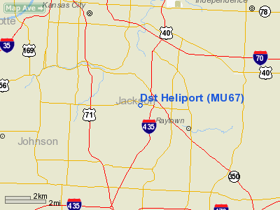
Location & QuickFacts
| FAA Information Effective: | 2008-09-25 |
| Airport Identifier: | MU67 |
| Airport Status: | Operational |
| Longitude/Latitude: | 094-30-37.8330W/39-00-43.0200N
-94.510509/39.011950 (Estimated) |
| Elevation: | 722 ft / 220.07 m (Estimated) |
| Land: | 0 acres |
| From nearest city: | 0 nautical miles N of Kansas City, MO |
| Location: | Jackson County, MO |
| Magnetic Variation: | 05E (1990) |
Owner & Manager
| Ownership: | Privately owned |
| Owner: | Dst Systems Inc |
| Address: | 7201 E 64 St
Kansas City, MO 64153 |
| Phone number: | 314-737-4073 |
| Manager: | James Hundley |
| Address: | 7201 E 64 St
Kansas City, MO 64153 |
| Phone number: | 573-737-4073 |
Airport Operations and Facilities
| Airport Use: | Private |
| Wind indicator: | Yes |
| Segmented Circle: | No |
| Control Tower: | No |
| Sectional chart: | Kansas City |
| Region: | ACE - Central |
| Boundary ARTCC: | ZKC - Kansas City |
| Tie-in FSS: | COU - Columbia |
| FSS on Airport: | No |
| FSS Toll Free: | 1-800-WX-BRIEF |
Runway Information
Helipad H1
| Dimension: | 30 x 30 ft / 9.1 x 9.1 m |
| Surface: | TURF, |
| |
Runway H1 |
Runway |
| Traffic Pattern: | Left | Left |
|
Radio Navigation Aids
| ID |
Type |
Name |
Ch |
Freq |
Var |
Dist |
| LXT | NDB | Lesumit | | 263.00 | 04E | 7.2 nm |
| GKB | NDB | Norge | | 517.00 | 05E | 7.4 nm |
| GQ | NDB | Norge | | 517.00 | 05E | 7.4 nm |
| DO | NDB | Dotte | | 359.00 | 05E | 16.8 nm |
| GPH | NDB | Mosby | | 284.00 | 03E | 22.2 nm |
| EZZ | NDB | Cameron | | 394.00 | 03E | 44.5 nm |
| HCK | NDB | Hawks | | 296.00 | 04E | 49.6 nm |
| SZL | TACAN | Whiteman | 035X | | 04E | 47.9 nm |
| RIS | VOR/DME | Riverside | 051X | 111.40 | 05E | 7.7 nm |
| OJC | VOR/DME | Johnson County | 077X | 113.00 | 06E | 14.8 nm |
| BQS | VOR/DME | Braymer | 049X | 111.20 | 03E | 47.5 nm |
| ANX | VORTAC | Napoleon | 087X | 114.00 | 07E | 18.5 nm |
| MCI | VORTAC | Kansas City | 079Y | 113.25 | 05E | 19.5 nm |
| BUM | VORTAC | Butler | 106X | 115.90 | 07E | 44.5 nm |
| TOP | VORTAC | Topeka | 125X | 117.80 | 05E | 49.0 nm |
| MKC | VOT | Kansas City Downtown | | 108.60 | | 7.8 nm |
Remarks
- OWNER DESIRES ARPT NOT BE CHARTED.
- PROVIDED APCHS MAINTAINED FOR AN 8:1 SLOPE & TRANSITIONAL SURFACES FOR 2:1 SLOPE & HIGH TENSION POWER LINE SHOULD BE OBSTRUCTION MARKED.
Images and information placed above are from
http://www.airport-data.com/airport/MU67/
We thank them for the data!
| General Info
|
| Country |
United States
|
| State |
MISSOURI
|
| FAA ID |
MU67
|
| Latitude |
39-00-43.020N
|
| Longitude |
094-30-37.833W
|
| Elevation |
722 feet
|
| Near City |
KANSAS CITY
|
We don't guarantee the information is fresh and accurate. The data may
be wrong or outdated.
For more up-to-date information please refer to other sources.
|
|


