 |
|
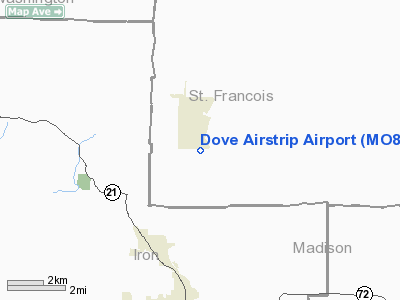
Location & QuickFacts
| FAA Information Effective: | 2008-09-25 |
| Airport Identifier: | MO81 |
| Airport Status: | Operational |
| Longitude/Latitude: | 090-36-53.4450W/37-40-15.1800N
-90.614846/37.670883 (Estimated) |
| Elevation: | 1080 ft / 329.18 m (Estimated) |
| Land: | 51 acres |
| From nearest city: | 5 nautical miles S of Bismarck, MO |
| Location: | St Francois County, MO |
| Magnetic Variation: | 02E (1985) |
Owner & Manager
| Ownership: | Privately owned |
| Owner: | Gwendolyn C. Slater |
| Address: | 722 Dillard Road
Ironton, MO 63650 |
| Phone number: | 314-734-2220 |
| Manager: | Delta Vict-air Aviation |
| Address: | Rt 1, Box 412
Ironton, MO 63650 |
| Phone number: | 314-677-4789 |
Airport Operations and Facilities
| Airport Use: | Private |
| Wind indicator: | Yes |
| Segmented Circle: | No |
| Control Tower: | No |
| Landing fee charge: | No |
| Sectional chart: | Kansas City |
| Region: | ACE - Central |
| Boundary ARTCC: | ZKC - Kansas City |
| Tie-in FSS: | STL - Saint Louis |
| FSS on Airport: | No |
| FSS Toll Free: | 1-800-WX-BRIEF |
Airport Communications
Airport Services
| Airframe Repair: | MAJOR |
| Power Plant Repair: | MAJOR |
Runway Information
Runway 09/27
| Dimension: | 2300 x 40 ft / 701.0 x 12.2 m |
| Surface: | GRVL-TURF,
SURFACE COMPOSITION LIME CHIPS AND SEALED. |
| |
Runway 09 |
Runway 27 |
| Traffic Pattern: | Left | Left |
|
Runway 14/32
| Dimension: | 2200 x 40 ft / 670.6 x 12.2 m |
| Surface: | GRVL-TRTD,
SURFACE COMPOSITION LIME CHIPS AND SEALED. |
| |
Runway 14 |
Runway 32 |
| Traffic Pattern: | Left | Left |
| Obstruction: | | 50 ft trees, 100.0 ft from runway |
|
Radio Navigation Aids
| ID |
Type |
Name |
Ch |
Freq |
Var |
Dist |
| PRI | NDB | Perrine | | 367.00 | 02E | 10.5 nm |
| FES | NDB | Festus | | 269.00 | 01E | 33.3 nm |
| UUV | NDB | Sullivan | | 356.00 | 02E | 42.8 nm |
| UBX | NDB | Cuba | | 380.00 | 01E | 45.3 nm |
| FAM | VORTAC | Farmington | 104X | 115.70 | 01E | 18.1 nm |
Remarks
- PRVDD APCH SLOPES ARE CLEARED & MAINT FOR A 20-1.
Images and information placed above are from
http://www.airport-data.com/airport/MO81/
We thank them for the data!
| General Info
|
| Country |
United States
|
| State |
MISSOURI
|
| FAA ID |
MO81
|
| Latitude |
37-40-15.180N
|
| Longitude |
090-36-53.445W
|
| Elevation |
1080 feet
|
| Near City |
BISMARCK
|
We don't guarantee the information is fresh and accurate. The data may
be wrong or outdated.
For more up-to-date information please refer to other sources.
|
|


