 |
|
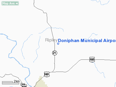
Doniphan Municipal Airport |
Location & QuickFacts
| FAA Information Effective: | 2008-09-25 |
| Airport Identifier: | X33 |
| Airport Status: | Operational |
| Longitude/Latitude: | 090-47-04.1000W/36-41-37.9000N
-90.784472/36.693861 (Estimated) |
| Elevation: | 635 ft / 193.55 m (Estimated) |
| Land: | 23 acres |
| From nearest city: | 5 nautical miles NN of Doniphan, MO |
| Location: | Ripley County, MO |
| Magnetic Variation: | 03E (1985) |
Owner & Manager
| Ownership: | Publicly owned |
| Owner: | City Of Doniphan |
| Address: | 124 Jefferson St
Doniphan, MO 63935 |
| Phone number: | 573-996-2623 |
| Manager: | Lance Pigg
CO-AMGR LONNIE REIRD LIVES ON ARPT (573) 996-9494. |
| Address: | 124 Jefferson St
Doniphan, MO 63935 |
| Phone number: | 573-996-2623 |
Airport Operations and Facilities
| Airport Use: | Open to public |
| Wind indicator: | Yes |
| Segmented Circle: | Yes |
| Control Tower: | No |
| Lighting Schedule: | RDO-CTL
ACTVT LIRL RY 7/25 - CTAF. |
| Sectional chart: | St Louis |
| Region: | ACE - Central |
| Boundary ARTCC: | ZME - Memphis |
| Tie-in FSS: | STL - Saint Louis |
| FSS on Airport: | No |
| FSS Toll Free: | 1-800-WX-BRIEF |
| NOTAMs Facility: | STL (NOTAM-d service avaliable) |
Airport Communications
| CTAF: | 122.900 |
| Unicom: | 123.000
UNICOM OTS INDEFLY. |
Airport Services
| Airframe Repair: | MINOR |
| Power Plant Repair: | MINOR |
Runway Information
Runway 07/25
| Dimension: | 2560 x 57 ft / 780.3 x 17.4 m
WIDTH VARIANCE 57-60 FT. |
| Surface: | ASPH, Fair Condition |
| Edge Lights: | Low |
| |
Runway 07 |
Runway 25 |
| Longitude: | 090-47-19.1200W | 090-46-49.0700W |
| Latitude: | 36-41-34.1700N | 36-41-41.6100N |
| Traffic Pattern: | Left | Right |
| Markings: | Nonstandard, Good Condition
RY 07/25 NSTD BSC MARKINGS; RY CNTRLN 10 INCHES WIDE; NO DSPLCD THLD ARROW HEADS OR RELOCATED THLD ARROW HEADS, & TWY CNTRLN MKGS MISSING TO DEMARCATION BAR. | Nonstandard, Good Condition
RY 07/25 NSTD BSC MARKINGS; RY CNTRLN 10 INCHES WIDE; TWY MKGS MISSING TO RELOCATED THLD. |
| Displaced threshold: | 457.00 ft | 0.00 ft |
| Obstruction: | 66 ft trees, 784.0 ft from runway, 7 ft right of centerline, 8:1 slope to clear
APCH RATIO 15:1 TO DSPLCD THLD; +60 FT TREE 530 FT 168 FT R; 8:1 BASED ON DSPLCD THLD; +66 FT TREES 1175 FT; 225 FTL; 17:1.
+1-2 FT GND 0-75 FT FM RY RELOCATED THLD 100-125 FT L. | 40 ft trees, 281.0 ft from runway, 131 ft left of centerline, 2:1 slope to clear
RWY 25 +1-2 BRUSH & HIGH GND; 0-200 FT FM RY END; 100-125 FT R; +1-10 FT BRUSH; FENCE & HIGH GND; 100-200 FT FM RY END; 100-125 FT L. |
|
Radio Navigation Aids
| ID |
Type |
Name |
Ch |
Freq |
Var |
Dist |
| FD | NDB | Earli | | 278.00 | 03E | 22.0 nm |
| TNZ | NDB | Lawrence County | | 227.00 | 01E | 30.1 nm |
| PGR | NDB | Paragould | | 383.00 | 01E | 40.2 nm |
| DXE | NDB | Dexter | | 423.00 | 00E | 41.0 nm |
| TKX | NDB | Kennett | | 358.00 | 00E | 45.6 nm |
| MNF | NDB | Mountain View | | 365.00 | 03E | 48.2 nm |
| ARG | VORTAC | Walnut Ridge | 092X | 114.50 | 04E | 36.0 nm |
| MAW | VORTAC | Malden | 049X | 111.20 | 03E | 42.9 nm |
Remarks
- WILDLIFE MAY BE ON RYS MORNING & EVENING HRS.
- SEE LETTER DEC 30, 1988.
Images and information placed above are from
http://www.airport-data.com/airport/X33/
We thank them for the data!
| General Info
|
| Country |
United States
|
| State |
MISSOURI
|
| FAA ID |
X33
|
| Latitude |
36-41-37.204N
|
| Longitude |
090-47-05.436W
|
| Elevation |
635 feet
|
| Near City |
DONIPHAN
|
We don't guarantee the information is fresh and accurate. The data may
be wrong or outdated.
For more up-to-date information please refer to other sources.
|
|


