 |
|
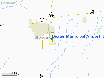
Location & QuickFacts
| FAA Information Effective: | 2008-09-25 |
| Airport Identifier: | DXE |
| Airport Status: | Operational |
| Longitude/Latitude: | 089-56-28.5000W/36-46-31.5000N
-89.941250/36.775417 (Estimated) |
| Elevation: | 304 ft / 92.66 m (Surveyed) |
| Land: | 840 acres |
| From nearest city: | 2 nautical miles SE of Dexter, MO |
| Location: | Stoddard County, MO |
| Magnetic Variation: | 00E (2000) |
Owner & Manager
| Ownership: | Publicly owned |
| Owner: | City Of Dexter |
| Address: | 301 E Stoddard St
Dexter, MO 63841 |
| Phone number: | 573-624-5959 |
| Manager: | Dean Bishop |
| Address: |
Dexter, MO 63841 |
| Phone number: | 573-624-4062 |
Airport Operations and Facilities
| Airport Use: | Open to public |
| Control Tower: | No |
| Lighting Schedule: | DUSK-DAWN
ACTVT MIRL RY 18/36 & PAPI RYS 18 & 36 - CTAF. |
| Beacon Color: | Clear-Green (lighted land airport) |
| Landing fee charge: | No |
| Sectional chart: | St Louis |
| Region: | ACE - Central |
| Boundary ARTCC: | ZME - Memphis |
| Tie-in FSS: | STL - Saint Louis |
| FSS on Airport: | No |
| FSS Toll Free: | 1-800-WX-BRIEF |
| NOTAMs Facility: | STL (NOTAM-d service avaliable) |
| Federal Agreements: | NGPY |
Airport Communications
| CTAF: | 122.800 |
| Unicom: | 122.800
UNICOM UNMONITORED. |
Airport Services
| Fuel available: | 100LLA
24-HR AUTOMATIC CREDIT CARD FOR FUEL. |
| Airframe Repair: | MINOR |
| Power Plant Repair: | MINOR |
| Bottled Oxygen: | NONE |
| Bulk Oxygen: | NONE |
Runway Information
Runway 18/36
| Dimension: | 5000 x 100 ft / 1524.0 x 30.5 m |
| Surface: | ASPH, Good Condition
VARIOUS AREAS WITH CRACKS AND GRASS & WEEDS GROWING IN THEM. |
| Weight Limit: | Single wheel: 30000 lbs. |
| Edge Lights: | Medium |
| |
Runway 18 |
Runway 36 |
| Longitude: | 089-56-27.5200W | 089-56-29.5400W |
| Latitude: | 36-46-56.2200N | 36-46-06.8100N |
| Elevation: | 304.00 ft | 297.00 ft |
| Alignment: | 127 | 2 |
| Traffic Pattern: | Left | Right |
| Markings: | Non-precision instrument, Good Condition | Non-precision instrument, Good Condition |
| Crossing Height: | 40.00 ft | 40.00 ft |
| VASI: | 2-light PAPI on left side | 2-light PAPI on left side |
| Visual Glide Angle: | 3.00° | 3.00° |
| Runway End Identifier: | No | No |
| Obstruction: | 60 ft trees, 2475.0 ft from runway, 370 ft left of centerline, 37:1 slope to clear | , 50:1 slope to clear |
|
Radio Navigation Aids
| ID |
Type |
Name |
Ch |
Freq |
Var |
Dist |
| DXE | NDB | Dexter | | 423.00 | 00E | 0.8 nm |
| FD | NDB | Earli | | 278.00 | 03E | 19.7 nm |
| CHQ | NDB | Charleston | | 208.00 | 01E | 28.4 nm |
| TKX | NDB | Kennett | | 358.00 | 00E | 33.2 nm |
| CIR | NDB | Cairo | | 397.00 | 00E | 38.6 nm |
| GOJ | VOR | Gosnell | | 111.80 | 01E | 49.6 nm |
| CGI | VOR/DME | Cape Girardeau | 076X | 112.90 | 01E | 32.4 nm |
| MAW | VORTAC | Malden | 049X | 111.20 | 03E | 13.3 nm |
Remarks
- CROP DUSTING ACFT ON & INVOF ARPT.
- MODEL AIRPLANE ACTIVITY ON & INVOF ARPT.
- PROVIDED THE APPROACH TO EACH RWY IS MAINTAINED FOR A MINIMUM 20:1 GLIDE SLOPE AND THE TRANSITIONAL SURFACE BE MAINTAINED FOR A 7:1 SLOPE.
Images and information placed above are from
http://www.airport-data.com/airport/DXE/
We thank them for the data!
| General Info
|
| Country |
United States
|
| State |
MISSOURI
|
| FAA ID |
DXE
|
| Latitude |
36-46-38.892N
|
| Longitude |
089-56-28.224W
|
| Elevation |
305 feet
|
| Near City |
DEXTER
|
We don't guarantee the information is fresh and accurate. The data may
be wrong or outdated.
For more up-to-date information please refer to other sources.
|
|


