 |
|
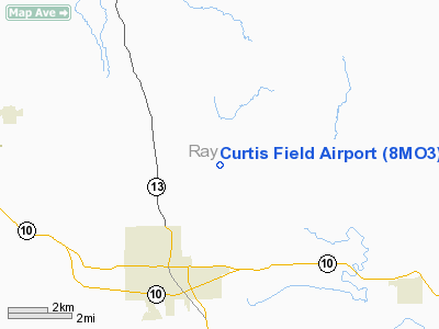
Location & QuickFacts
| FAA Information Effective: | 2008-09-25 |
| Airport Identifier: | 8MO3 |
| Airport Status: | Operational |
| Longitude/Latitude: | 093-56-29.7890W/39-19-29.0410N
-93.941608/39.324734 (Estimated) |
| Elevation: | 760 ft / 231.65 m (Estimated) |
| Land: | 0 acres |
| From nearest city: | 3 nautical miles NE of Richmond, MO |
| Location: | Ray County, MO |
| Magnetic Variation: | 04E (1985) |
Owner & Manager
| Ownership: | Privately owned |
| Owner: | Gerald E Curtis |
| Address: | Rt 1, Box 7
Richmond, MO 64085 |
| Phone number: | 816-776-3742 |
| Manager: | Doug Curtis |
| Address: | Route 4 Box 158
Richmond, MO 64085-9532 |
| Phone number: | 816-776-6367 |
Airport Operations and Facilities
| Airport Use: | Private |
| Wind indicator: | Yes |
| Segmented Circle: | No |
| Control Tower: | No |
| Lighting Schedule: | PHONE REQ
FOR ROTG BCN & LIRL RY 17/35 CALL (816) 776-6367. |
| Beacon Color: | Clear-Green (lighted land airport) |
| Landing fee charge: | No |
| Sectional chart: | Kansas City |
| Region: | ACE - Central |
| Boundary ARTCC: | ZKC - Kansas City |
| Tie-in FSS: | COU - Columbia |
| FSS on Airport: | No |
| FSS Toll Free: | 1-800-WX-BRIEF |
Runway Information
Runway 09/27
| Dimension: | 2200 x 80 ft / 670.6 x 24.4 m |
| Surface: | TURF, |
| |
Runway 09 |
Runway 27 |
| Traffic Pattern: | Left | Left |
|
Runway 17/35
| Dimension: | 2400 x 80 ft / 731.5 x 24.4 m |
| Surface: | TURF, |
| Edge Lights: | Low |
| |
Runway 17 |
Runway 35 |
| Traffic Pattern: | Left | Left |
|
Radio Navigation Aids
| ID |
Type |
Name |
Ch |
Freq |
Var |
Dist |
| GPH | NDB | Mosby | | 284.00 | 03E | 17.1 nm |
| EZZ | NDB | Cameron | | 394.00 | 03E | 28.7 nm |
| LXT | NDB | Lesumit | | 263.00 | 04E | 29.7 nm |
| CHT | NDB | Chillicothe | | 375.00 | 03E | 34.2 nm |
| GQ | NDB | Norge | | 517.00 | 05E | 36.8 nm |
| GKB | NDB | Norge | | 517.00 | 05E | 36.8 nm |
| DO | NDB | Dotte | | 359.00 | 05E | 38.1 nm |
| PUR | NDB | Marshall | | 371.00 | 03E | 38.7 nm |
| HCK | NDB | Hawks | | 296.00 | 04E | 45.2 nm |
| BZK | NDB | Brookfield | | 383.00 | 03E | 46.8 nm |
| TRX | NDB | Trenton | | 400.00 | 03E | 48.2 nm |
| SZL | TACAN | Whiteman | 035X | | 04E | 39.8 nm |
| BQS | VOR/DME | Braymer | 049X | 111.20 | 03E | 18.6 nm |
| RIS | VOR/DME | Riverside | 051X | 111.40 | 05E | 32.9 nm |
| OJC | VOR/DME | Johnson County | 077X | 113.00 | 06E | 47.1 nm |
| ANX | VORTAC | Napoleon | 087X | 114.00 | 07E | 16.3 nm |
| MCI | VORTAC | Kansas City | 079Y | 113.25 | 05E | 37.1 nm |
| MKC | VOT | Kansas City Downtown | | 108.60 | | 32.9 nm |
Remarks
- PRVDD APCH SLOPES ARE MAINTD FOR A 20:1 GLIDE SLOPE & TRSNL SFC MAINTD FOR A 7:1 SLOPE.
Images and information placed above are from
http://www.airport-data.com/airport/8MO3/
We thank them for the data!
| General Info
|
| Country |
United States
|
| State |
MISSOURI
|
| FAA ID |
8MO3
|
| Latitude |
39-19-29.041N
|
| Longitude |
093-56-29.789W
|
| Elevation |
760 feet
|
| Near City |
RICHMOND
|
We don't guarantee the information is fresh and accurate. The data may
be wrong or outdated.
For more up-to-date information please refer to other sources.
|
|


