 |
|
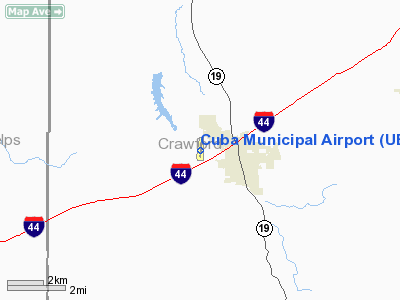
Location & QuickFacts
| FAA Information Effective: | 2008-09-25 |
| Airport Identifier: | UBX |
| Airport Status: | Operational |
| Longitude/Latitude: | 091-25-43.8850W/38-04-07.5960N
-91.428857/38.068777 (Estimated) |
| Elevation: | 1023 ft / 311.81 m (Surveyed) |
| Land: | 105 acres |
| From nearest city: | 1 nautical miles NW of Cuba, MO |
| Location: | Crawford County, MO |
| Magnetic Variation: | 01E (2000) |
Owner & Manager
| Ownership: | Publicly owned |
| Owner: | City Of Cuba |
| Address: | 112 North Smith St. - Box K
Cuba, MO 65453 |
| Phone number: | 573-885-7432 |
| Manager: | Fred Goodwin |
| Address: | 1312 Hwy Dd
Cuba, MO 65453 |
| Phone number: | 573-885-2479 |
Airport Operations and Facilities
| Airport Use: | Open to public |
| Wind indicator: | Yes |
| Segmented Circle: | Yes |
| Control Tower: | No |
| Lighting Schedule: | DUSK-DAWN
MIRL RY 18/36 PRESET ON LOW INTST; TO INCR INTST ACTVT REIL RYS 18 & 36 - CTAF. |
| Beacon Color: | Clear-Green (lighted land airport) |
| Landing fee charge: | No |
| Sectional chart: | Kansas City |
| Region: | ACE - Central |
| Boundary ARTCC: | ZKC - Kansas City |
| Tie-in FSS: | STL - Saint Louis |
| FSS Toll Free: | 1-800-WX-BRIEF |
| NOTAMs Facility: | STL (NOTAM-d service avaliable) |
| Federal Agreements: | NGY |
Airport Communications
| CTAF: | 122.800 |
| Unicom: | 122.800
UNICOM UNMON. |
Airport Services
| Fuel available: | 100LL
FUEL AVBL 24 HRS A DAY CALL NR POSTED AT FUELING AREA. |
| Airframe Repair: | MAJOR
IREG SCHEDULE. |
| Power Plant Repair: | MAJOR
IREG SCHEDULE. |
| Bottled Oxygen: | NONE |
| Bulk Oxygen: | NONE |
Runway Information
Runway 18/36
| Dimension: | 3420 x 60 ft / 1042.4 x 18.3 m |
| Surface: | ASPH, Good Condition |
| Weight Limit: | Single wheel: 12500 lbs. |
| Edge Lights: | Medium |
| |
Runway 18 |
Runway 36 |
| Longitude: | 091-25-41.7700W | 091-25-46.0000W |
| Latitude: | 38-04-24.4200N | 38-03-50.7700N |
| Elevation: | 1023.00 ft | 1019.00 ft |
| Alignment: | 127 | 6 |
| Traffic Pattern: | Left | Left |
| Markings: | Non-precision instrument, Good Condition
MARKINGS FADED. | Non-precision instrument, Good Condition
MARKINGS FADED. |
| Crossing Height: | 40.00 ft | 40.00 ft |
| VASI: | 2-light PAPI on left side | 2-light PAPI on left side |
| Visual Glide Angle: | 3.00° | 3.00° |
| Runway End Identifier: | Yes
REIL OTS INDEFLY. | Yes
REIL OTS INDEFLY. |
| Obstruction: | 49 ft tree, 1300.0 ft from runway, 90 ft right of centerline, 22:1 slope to clear | 29 ft trees, 601.0 ft from runway, 150 ft left of centerline, 13:1 slope to clear |
|
Radio Navigation Aids
| ID |
Type |
Name |
Ch |
Freq |
Var |
Dist |
| UBX | NDB | Cuba | | 380.00 | 01E | 0.2 nm |
| UUV | NDB | Sullivan | | 356.00 | 02E | 16.0 nm |
| BHN | NDB | Buckhorn | | 391.00 | 03E | 39.0 nm |
| JE | NDB | Algoa | | 397.00 | 03E | 41.8 nm |
| FES | NDB | Festus | | 269.00 | 01E | 49.8 nm |
| TBN | VOR | Forney | | 110.00 | 03E | 39.0 nm |
| VIH | VOR/DME | Vichy | 124X | 117.70 | 06E | 14.1 nm |
| MAP | VORTAC | Maples | 081X | 113.40 | 06E | 33.4 nm |
| FTZ | VORTAC | Foristell | 045X | 110.80 | 05E | 43.4 nm |
| JEF | VOT | Jefferson City | | 112.00 | | 46.1 nm |
Remarks
- RY 36 CLSD TO TOUCH & GO LNDGS.
Images and information placed above are from
http://www.airport-data.com/airport/UBX/
We thank them for the data!
| General Info
|
| Country |
United States
|
| State |
MISSOURI
|
| FAA ID |
UBX
|
| Latitude |
38-04-07.596N
|
| Longitude |
091-25-43.885W
|
| Elevation |
1023 feet
|
| Near City |
CUBA
|
We don't guarantee the information is fresh and accurate. The data may
be wrong or outdated.
For more up-to-date information please refer to other sources.
|
|


