|
|
|
 |
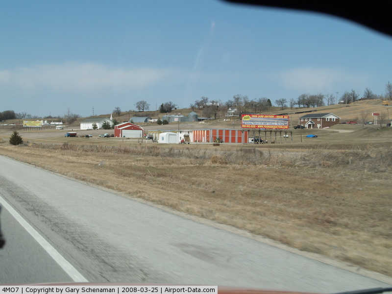
(Click on the photo to enlarge) |
Location & QuickFacts
| FAA Information Effective: | 2008-09-25 |
| Airport Identifier: | 4MO7 |
| Airport Status: | Operational |
| Longitude/Latitude: | 095-14-27.0000W/40-08-29.0000N
-95.240833/40.141389 (Estimated) |
| Elevation: | 875 ft / 266.70 m (Estimated) |
| Land: | 10 acres |
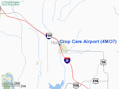
| From nearest city: | 1 nautical miles N of Mound City, MO |
| Location: | Holt County, MO |
| Magnetic Variation: | 05E (1990) |
Owner & Manager
| Ownership: | Privately owned |
| Owner: | Kurtz Rural Aviation |
| Address: | P.o. Box 44
Mound City, MO 64470 |
| Phone number: | 816-442-5611 |
| Manager: | Garold Kurtz |
| Address: | P.o. Box 44
Mound City, MO 64470 |
| Phone number: | 816-442-5611 |
Airport Operations and Facilities
| Airport Use: | Private |
| Wind indicator: | Yes |
| Segmented Circle: | No |
| Control Tower: | No |
| Sectional chart: | Omaha |
| Region: | ACE - Central |
| Boundary ARTCC: | ZKC - Kansas City |
| Tie-in FSS: | COU - Columbia |
| FSS on Airport: | No |
| FSS Toll Free: | 1-800-WX-BRIEF |
Runway Information
Runway 15/33
| Dimension: | 2200 x 40 ft / 670.6 x 12.2 m |
| Surface: | GRVL, |
| |
Runway 15 |
Runway 33 |
| Traffic Pattern: | Left | Left |
|
Radio Navigation Aids
| ID |
Type |
Name |
Ch |
Freq |
Var |
Dist |
| FNB | NDB | Brenner | | 404.00 | 05E | 16.4 nm |
| EVU | NDB | Emville | | 317.00 | 05E | 19.4 nm |
| AZN | NDB | Amazon | | 233.00 | 06E | 21.8 nm |
| AYB | NDB | Auburn | | 430.00 | 05E | 31.3 nm |
| ICL | NDB | Clarinda | | 353.00 | 04E | 36.5 nm |
| SDA | NDB | Shenandoah | | 411.00 | 05E | 37.5 nm |
| AFK | NDB | Nebraska City | | 347.00 | 05E | 39.8 nm |
| RBA | VOR/DME | Robinson | 019X | 108.20 | 04E | 19.4 nm |
| STJ | VORTAC | St Joseph | 102X | 115.50 | 08E | 18.1 nm |
| PWE | VORTAC | Pawnee City | 071X | 112.40 | 05E | 44.5 nm |
Remarks
- PRVDD 20:1 APCH SLOPE MAINTAINED; TRANSITIONAL SFC MAINTAINED FOR A 7:1.
Images and information placed above are from
http://www.airport-data.com/airport/4MO7/
We thank them for the data!
| General Info
|
| Country |
United States
|
| State |
MISSOURI
|
| FAA ID |
4MO7
|
| Latitude |
40-08-29.000N
|
| Longitude |
095-14-27.000W
|
| Elevation |
875 feet
|
| Near City |
MOUND CITY
|
We don't guarantee the information is fresh and accurate. The data may
be wrong or outdated.
For more up-to-date information please refer to other sources.
|
|