 |
|
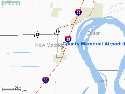
Location & QuickFacts
| FAA Information Effective: | 2008-09-25 |
| Airport Identifier: | EIW |
| Airport Status: | Operational |
| Longitude/Latitude: | 089-35-59.0000W/36-32-07.1000N
-89.599722/36.535306 (Estimated) |
| Elevation: | 296 ft / 90.22 m (Surveyed) |
| Land: | 110 acres |
| From nearest city: | 4 nautical miles SW of New Madrid, MO |
| Location: | New Madrid County, MO |
| Magnetic Variation: | 00E (2000) |
Owner & Manager
| Ownership: | Publicly owned |
| Owner: | County Of New Madrid |
| Address: | Po Box 68
New Madrid, MO 63869 |
| Phone number: | 573-748-2524 |
| Manager: | Clement Cravens
COUNTY CLERK. |
| Address: | P.o. Box 68
New Madrid, MO 63869 |
| Phone number: | 573-748-2524 |
Airport Operations and Facilities
| Airport Use: | Open to public |
| Wind indicator: | Yes |
| Segmented Circle: | Yes |
| Control Tower: | No |
| Lighting Schedule: | DUSK-DAWN
MIRL RY 18/36 PRESET ON MED INTST; TO INCR INTST & ACTVT MIRL RY 18/36 - CTAF. |
| Beacon Color: | Clear-Green (lighted land airport) |
| Landing fee charge: | No |
| Sectional chart: | St Louis |
| Region: | ACE - Central |
| Boundary ARTCC: | ZME - Memphis |
| Tie-in FSS: | STL - Saint Louis |
| FSS on Airport: | No |
| FSS Toll Free: | 1-800-WX-BRIEF |
| NOTAMs Facility: | STL (NOTAM-d service avaliable) |
| Federal Agreements: | NY1 |
Airport Communications
| CTAF: | 122.800 |
| Unicom: | 122.800
UNICOM UNMONITORED. |
Airport Services
| Fuel available: | 100LL
FOR SERVICE AFTER HRS, CALL ARPT MGR AT (573) 688-5058 OR (573) 934-3734. |
| Airframe Repair: | NONE |
| Power Plant Repair: | NONE |
Runway Information
Runway 18/36
| Dimension: | 3200 x 60 ft / 975.4 x 18.3 m |
| Surface: | ASPH, Fair Condition |
| Edge Lights: | Medium |
| |
Runway 18 |
Runway 36 |
| Longitude: | 089-35-59.0700W | 089-35-58.9400W |
| Latitude: | 36-32-22.9300N | 36-31-51.2900N |
| Elevation: | 295.00 ft | 296.00 ft |
| Alignment: | 127 | 127 |
| Traffic Pattern: | Left | Left |
| Markings: | Non-precision instrument, Fair Condition | Non-precision instrument, Fair Condition |
| Obstruction: | 56 ft tree, 300.0 ft from runway, 242 ft left of centerline, 1:1 slope to clear
+1-3 FT FENCE 0-200 FT FM RY END 230 FT L. | 32 ft pole, 670.0 ft from runway, 213 ft left of centerline, 14:1 slope to clear
+1-4' FENCE, 0-200' FM RY END 230' R. |
|
Radio Navigation Aids
| ID |
Type |
Name |
Ch |
Freq |
Var |
Dist |
| CHQ | NDB | Charleston | | 208.00 | 01E | 22.0 nm |
| DXE | NDB | Dexter | | 423.00 | 00E | 22.4 nm |
| TKX | NDB | Kennett | | 358.00 | 00E | 28.1 nm |
| UC | NDB | Obion | | 212.00 | 00E | 32.6 nm |
| DNT | NDB | Nally Dunston | | 343.00 | 01W | 33.8 nm |
| FD | NDB | Earli | | 278.00 | 03E | 36.1 nm |
| CIR | NDB | Cairo | | 397.00 | 00E | 36.5 nm |
| IUI | NDB | Hicks | | 350.00 | 01E | 37.7 nm |
| MXA | NDB | Manila | | 282.00 | 01E | 47.2 nm |
| GGK | NDB | Mayfield | | 401.00 | 00E | 49.5 nm |
| GOJ | VOR | Gosnell | | 111.80 | 01E | 38.8 nm |
| CGI | VOR/DME | Cape Girardeau | 076X | 112.90 | 01E | 41.6 nm |
| MAW | VORTAC | Malden | 049X | 111.20 | 03E | 15.1 nm |
| DYR | VORTAC | Dyersburg | 115X | 116.80 | 03E | 33.9 nm |
| CNG | VORTAC | Cunningham | 078X | 113.10 | 03E | 46.5 nm |
Remarks
- CROP DUSTING ACFT ON & INVOF ARPT.
Images and information placed above are from
http://www.airport-data.com/airport/EIW/
We thank them for the data!
| General Info
|
| Country |
United States
|
| State |
MISSOURI
|
| FAA ID |
EIW
|
| Latitude |
36-32-07.119N
|
| Longitude |
089-35-58.982W
|
| Elevation |
295 feet
|
| Near City |
NEW MADRID
|
We don't guarantee the information is fresh and accurate. The data may
be wrong or outdated.
For more up-to-date information please refer to other sources.
|
|


