 |
|
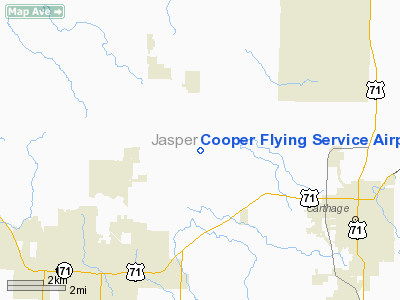
Cooper Flying Service Airport |
Location & QuickFacts
| FAA Information Effective: | 2008-09-25 |
| Airport Identifier: | 00MO |
| Airport Status: | Operational |
| Longitude/Latitude: | 094-24-44.8120W/37-12-10.2050N
-94.412448/37.202835 (Estimated) |
| Elevation: | 970 ft / 295.66 m (Estimated) |
| Land: | 0 acres |
| From nearest city: | 3 nautical miles S of Alba, MO |
| Location: | Jasper County, MO |
| Magnetic Variation: | 05E (1985) |
Owner & Manager
| Ownership: | Privately owned |
| Owner: | Randall G. Cooper |
| Address: | Route 1, Box 48
Webb City, MO 64870 |
| Phone number: | 417-782-0354 |
| Manager: | Randall G. Cooper |
| Address: | Route 1, Box 48
Webb City, MO 64870 |
| Phone number: | 417-782-0354 |
Airport Operations and Facilities
| Airport Use: | Private |
| Wind indicator: | Yes |
| Segmented Circle: | No |
| Control Tower: | No |
| Landing fee charge: | No |
| Sectional chart: | Kansas City |
| Region: | ACE - Central |
| Boundary ARTCC: | ZKC - Kansas City |
| Tie-in FSS: | COU - Columbia |
| FSS on Airport: | No |
| FSS Toll Free: | 1-800-WX-BRIEF |
Runway Information
Runway 08/26
| Dimension: | 2400 x 25 ft / 731.5 x 7.6 m |
| Surface: | TURF, |
| |
Runway 08 |
Runway 26 |
| Traffic Pattern: | Right | Right |
|
Radio Navigation Aids
| ID |
Type |
Name |
Ch |
Freq |
Var |
Dist |
| LLU | NDB | Spring River | | 356.00 | 05E | 17.8 nm |
| PTS | NDB | Pittsburg | | 365.00 | 05E | 20.8 nm |
| FSK | NDB | Fort Scott | | 379.00 | 05E | 39.5 nm |
| EAD | NDB | Nevada | | 209.00 | 06E | 39.8 nm |
| ILJ | NDB | Willard | | 254.00 | 03E | 46.9 nm |
| EOS | VOR/DME | Neosho | 120X | 117.30 | 07E | 21.7 nm |
| OSW | VORTAC | Oswego | 123X | 117.60 | 08E | 38.0 nm |
Remarks
- 60' PLINE 1000' FROM THR RWY 26.
- RUTS IN MIDDLE 1/3 OF RUNWAY; LAND AT OWN RISK.
- PRVDD APCH TO EACH RWY MAINTD FOR MNM 20:1 GLIDE SLOPE AND TRSNL SFC MAINTD FOR 7:1 SLOPE.
Images and information placed above are from
http://www.airport-data.com/airport/00MO/
We thank them for the data!
| General Info
|
| Country |
United States
|
| State |
MISSOURI
|
| FAA ID |
00MO
|
| Latitude |
37-12-10.205N
|
| Longitude |
094-24-44.812W
|
| Elevation |
970 feet
|
| Near City |
ALBA
|
We don't guarantee the information is fresh and accurate. The data may
be wrong or outdated.
For more up-to-date information please refer to other sources.
|
|


