 |
|
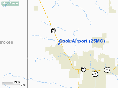
Location & QuickFacts
| FAA Information Effective: | 2008-09-25 |
| Airport Identifier: | 25MO |
| Airport Status: | Operational |
| Longitude/Latitude: | 094-33-04.0000W/37-11-09.0000N
-94.551111/37.185833 (Estimated) |
| Elevation: | 920 ft / 280.42 m (Estimated) |
| Land: | 42 acres |
| From nearest city: | 1 nautical miles NE of Carl Junction, MO |
| Location: | Jasper County, MO |
| Magnetic Variation: | 04E (1995) |
Owner & Manager
| Ownership: | Privately owned |
| Owner: | Gregory Cook & Susan Cook |
| Address: | 8990 County Road 275
Carl Junction, MO 64834 |
| Phone number: | 417-649-7545 |
| Manager: | Gregory Cook & Susan Cook |
| Address: | 8990 County Road 275
Carl Junction, MO 64834 |
| Phone number: | 417-649-7545 |
Airport Operations and Facilities
| Airport Use: | Private |
| Segmented Circle: | No |
| Control Tower: | No |
| Landing fee charge: | No |
| Sectional chart: | Kansas City |
| Region: | ACE - Central |
| Boundary ARTCC: | ZKC - Kansas City |
| Tie-in FSS: | COU - Columbia |
| FSS on Airport: | No |
| FSS Toll Free: | 1-800-WX-BRIEF |
Runway Information
Runway 11/29
| Dimension: | 1900 x 40 ft / 579.1 x 12.2 m |
| Surface: | TURF, |
| |
Runway 11 |
Runway 29 |
| Traffic Pattern: | Left | Left |
| Obstruction: | 40 ft plines, 150.0 ft from runway | 40 ft trees, 80.0 ft from runway |
|
Radio Navigation Aids
| ID |
Type |
Name |
Ch |
Freq |
Var |
Dist |
| PTS | NDB | Pittsburg | | 365.00 | 05E | 17.6 nm |
| LLU | NDB | Spring River | | 356.00 | 05E | 21.5 nm |
| FSK | NDB | Fort Scott | | 379.00 | 05E | 38.1 nm |
| EAD | NDB | Nevada | | 209.00 | 06E | 42.2 nm |
| PPF | NDB | Parsons | | 258.00 | 06E | 46.7 nm |
| CFV | NDB | Coffeyville | | 212.00 | 05E | 49.2 nm |
| EOS | VOR/DME | Neosho | 120X | 117.30 | 07E | 21.4 nm |
| OSW | VORTAC | Oswego | 123X | 117.60 | 08E | 31.3 nm |
Remarks
- PRVDD 20:1 APCH TO EACH RY AND 7:1 TRANSITIONAL SURFACES ARE MAINTAINED; ALL LANDINGS ARE MADE TO RY 11 AND TKOFS FM RY 29.
Images and information placed above are from
http://www.airport-data.com/airport/25MO/
We thank them for the data!
| General Info
|
| Country |
United States
|
| State |
MISSOURI
|
| FAA ID |
25MO
|
| Latitude |
37-11-09.000N
|
| Longitude |
094-33-04.000W
|
| Elevation |
920 feet
|
| Near City |
CARL JUNCTION
|
We don't guarantee the information is fresh and accurate. The data may
be wrong or outdated.
For more up-to-date information please refer to other sources.
|
|


