|
|
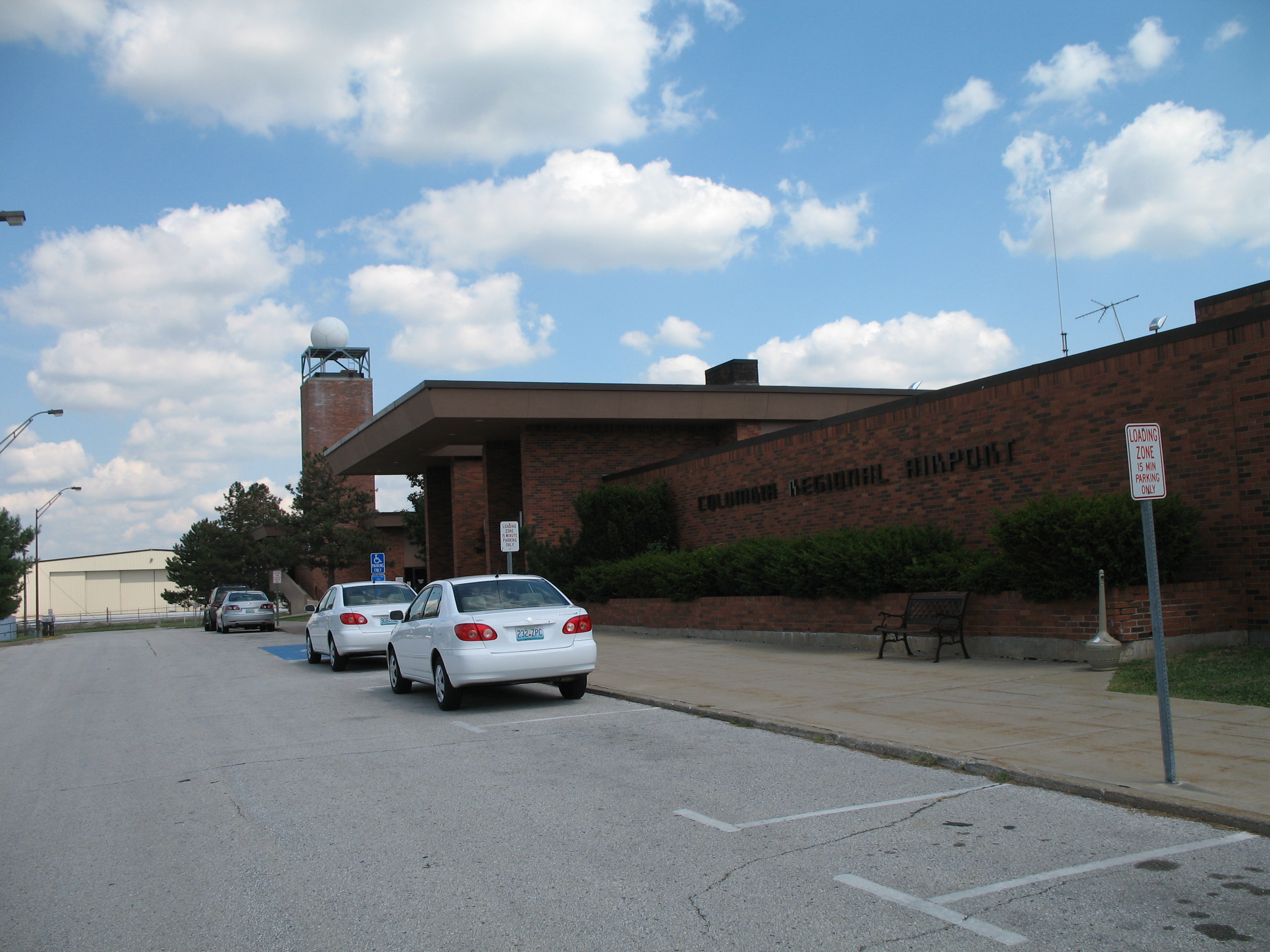
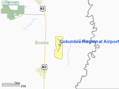
Columbia Regional Airport |
| Columbia Regional Airport |
 |
| IATA: COU – ICAO: KCOU |
| Summary |
| Airport type |
Public |
| Operator |
City of Columbia |
| Location |
Columbia, Missouri |
| Elevation AMSL |
889 ft / 271 m |
| Coordinates |
38°49′05″N 92°13′11″W / 38.81806°N 92.21972°W / 38.81806; -92.21972Coordinates: 38°49′05″N 92°13′11″W / 38.81806°N 92.21972°W / 38.81806; -92.21972 |
| Runways |
| Direction |
Length |
Surface |
| ft |
m |
| 2/20 |
6,501 |
1,982 |
Concrete |
| 13/31 |
4,401 |
1,341 |
Asphalt |
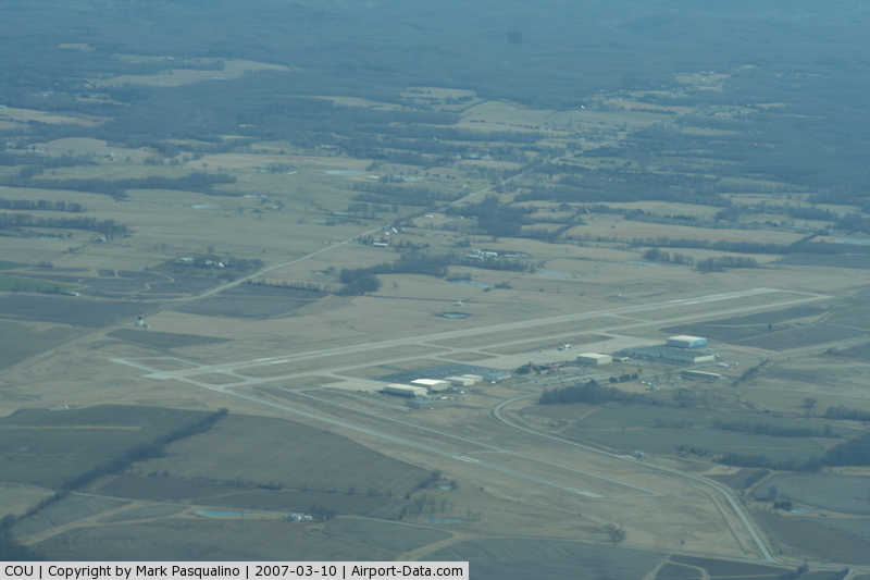
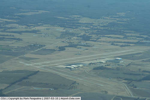
Airport diagram Columbia Regional Airport (IATA: COU, ICAO: KCOU) is a public airport located 10 miles (16 km) southeast of the central business district (CBD) of Columbia, a city in Boone County, Missouri, USA. The airport covers 1,538 acres (622 ha) and has two runways. It is mostly used for general aviation, but is also served by one commercial airline. Service is subsidized by the Essential Air Service program.
Airlines and destinations
| Airlines |
Destinations |
| Delta Connection operated by Pinnacle Airlines |
Memphis |
The above content comes from Wikipedia and is published under free licenses – click here to read more.
|
 |
(Click on the photo to enlarge) |
Location & QuickFacts
| FAA Information Effective: | 2008-09-25 |
| Airport Identifier: | COU |
| Airport Status: | Operational |
| Longitude/Latitude: | 092-13-10.6650W/38-49-05.1350N
-92.219629/38.818093 (Estimated) |
| Elevation: | 889 ft / 270.97 m (Surveyed) |
| Land: | 1538 acres |
| From nearest city: | 10 nautical miles SE of Columbia, MO |
| Location: | Boone County, MO |
| Magnetic Variation: | 03E (1990) |
Owner & Manager
| Ownership: | Publicly owned |
| Owner: | City Of Columbia |
| Address: | P O Box N
Columbia, MO 65201 |
| Phone number: | 573-874-7250 |
| Manager: | Ms. Kathy Frerking |
| Address: | 11300 S. Airport Rd
Columbia, MO 65201 |
| Phone number: | 573-442-9770 |
Airport Operations and Facilities
| Airport Use: | Open to public |
| Wind indicator: | Yes |
| Segmented Circle: | Yes |
| Control Tower: | Yes |
| Lighting Schedule: | DUSK-DAWN
WHEN ATCT CLSD ACTVT HIRL RY 02/20; MIRL RY 13/31; MALSR RY 02; AND ODALS RY 20 - 119.3. |
| Beacon Color: | Clear-Green (lighted land airport) |
| Landing fee charge: | No |
| Sectional chart: | Kansas City |
| Region: | ACE - Central |
| Boundary ARTCC: | ZKC - Kansas City |
| Tie-in FSS: | COU - Columbia
CTC COLUMBIA RADIO FOR AIRPORT ADVISORY SERVICE ON 119.3 WHEN TOWER IS CLSD. |
| FSS on Airport: | Yes |
| FSS Toll Free: | 1-800-WX-BRIEF |
| NOTAMs Facility: | COU (NOTAM-d service avaliable) |
| Certification type/date: | I A S 05/1973
48 HRS PPR FOR UNSKED ACR OPNS WITH MORE THAN 30 PSGR SEATS; CALL SAFETY OFFICER (573) 443-2811. ARFF INDEX B IS PROVIDED. |
| Federal Agreements: | NGY |
Airport Communications
| CTAF: | 119.300 |
| Unicom: | 122.950 |
Airport Services
| Fuel available: | 100LLA |
| Airframe Repair: | MAJOR |
| Power Plant Repair: | MAJOR |
| Bottled Oxygen: | NONE |
| Bulk Oxygen: | LOW |
Runway Information
Runway 02/20
| Dimension: | 6501 x 150 ft / 1981.5 x 45.7 m |
| Surface: | CONC, Fair Condition |
| Surface Treatment: | Saw-cut or plastic Grooved |
| Weight Limit: | Single wheel: 92000 lbs.
Dual wheel: 125000 lbs.
Dual tandem wheel: 215000 lbs. |
| Edge Lights: | High |
| |
Runway 02 |
Runway 20 |
| Longitude: | 092-13-25.4155W | 092-12-55.4009W |
| Latitude: | 38-48-18.7816N | 38-49-18.5884N |
| Elevation: | 882.00 ft | 886.00 ft |
| Alignment: | 21 | 127 |
| ILS Type: | ILS/DME
| |
| Traffic Pattern: | Left | Left |
| Markings: | Precision instrument, Good Condition | Precision instrument, Good Condition |
| Crossing Height: | 0.00 ft | 39.00 ft |
| VASI: | | 4-box on left side |
| Visual Glide Angle: | 0.00° | 3.00° |
| RVR Equipment: | touchdown | |
| Approach lights: | MALSR | ODALS |
| Runway End Identifier: | | Yes |
|
Runway 13/31
| Dimension: | 4401 x 75 ft / 1341.4 x 22.9 m |
| Surface: | ASPH, Fair Condition |
| Weight Limit: | Single wheel: 24000 lbs.
Dual wheel: 24000 lbs. |
| Edge Lights: | Medium |
| |
Runway 13 |
Runway 31 |
| Longitude: | 092-13-30.0415W | 092-12-51.0182W |
| Latitude: | 38-49-43.8938N | 38-49-12.9108N |
| Elevation: | 888.00 ft | 886.00 ft |
| Alignment: | 127 | 127 |
| Traffic Pattern: | Left | Left |
| Markings: | Non-precision instrument, Good Condition | Non-precision instrument, Good Condition |
| Crossing Height: | 44.00 ft | 33.00 ft |
| VASI: | 2-box on left side | 2-box on left side |
| Visual Glide Angle: | 3.00° | 3.15° |
| Runway End Identifier: | Yes | Yes |
| Obstruction: | 10 ft road, 675.0 ft from runway, 300 ft right of centerline, 47:1 slope to clear | , 50:1 slope to clear |
|
Radio Navigation Aids
| ID |
Type |
Name |
Ch |
Freq |
Var |
Dist |
| FTT | NDB | Guthrie | | 317.00 | 03E | 10.2 nm |
| ONH | NDB | Noah | | 515.00 | 03E | 10.9 nm |
| JE | NDB | Algoa | | 397.00 | 03E | 17.6 nm |
| VER | NDB | Viertel | | 347.00 | 02E | 23.1 nm |
| DMO | NDB | Sedalia | | 281.00 | 03E | 45.4 nm |
| AIZ | NDB | Kaiser | | 377.00 | 05E | 46.1 nm |
| PUR | NDB | Marshall | | 371.00 | 03E | 47.6 nm |
| COU | VOR/DME | Columbia | 039X | 110.20 | 03E | 0.4 nm |
| VIH | VOR/DME | Vichy | 124X | 117.70 | 06E | 46.6 nm |
| HLV | VORTAC | Hallsville | 089X | 114.20 | 06E | 18.3 nm |
| JEF | VOT | Jefferson City | | 112.00 | | 14.2 nm |
Remarks
- ARFF INDEX C LEVEL EQUIP AVBL UPON REQUEST WITH 48 HRS PPR CALL 573-442-9770.
Images and information placed above are from
http://www.airport-data.com/airport/COU/
We thank them for the data!
| General Info
|
| Country |
United States
|
| State |
MISSOURI
|
| FAA ID |
COU
|
| Latitude |
38-49-05.135N
|
| Longitude |
092-13-10.665W
|
| Elevation |
889 feet
|
| Near City |
COLUMBIA
|
We don't guarantee the information is fresh and accurate. The data may
be wrong or outdated.
For more up-to-date information please refer to other sources.
|
|