 |
|
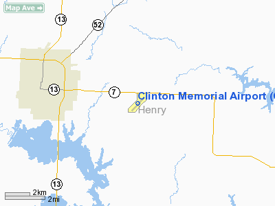
Location & QuickFacts
| FAA Information Effective: | 2008-09-25 |
| Airport Identifier: | GLY |
| Airport Status: | Operational |
| Longitude/Latitude: | 093-41-03.0370W/38-21-23.6630N
-93.684177/38.356573 (Estimated) |
| Elevation: | 822 ft / 250.55 m (Surveyed) |
| Land: | 85 acres |
| From nearest city: | 4 nautical miles E of Clinton, MO |
| Location: | Henry County, MO |
| Magnetic Variation: | 04E (1985) |
Owner & Manager
| Ownership: | Publicly owned |
| Owner: | City Of Clinton |
| Address: | 105 E. Ohio
Clinton, MO 64735 |
| Phone number: | 660-885-6121 |
| Manager: | Wallace White |
| Address: | 205 S. Washington
Clinton, MO 64735
ARPRT ASSOCIATION ADDRESS. |
| Phone number: | 660-885-3091 |
Airport Operations and Facilities
| Airport Use: | Open to public |
| Wind indicator: | Yes |
| Segmented Circle: | Yes |
| Control Tower: | No |
| Lighting Schedule: | DUSK-0000
BCN AVBL AFT 0000 BY PRIOR REQUEST - CALL 660-885-8889. |
| Beacon Color: | Clear-Green (lighted land airport) |
| Landing fee charge: | No |
| Sectional chart: | Kansas City |
| Region: | ACE - Central |
| Boundary ARTCC: | ZKC - Kansas City |
| Tie-in FSS: | COU - Columbia |
| FSS on Airport: | No |
| FSS Toll Free: | 1-800-WX-BRIEF |
| NOTAMs Facility: | COU (NOTAM-d service avaliable) |
| Federal Agreements: | NGY |
Airport Communications
| CTAF: | 122.800 |
| Unicom: | 122.800 |
Airport Services
| Fuel available: | 100LLA
FUEL AVBL 24 HRS. |
| Airframe Repair: | MAJOR |
| Power Plant Repair: | MINOR |
| Bulk Oxygen: | NONE |
Runway Information
Runway 04/22
| Dimension: | 4001 x 60 ft / 1219.5 x 18.3 m |
| Surface: | ASPH, Fair Condition |
| Weight Limit: | Single wheel: 12500 lbs.
Dual wheel: 16000 lbs. |
| Edge Lights: | Medium |
| |
Runway 04 |
Runway 22 |
| Longitude: | 093-41-20.7760W | 093-40-45.2960W |
| Latitude: | 38-21-09.6650N | 38-21-37.6620N |
| Elevation: | 819.00 ft | 822.00 ft |
| Alignment: | 45 | 127 |
| Traffic Pattern: | Left | Left |
| Markings: | Non-precision instrument, Fair Condition | Non-precision instrument, Fair Condition |
| Crossing Height: | 39.00 ft | 39.00 ft |
| VASI: | 4-light PAPI on left side | 4-light PAPI on left side |
| Visual Glide Angle: | 3.50° | 3.50° |
| Runway End Identifier: | Yes | Yes |
| Obstruction: | 52 ft trees, 1030.0 ft from runway, 75 ft left of centerline, 15:1 slope to clear | 50 ft trees, 1120.0 ft from runway, 258 ft left of centerline, 18:1 slope to clear |
|
Radio Navigation Aids
| ID |
Type |
Name |
Ch |
Freq |
Var |
Dist |
| GLY | NDB | Golden Valley | | 388.00 | 04E | 0.1 nm |
| HCK | NDB | Hawks | | 296.00 | 04E | 17.2 nm |
| DMO | NDB | Sedalia | | 281.00 | 03E | 31.7 nm |
| EAD | NDB | Nevada | | 209.00 | 06E | 41.8 nm |
| PUR | NDB | Marshall | | 371.00 | 03E | 47.1 nm |
| LXT | NDB | Lesumit | | 263.00 | 04E | 48.6 nm |
| SZL | TACAN | Whiteman | 035X | | 04E | 23.6 nm |
| BUM | VORTAC | Butler | 106X | 115.90 | 07E | 38.3 nm |
| ANX | VORTAC | Napoleon | 087X | 114.00 | 07E | 49.1 nm |
Images and information placed above are from
http://www.airport-data.com/airport/GLY/
We thank them for the data!
| General Info
|
| Country |
United States
|
| State |
MISSOURI
|
| FAA ID |
GLY
|
| Latitude |
38-21-23.663N
|
| Longitude |
093-41-03.037W
|
| Elevation |
822 feet
|
| Near City |
CLINTON
|
We don't guarantee the information is fresh and accurate. The data may
be wrong or outdated.
For more up-to-date information please refer to other sources.
|
|


