 |
|
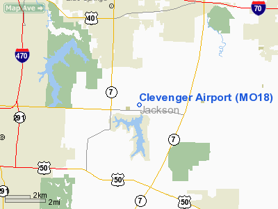
Location & QuickFacts
| FAA Information Effective: | 2008-09-25 |
| Airport Identifier: | MO18 |
| Airport Status: | Operational |
| Longitude/Latitude: | 094-14-56.8090W/38-56-50.0260N
-94.249114/38.947229 (Estimated) |
| Elevation: | 990 ft / 301.75 m (Estimated) |
| Land: | 120 acres |
| From nearest city: | 5 nautical miles S of Blue Springs, MO |
| Location: | Jackson County, MO |
| Magnetic Variation: | 05E (1985) |
Owner & Manager
| Ownership: | Privately owned |
| Owner: | Stephen Mark Clevenger |
| Address: | 28800 Colbern Rd
Lee's Summit, MO 64063 |
| Phone number: | 816-228-9111 |
| Manager: | Mark Clevenger |
| Address: | 3201 Owen School Road
Independence, MO 64057 |
| Phone number: | 816-228-9111 |
Airport Operations and Facilities
| Airport Use: | Private
PERSONAL USE |
| Segmented Circle: | No |
| Control Tower: | No |
| Sectional chart: | Kansas City |
| Region: | ACE - Central |
| Boundary ARTCC: | ZKC - Kansas City |
| Tie-in FSS: | COU - Columbia |
| FSS Toll Free: | 1-800-WX-BRIEF |
Runway Information
Runway 18/36
| Dimension: | 2400 x 200 ft / 731.5 x 61.0 m |
| Surface: | TURF, |
| |
Runway 18 |
Runway 36 |
| Traffic Pattern: | Left | Left |
| Displaced threshold: | 0.00 ft | 200.00 ft |
| Obstruction: | | 25 ft trees, 15.0 ft from runway |
|
Radio Navigation Aids
| ID |
Type |
Name |
Ch |
Freq |
Var |
Dist |
| LXT | NDB | Lesumit | | 263.00 | 04E | 5.8 nm |
| GKB | NDB | Norge | | 517.00 | 05E | 20.2 nm |
| GQ | NDB | Norge | | 517.00 | 05E | 20.2 nm |
| GPH | NDB | Mosby | | 284.00 | 03E | 24.1 nm |
| DO | NDB | Dotte | | 359.00 | 05E | 28.6 nm |
| HCK | NDB | Hawks | | 296.00 | 04E | 37.0 nm |
| GLY | NDB | Golden Valley | | 388.00 | 04E | 44.2 nm |
| EZZ | NDB | Cameron | | 394.00 | 03E | 47.0 nm |
| PUR | NDB | Marshall | | 371.00 | 03E | 49.5 nm |
| SZL | TACAN | Whiteman | 035X | | 04E | 35.1 nm |
| RIS | VOR/DME | Riverside | 051X | 111.40 | 05E | 19.3 nm |
| OJC | VOR/DME | Johnson County | 077X | 113.00 | 06E | 23.7 nm |
| BQS | VOR/DME | Braymer | 049X | 111.20 | 03E | 44.6 nm |
| ANX | VORTAC | Napoleon | 087X | 114.00 | 07E | 10.5 nm |
| MCI | VORTAC | Kansas City | 079Y | 113.25 | 05E | 30.5 nm |
| BUM | VORTAC | Butler | 106X | 115.90 | 07E | 42.1 nm |
| MKC | VOT | Kansas City Downtown | | 108.60 | | 19.4 nm |
Remarks
- PRVDD APCH TO EACH RWY MAINTD FOR MIN 20:1 GLIDE SLOPE; APT TRSNL SFC MAINTD FOR A 7:1 SLOPE; TFC PATTERN LANDING N OR DEPARTING S MUST BE MADE N OF LAKE LOTOWANA AT NO GRTR THAN 500' AGL.
Images and information placed above are from
http://www.airport-data.com/airport/MO18/
We thank them for the data!
| General Info
|
| Country |
United States
|
| State |
MISSOURI
|
| FAA ID |
MO18
|
| Latitude |
38-56-50.026N
|
| Longitude |
094-14-56.809W
|
| Elevation |
990 feet
|
| Near City |
BLUE SPRINGS
|
We don't guarantee the information is fresh and accurate. The data may
be wrong or outdated.
For more up-to-date information please refer to other sources.
|
|


