 |
|
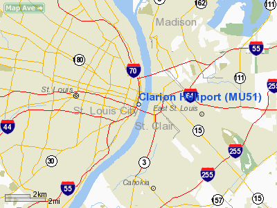
Location & QuickFacts
| FAA Information Effective: | 2008-09-25 |
| Airport Identifier: | MU51 |
| Airport Status: | Operational |
| Longitude/Latitude: | 090-11-11.3980W/38-37-22.1830N
-90.186499/38.622829 (Estimated) |
| Elevation: | 500 ft / 152.40 m (Estimated) |
| Land: | 0 acres |
| From nearest city: | 0 nautical miles N of St Louis, MO |
| Location: | St Louis City County, MO |
| Magnetic Variation: | 02E (1985) |
Owner & Manager
| Ownership: | Privately owned |
| Owner: | Clarion Hotel |
| Address: | 200 South 4th Street
St. Louis, MO 63102 |
| Phone number: | 573-241-9500 |
| Manager: | Bob Gaul |
| Address: | 200 South 4th Street
St. Louis, MO 63102 |
| Phone number: | 573-241-9500 |
Airport Operations and Facilities
| Airport Use: | Private |
| Wind indicator: | Yes |
| Segmented Circle: | No |
| Control Tower: | No |
| Lighting Schedule: | PHONE REQ
FOR FLOOD LGTS CALL 314-421-5440. |
| Landing fee charge: | No |
| Sectional chart: | St Louis |
| Region: | ACE - Central |
| Boundary ARTCC: | ZKC - Kansas City |
| Tie-in FSS: | STL - Saint Louis |
| FSS on Airport: | No |
| FSS Toll Free: | 1-800-WX-BRIEF |
Runway Information
Helipad H1
| Dimension: | 250 x 150 ft / 76.2 x 45.7 m |
| Surface: | CONC, |
| |
Runway H1 |
Runway |
| Traffic Pattern: | Left | Left |
|
Radio Navigation Aids
| ID |
Type |
Name |
Ch |
Freq |
Var |
Dist |
| LM | NDB | Oblio | | 338.00 | 00E | 17.2 nm |
| CVM | NDB | Civic Memorial | | 263.00 | 02E | 17.3 nm |
| BL | NDB | Belleville | | 362.00 | 02E | 22.3 nm |
| FES | NDB | Festus | | 269.00 | 01E | 27.4 nm |
| SAR | NDB | Sparta | | 239.00 | 01E | 36.7 nm |
| LTD | NDB | Litchfield | | 371.00 | 01E | 40.4 nm |
| SKE | TACAN | Scott | 059X | | 02E | 16.4 nm |
| CSX | VOR/DME | Cardinal | 111Y | 116.45 | 00E | 11.3 nm |
| TOY | VORTAC | Troy | 107X | 116.00 | 04E | 14.4 nm |
| STL | VORTAC | St Louis | 121X | 117.40 | 01E | 19.9 nm |
| FTZ | VORTAC | Foristell | 045X | 110.80 | 05E | 37.1 nm |
| ENL | VORTAC | Centralia | 097X | 115.00 | 04E | 49.8 nm |
| STL | VOT | St Louis Lambert | | 111.00 | | 11.2 nm |
| SUS | VOT | Spirit Of St Louis | | 112.20 | | 22.0 nm |
Remarks
- PROVIDED APCH/DEP PATH ARE MAINTAINED FOR AN 8:1 GLIDE SLOPE & TRANSITIONAL SFCS FOR A 2:1 SLOPE.
Images and information placed above are from
http://www.airport-data.com/airport/MU51/
We thank them for the data!
| General Info
|
| Country |
United States
|
| State |
MISSOURI
|
| FAA ID |
MU51
|
| Latitude |
38-37-22.183N
|
| Longitude |
090-11-11.398W
|
| Elevation |
500 feet
|
| Near City |
ST LOUIS
|
We don't guarantee the information is fresh and accurate. The data may
be wrong or outdated.
For more up-to-date information please refer to other sources.
|
|


