 |
|
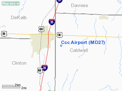
Location & QuickFacts
| FAA Information Effective: | 2008-09-25 |
| Airport Identifier: | MO27 |
| Airport Status: | Operational |
| Longitude/Latitude: | 094-11-33.8000W/39-44-07.0100N
-94.192722/39.735281 (Estimated) |
| Elevation: | 984 ft / 299.92 m (Estimated) |
| Land: | 40 acres |
| From nearest city: | 2 nautical miles E of Cameron, MO |
| Location: | Caldwell County, MO |
| Magnetic Variation: | 03E (2000) |
Owner & Manager
| Ownership: | Privately owned |
| Owner: | Marvin Carpenter |
| Address: | 6135 Nw Sale Barn Rd.
Cameron, MO 64429 |
| Phone number: | 816-632-2877 |
| Manager: | Marvin Carpenter |
| Address: | 6135 Nw Sale Barn Rd
Cameron, MO 64429 |
| Phone number: | 816-632-2877 |
Airport Operations and Facilities
| Airport Use: | Private |
| Segmented Circle: | No |
| Control Tower: | No |
| Region: | ACE - Central |
| Boundary ARTCC: | ZKC - Kansas City |
| Tie-in FSS: | COU - Columbia |
| FSS Toll Free: | 1-800-WX-BRIEF |
Runway Information
Runway 11/29
| Dimension: | 1500 x 60 ft / 457.2 x 18.3 m |
| Surface: | TURF, |
| |
Runway 11 |
Runway 29 |
| Traffic Pattern: | Left | Right |
|
Radio Navigation Aids
| ID |
Type |
Name |
Ch |
Freq |
Var |
Dist |
| EZZ | NDB | Cameron | | 394.00 | 03E | 3.7 nm |
| GPH | NDB | Mosby | | 284.00 | 03E | 24.0 nm |
| CHT | NDB | Chillicothe | | 375.00 | 03E | 32.4 nm |
| AZN | NDB | Amazon | | 233.00 | 06E | 34.2 nm |
| TRX | NDB | Trenton | | 400.00 | 03E | 34.6 nm |
| DO | NDB | Dotte | | 359.00 | 05E | 40.3 nm |
| GKB | NDB | Norge | | 517.00 | 05E | 45.9 nm |
| GQ | NDB | Norge | | 517.00 | 05E | 45.9 nm |
| LXT | NDB | Lesumit | | 263.00 | 04E | 47.3 nm |
| EVU | NDB | Emville | | 317.00 | 05E | 49.6 nm |
| BQS | VOR/DME | Braymer | 049X | 111.20 | 03E | 16.0 nm |
| RIS | VOR/DME | Riverside | 051X | 111.40 | 05E | 41.4 nm |
| STJ | VORTAC | St Joseph | 102X | 115.50 | 08E | 36.4 nm |
| MCI | VORTAC | Kansas City | 079Y | 113.25 | 05E | 37.0 nm |
| ANX | VORTAC | Napoleon | 087X | 114.00 | 07E | 38.6 nm |
| MKC | VOT | Kansas City Downtown | | 108.60 | | 41.3 nm |
Remarks
- OWNER DESIRES ARPT NOT BE CHARTED.
- PRVDD CLEAR APCH TO EA RY END FOR A 20:1 GLIDE SLOPE & A CLEAR TRANSITIONAL SFC FOR A 7:1 SLOPE.
Images and information placed above are from
http://www.airport-data.com/airport/MO27/
We thank them for the data!
| General Info
|
| Country |
United States
|
| State |
MISSOURI
|
| FAA ID |
MO27
|
| Latitude |
39-44-07.010N
|
| Longitude |
094-11-33.800W
|
| Elevation |
984 feet
|
| Near City |
CAMERON
|
We don't guarantee the information is fresh and accurate. The data may
be wrong or outdated.
For more up-to-date information please refer to other sources.
|
|


