 |
|
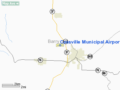
Cassville Municipal Airport |
Location & QuickFacts
| FAA Information Effective: | 2008-09-25 |
| Airport Identifier: | 94K |
| Airport Status: | Operational |
| Longitude/Latitude: | 093-54-01.9000W/36-41-50.7000N
-93.900528/36.697417 (Estimated) |
| Elevation: | 1482 ft / 451.71 m (Surveyed) |
| Land: | 104 acres |
| From nearest city: | 2 nautical miles NW of Cassville, MO |
| Location: | Barry County, MO |
| Magnetic Variation: | 06E (1980) |
Owner & Manager
| Ownership: | Publicly owned |
| Owner: | City Of Cassville |
| Address: | 300 S Main
Cassville, MO 65625 |
| Phone number: | 417-847-4441 |
| Manager: | Jim Steward |
| Address: | 300 S Main
Cassville, MO 65625 |
| Phone number: | 417-847-5499
EVENING PHONE # 417-835-8063 |
Airport Operations and Facilities
| Airport Use: | Open to public |
| Wind indicator: | Yes |
| Segmented Circle: | Yes |
| Control Tower: | No |
| Lighting Schedule: | DUSK-DAWN
ACTVT MIRL RY 09/27 - CTAF. |
| Beacon Color: | Clear-Green (lighted land airport) |
| Landing fee charge: | No |
| Sectional chart: | Kansas City |
| Region: | ACE - Central |
| Boundary ARTCC: | ZKC - Kansas City |
| Tie-in FSS: | COU - Columbia |
| FSS on Airport: | No |
| FSS Toll Free: | 1-800-WX-BRIEF |
| NOTAMs Facility: | COU (NOTAM-d service avaliable) |
| Federal Agreements: | NGY |
Airport Communications
Airport Services
| Fuel available: | 100LL
FOR FUEL CALL PHONE NR ON TERMINAL BLDG. |
| Airframe Repair: | MINOR |
| Power Plant Repair: | MINOR |
| Bottled Oxygen: | NONE |
| Bulk Oxygen: | NONE |
Runway Information
Runway 09/27
| Dimension: | 3600 x 60 ft / 1097.3 x 18.3 m |
| Surface: | ASPH, Good Condition |
| Weight Limit: | Single wheel: 8000 lbs. |
| Edge Lights: | Medium |
| |
Runway 09 |
Runway 27 |
| Longitude: | 093-54-24.0010W | 093-53-39.7980W |
| Latitude: | 36-41-50.5760N | 36-41-50.7730N |
| Elevation: | 1482.00 ft | 1471.00 ft |
| Alignment: | 90 | 127 |
| Traffic Pattern: | Left | Left |
| Markings: | Non-precision instrument, Good Condition | Non-precision instrument, Good Condition |
| Obstruction: | 47 ft tree, 2000.0 ft from runway, 323 ft left of centerline, 38:1 slope to clear | 45 ft pline, 1430.0 ft from runway, 27:1 slope to clear |
|
Radio Navigation Aids
| ID |
Type |
Name |
Ch |
Freq |
Var |
Dist |
| PLK | NDB | Point Lookout/dcmsnd | | 204.00 | 03E | 32.6 nm |
| SLG | NDB | Siloam Springs | | 284.00 | 04E | 41.7 nm |
| ILJ | NDB | Willard | | 254.00 | 03E | 42.4 nm |
| EOS | VOR/DME | Neosho | 120X | 117.30 | 07E | 27.2 nm |
| HRO | VOR/DME | Harrison | 072X | 112.50 | 04E | 40.3 nm |
| DAK | VOR/DME | Drake | 025X | 108.80 | 07E | 41.9 nm |
| RZC | VORTAC | Razorback | 111X | 116.40 | 04E | 29.1 nm |
| SGF | VORTAC | Springfield | 116X | 116.90 | 04E | 48.0 nm |
Images and information placed above are from
http://www.airport-data.com/airport/94K/
We thank them for the data!
| General Info
|
| Country |
United States
|
| State |
MISSOURI
|
| FAA ID |
94K
|
| Latitude |
36-41-50.700N
|
| Longitude |
093-54-01.900W
|
| Elevation |
1482 feet
|
| Near City |
CASSVILLE
|
We don't guarantee the information is fresh and accurate. The data may
be wrong or outdated.
For more up-to-date information please refer to other sources.
|
|


