 |
|
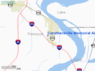
Caruthersville Memorial Airport |
Location & QuickFacts
| FAA Information Effective: | 2008-09-25 |
| Airport Identifier: | M05 |
| Airport Status: | Operational |
| Longitude/Latitude: | 089-40-35.3000W/36-10-08.8000N
-89.676472/36.169111 (Estimated) |
| Elevation: | 268 ft / 81.69 m (Surveyed) |
| Land: | 57 acres |
| From nearest city: | 1 nautical miles SW of Caruthersville, MO |
| Location: | Pemiscot County, MO |
| Magnetic Variation: | 00W (2005) |
Owner & Manager
| Ownership: | Publicly owned |
| Owner: | City Of Caruthersville |
| Address: | 200 W 3rd St.
Caruthersville, MO 63830 |
| Phone number: | 573-333-2142 |
| Manager: | City Of Caruthersville |
| Address: | 200 W 3rd St.
Caruthersville, MO 63830
ARPT ADDRESS 2204 AIRPORT ROAD. |
| Phone number: | 573-333-2142
ALTERNATE PHONE NBR 573-333-4296. |
Airport Operations and Facilities
| Airport Use: | Open to public |
| Wind indicator: | Yes |
| Segmented Circle: | Yes |
| Control Tower: | No |
| Lighting Schedule: | DUSK-DAWN
ACTVT MIRL RY 18/36 - CTAF. |
| Beacon Color: | Clear-Green (lighted land airport) |
| Landing fee charge: | No |
| Sectional chart: | St Louis |
| Region: | ACE - Central |
| Boundary ARTCC: | ZME - Memphis |
| Tie-in FSS: | STL - Saint Louis |
| FSS on Airport: | No |
| FSS Toll Free: | 1-800-WX-BRIEF |
| NOTAMs Facility: | STL (NOTAM-d service avaliable) |
| Federal Agreements: | NY1 |
Airport Communications
Airport Services
| Fuel available: | 100LLA
100LL FUEL AVBL 24 HRS. |
| Airframe Repair: | NONE |
| Power Plant Repair: | NONE |
Runway Information
Runway 18/36
| Dimension: | 4005 x 75 ft / 1220.7 x 22.9 m |
| Surface: | ASPH, Fair Condition |
| Edge Lights: | Medium |
| |
Runway 18 |
Runway 36 |
| Longitude: | 089-40-35.6060W | 089-40-35.0550W |
| Latitude: | 36-10-28.6480N | 36-09-49.0460N |
| Elevation: | 268.00 ft | 266.00 ft |
| Alignment: | 127 | 127 |
| Traffic Pattern: | Right | Left |
| Markings: | Non-precision instrument, Fair Condition | Non-precision instrument, Fair Condition |
| Runway End Identifier: | No | No |
| Obstruction: | 78 ft trees, 666.0 ft from runway, 278 ft right of centerline, 5:1 slope to clear | 46 ft trees, 1008.0 ft from runway, 278 ft right of centerline, 17:1 slope to clear
RWY 36; +1-10 FT BRUSH, 0-80 FT FM RWY END, 192 FT L. |
|
Radio Navigation Aids
| ID |
Type |
Name |
Ch |
Freq |
Var |
Dist |
| IUI | NDB | Hicks | | 350.00 | 01E | 15.9 nm |
| DNT | NDB | Nally Dunston | | 343.00 | 01W | 16.8 nm |
| TKX | NDB | Kennett | | 358.00 | 00E | 17.9 nm |
| MXA | NDB | Manila | | 282.00 | 01E | 28.7 nm |
| BPW | NDB | Osceola | | 239.00 | 02E | 33.0 nm |
| UC | NDB | Obion | | 212.00 | 00E | 33.9 nm |
| COO | NDB | Covington | | 326.00 | 02E | 35.1 nm |
| DXE | NDB | Dexter | | 423.00 | 00E | 39.3 nm |
| PGR | NDB | Paragould | | 383.00 | 01E | 41.0 nm |
| TGC | NDB | Gibson | | 378.00 | 01E | 42.5 nm |
| CHQ | NDB | Charleston | | 208.00 | 01E | 43.5 nm |
| FD | NDB | Earli | | 278.00 | 03E | 43.6 nm |
| GOJ | VOR | Gosnell | | 111.80 | 01E | 18.4 nm |
| JBR | VOR/DME | Jonesboro | 023X | 108.60 | 02E | 47.7 nm |
| DYR | VORTAC | Dyersburg | 115X | 116.80 | 03E | 19.6 nm |
| MAW | VORTAC | Malden | 049X | 111.20 | 03E | 25.8 nm |
Remarks
- CROP DUSTING ACFT ON & INVOF ARPT.
- ROUGH GND IN RY SAFETY AREA ON SIDES & BOTH ENDS OF RY.
Images and information placed above are from
http://www.airport-data.com/airport/M05/
We thank them for the data!
| General Info
|
| Country |
United States
|
| State |
MISSOURI
|
| FAA ID |
M05
|
| Latitude |
36-10-08.851N
|
| Longitude |
089-40-35.330W
|
| Elevation |
268 feet
|
| Near City |
CARUTHERSVILLE
|
We don't guarantee the information is fresh and accurate. The data may
be wrong or outdated.
For more up-to-date information please refer to other sources.
|
|


