 |
|
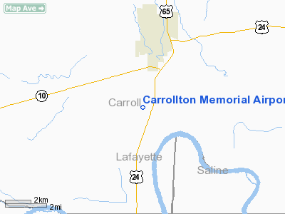
Carrollton Memorial Airport |
Location & QuickFacts
| FAA Information Effective: | 2008-09-25 |
| Airport Identifier: | K26 |
| Airport Status: | Operational |
| Longitude/Latitude: | 093-30-23.6000W/39-18-44.7000N
-93.506556/39.312417 (Estimated) |
| Elevation: | 670 ft / 204.22 m (Estimated) |
| Land: | 40 acres |
| From nearest city: | 3 nautical miles S of Carrollton, MO |
| Location: | Carroll County, MO |
| Magnetic Variation: | 04E (1985) |
Owner & Manager
| Ownership: | Publicly owned |
| Owner: | City Of Carrollton |
| Address: | 206 W. Washington
Carrollton, MO 64633 |
| Phone number: | 660-542-1414 |
| Manager: | John Sweeny
ARPRT BOARD CHAIRMAN. |
| Address: | 206 W. Washington
Carrollton, MO 64633 |
| Phone number: | 816-506-0203
ALT PHONE 660-542-0518 (JIM EVANS). |
Airport Operations and Facilities
| Airport Use: | Open to public |
| Wind indicator: | Yes |
| Segmented Circle: | No |
| Control Tower: | No |
| Lighting Schedule: | DUSK-DAWN
MIRL RY 18/36 PRESET ON LOW INTST. |
| Beacon Color: | Clear-Green (lighted land airport) |
| Landing fee charge: | No |
| Sectional chart: | Kansas City |
| Region: | ACE - Central |
| Boundary ARTCC: | ZKC - Kansas City |
| Tie-in FSS: | COU - Columbia |
| FSS on Airport: | No |
| FSS Toll Free: | 1-800-WX-BRIEF |
| NOTAMs Facility: | COU (NOTAM-d service avaliable) |
| Federal Agreements: | GY |
Airport Communications
Airport Services
| Fuel available: | 100LL
SELF-SERVE FUEL WITH CREDIT CARD. |
| Airframe Repair: | NONE |
| Power Plant Repair: | NONE |
Runway Information
Runway 18/36
| Dimension: | 2600 x 50 ft / 792.5 x 15.2 m |
| Surface: | ASPH, Good Condition |
| Surface Treatment: | Aggregate Friction Seal Coat |
| Edge Lights: | Medium |
| |
Runway 18 |
Runway 36 |
| Longitude: | 093-30-23.3200W | 093-30-23.8800W |
| Latitude: | 39-18-57.5900N | 39-18-31.8900N |
| Traffic Pattern: | Left | Left |
| Markings: | Basic, Good Condition | Basic, Good Condition |
| Obstruction: | 8 ft brush, 355.0 ft from runway, 75 ft right of centerline, 19:1 slope to clear | 33 ft pline, 1365.0 ft from runway, 35:1 slope to clear |
|
Radio Navigation Aids
| ID |
Type |
Name |
Ch |
Freq |
Var |
Dist |
| PUR | NDB | Marshall | | 371.00 | 03E | 21.8 nm |
| CHT | NDB | Chillicothe | | 375.00 | 03E | 27.9 nm |
| BZK | NDB | Brookfield | | 383.00 | 03E | 32.8 nm |
| GPH | NDB | Mosby | | 284.00 | 03E | 37.3 nm |
| DMO | NDB | Sedalia | | 281.00 | 03E | 39.7 nm |
| HCK | NDB | Hawks | | 296.00 | 04E | 41.2 nm |
| EZZ | NDB | Cameron | | 394.00 | 03E | 43.4 nm |
| VER | NDB | Viertel | | 347.00 | 02E | 44.1 nm |
| LXT | NDB | Lesumit | | 263.00 | 04E | 45.5 nm |
| TRX | NDB | Trenton | | 400.00 | 03E | 46.3 nm |
| SZL | TACAN | Whiteman | 035X | | 04E | 34.7 nm |
| BQS | VOR/DME | Braymer | 049X | 111.20 | 03E | 25.7 nm |
| ANX | VORTAC | Napoleon | 087X | 114.00 | 07E | 31.8 nm |
Remarks
- LOW LEVEL CROPS WITHIN 60 FT OF RY CNTRLN.
Images and information placed above are from
http://www.airport-data.com/airport/K26/
We thank them for the data!
| General Info
|
| Country |
United States
|
| State |
MISSOURI
|
| FAA ID |
K26
|
| Latitude |
39-19-00.073N
|
| Longitude |
093-30-00.762W
|
| Elevation |
670 feet
|
| Near City |
CARROLLTON
|
We don't guarantee the information is fresh and accurate. The data may
be wrong or outdated.
For more up-to-date information please refer to other sources.
|
|


