 |
|
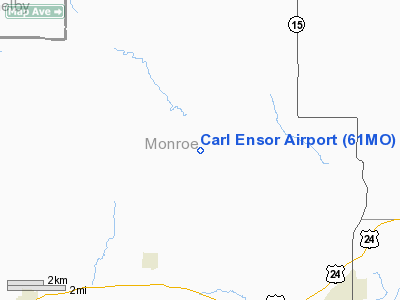
Location & QuickFacts
| FAA Information Effective: | 2008-09-25 |
| Airport Identifier: | 61MO |
| Airport Status: | Operational |
| Longitude/Latitude: | 092-05-55.6240W/39-32-55.1360N
-92.098784/39.548649 (Estimated) |
| Elevation: | 740 ft / 225.55 m (Estimated) |
| Land: | 0 acres |
| From nearest city: | 1 nautical miles S of Grainville, MO |
| Location: | Monroe County, MO |
| Magnetic Variation: | 03E (1985) |
Owner & Manager
| Ownership: | Privately owned |
| Owner: | Carl Ensor |
| Address: | Rr 1
Holliday, MO 65258 |
| Phone number: | 816-266-3378 |
| Manager: | Carl Ensor |
| Address: | Rr 1
Holliday, MO 65258 |
| Phone number: | 816-266-3378 |
Airport Operations and Facilities
| Airport Use: | Private |
| Wind indicator: | Yes |
| Segmented Circle: | No |
| Control Tower: | No |
| Landing fee charge: | No |
| Sectional chart: | Kansas City |
| Region: | ACE - Central |
| Boundary ARTCC: | ZKC - Kansas City |
| Tie-in FSS: | COU - Columbia |
| FSS on Airport: | No |
| FSS Toll Free: | 1-800-WX-BRIEF |
Runway Information
Runway 18/36
| Dimension: | 2600 x 75 ft / 792.5 x 22.9 m |
| Surface: | TURF, |
| |
Runway 18 |
Runway 36 |
| Traffic Pattern: | Left | Left |
| Obstruction: | 50 ft trees, 1300.0 ft from runway | 50 ft trees, 1000.0 ft from runway |
|
Radio Navigation Aids
| ID |
Type |
Name |
Ch |
Freq |
Var |
Dist |
| HAE | NDB | Hannibal | | 411.00 | 03E | 32.0 nm |
| FTT | NDB | Guthrie | | 317.00 | 03E | 42.7 nm |
| UI | NDB | Quincy | | 293.00 | 02E | 44.1 nm |
| VER | NDB | Viertel | | 347.00 | 02E | 45.2 nm |
| BZK | NDB | Brookfield | | 383.00 | 03E | 48.5 nm |
| MCM | VOR/DME | Macon | 076X | 112.90 | 06E | 18.9 nm |
| COU | VOR/DME | Columbia | 039X | 110.20 | 03E | 44.7 nm |
| HLV | VORTAC | Hallsville | 089X | 114.20 | 06E | 26.2 nm |
| IRK | VORTAC | Kirksville | 093X | 114.60 | 06E | 41.9 nm |
| UIN | VORTAC | Quincy | 083X | 113.60 | 05E | 42.0 nm |
Remarks
Images and information placed above are from
http://www.airport-data.com/airport/61MO/
We thank them for the data!
| General Info
|
| Country |
United States
|
| State |
MISSOURI
|
| FAA ID |
61MO
|
| Latitude |
39-32-55.136N
|
| Longitude |
092-05-55.624W
|
| Elevation |
740 feet
|
| Near City |
GRAINVILLE
|
We don't guarantee the information is fresh and accurate. The data may
be wrong or outdated.
For more up-to-date information please refer to other sources.
|
|


