 |
|
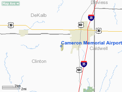
Location & QuickFacts
| FAA Information Effective: | 2008-09-25 |
| Airport Identifier: | EZZ |
| Airport Status: | Operational |
| Longitude/Latitude: | 094-16-34.9500W/39-43-39.2150N
-94.276375/39.727560 (Estimated) |
| Elevation: | 1036 ft / 315.77 m (Estimated) |
| Land: | 202 acres |
| From nearest city: | 2 nautical miles SW of Cameron, MO |
| Location: | Clinton County, MO |
| Magnetic Variation: | 05E (1985) |
Owner & Manager
| Ownership: | Publicly owned |
| Owner: | City Of Cameron |
| Address: | 205 North Main
Cameron, MO 64429 |
| Phone number: | 816-632-2177 |
| Manager: | Eric Evans |
| Address: | 11766 Northeast A Hwy
Cameron, MO 64429 |
| Phone number: | 816-632-2423 |
Airport Operations and Facilities
| Airport Use: | Open to public |
| Wind indicator: | Yes |
| Segmented Circle: | Yes |
| Control Tower: | No |
| Lighting Schedule: | DUSK-DAWN
MIRL RY 17/35, PAPI RYS 17 & 35, REIL RYS 17 & 35 OPER DUSK-2400; AFT 2400 ACTVT & INCR INTS - CTAF. |
| Beacon Color: | Clear-Green (lighted land airport) |
| Landing fee charge: | No |
| Sectional chart: | Kansas City |
| Region: | ACE - Central |
| Boundary ARTCC: | ZKC - Kansas City |
| Tie-in FSS: | COU - Columbia |
| FSS on Airport: | No |
| FSS Toll Free: | 1-800-WX-BRIEF |
| NOTAMs Facility: | COU (NOTAM-d service avaliable) |
| Federal Agreements: | NGY |
Airport Communications
| CTAF: | 122.800 |
| Unicom: | 122.800 |
Airport Services
| Fuel available: | 100LL
AUTOMATED SELF FUEL AVBL 24 HRS. |
Runway Information
Runway 17/35
| Dimension: | 4000 x 75 ft / 1219.2 x 22.9 m |
| Surface: | CONC, Good Condition |
| Weight Limit: | Single wheel: 30000 lbs. |
| Edge Lights: | Medium |
| |
Runway 17 |
Runway 35 |
| Longitude: | 094-16-36.3800W | 094-16-31.5100W |
| Latitude: | 39-43-58.9300N | 39-43-19.4700N |
| Elevation: | 1042.00 ft | 1020.00 ft |
| Traffic Pattern: | Left | Left |
| Markings: | Non-precision instrument, Good Condition | Non-precision instrument, Good Condition |
| Crossing Height: | 21.00 ft | 22.00 ft |
| VASI: | 4-light PAPI on left side | 4-light PAPI on left side |
| Visual Glide Angle: | 3.00° | 3.00° |
| Runway End Identifier: | Yes | Yes |
| Obstruction: | , 50:1 slope to clear
+1-3 FT WEEDS, 25-200 FT FM RWY END, L & R. | 23 ft trees, 1220.0 ft from runway, 326 ft left of centerline, 44:1 slope to clear
+1-3 FT BRUSH, 0-100 FT FM RY END, 75-100 FT R, 75-85L. |
|
Radio Navigation Aids
| ID |
Type |
Name |
Ch |
Freq |
Var |
Dist |
| EZZ | NDB | Cameron | | 394.00 | 03E | 0.2 nm |
| GPH | NDB | Mosby | | 284.00 | 03E | 23.0 nm |
| AZN | NDB | Amazon | | 233.00 | 06E | 30.7 nm |
| CHT | NDB | Chillicothe | | 375.00 | 03E | 36.3 nm |
| DO | NDB | Dotte | | 359.00 | 05E | 37.6 nm |
| TRX | NDB | Trenton | | 400.00 | 03E | 38.0 nm |
| GKB | NDB | Norge | | 517.00 | 05E | 43.8 nm |
| GQ | NDB | Norge | | 517.00 | 05E | 43.8 nm |
| LXT | NDB | Lesumit | | 263.00 | 04E | 46.3 nm |
| EVU | NDB | Emville | | 317.00 | 05E | 47.5 nm |
| BQS | VOR/DME | Braymer | 049X | 111.20 | 03E | 19.4 nm |
| RIS | VOR/DME | Riverside | 051X | 111.40 | 05E | 39.4 nm |
| STJ | VORTAC | St Joseph | 102X | 115.50 | 08E | 33.1 nm |
| MCI | VORTAC | Kansas City | 079Y | 113.25 | 05E | 34.1 nm |
| ANX | VORTAC | Napoleon | 087X | 114.00 | 07E | 38.6 nm |
| MKC | VOT | Kansas City Downtown | | 108.60 | | 39.3 nm |
Images and information placed above are from
http://www.airport-data.com/airport/EZZ/
We thank them for the data!
| General Info
|
| Country |
United States
|
| State |
MISSOURI
|
| FAA ID |
EZZ
|
| Latitude |
39-43-39.215N
|
| Longitude |
094-16-34.950W
|
| Elevation |
1036 feet
|
| Near City |
CAMERON
|
We don't guarantee the information is fresh and accurate. The data may
be wrong or outdated.
For more up-to-date information please refer to other sources.
|
|


