 |
|
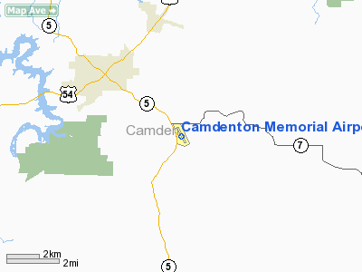
Camdenton Memorial Airport |
Location & QuickFacts
| FAA Information Effective: | 2008-09-25 |
| Airport Identifier: | H21 |
| Airport Status: | Operational |
| Longitude/Latitude: | 092-41-28.2450W/37-58-26.2800N
-92.691179/37.973967 (Estimated) |
| Elevation: | 1062 ft / 323.70 m (Surveyed) |
| Land: | 192 acres |
| From nearest city: | 3 nautical miles SE of Camdenton, MO |
| Location: | Camden County, MO |
| Magnetic Variation: | 03E (1995) |
Owner & Manager
| Ownership: | Publicly owned |
| Owner: | City Of Camdenton |
| Address: | Box 1048 112 Court St
Camdenton, MO 65020 |
| Phone number: | 573-346-3600 |
| Manager: | Tim Miller & Corey Leuwerke |
| Address: | 20 Airport Drive
Camdenton, MO 65020 |
| Phone number: | 573-346-0300 |
Airport Operations and Facilities
| Airport Use: | Open to public |
| Wind indicator: | Yes |
| Segmented Circle: | Yes |
| Control Tower: | No |
| Lighting Schedule: | DUSK-DAWN
MIRL RY 15/33 DUSK-2330. AFTER 2330 ACTVT MIRL AND REIL RYS 15 & 33 - CTAF. PAPI RYS 15 & 33 24 HRS. |
| Beacon Color: | Clear-Green (lighted land airport) |
| Landing fee charge: | No |
| Sectional chart: | Kansas City |
| Region: | ACE - Central |
| Boundary ARTCC: | ZKC - Kansas City |
| Tie-in FSS: | COU - Columbia |
| FSS on Airport: | No |
| FSS Toll Free: | 1-800-WX-BRIEF |
| NOTAMs Facility: | COU (NOTAM-d service avaliable) |
| Federal Agreements: | NGY |
Airport Communications
| CTAF: | 122.800 |
| Unicom: | 122.800 |
Airport Services
| Fuel available: | 100LLA
FOR FUEL AFTER HRS CALL NR ON TERMINAL DOOR. |
| Airframe Repair: | MAJOR |
| Power Plant Repair: | MAJOR |
| Bulk Oxygen: | NONE |
Runway Information
Runway 15/33
| Dimension: | 4000 x 75 ft / 1219.2 x 22.9 m |
| Surface: | ASPH, Good Condition |
| Weight Limit: | Single wheel: 12500 lbs. |
| Edge Lights: | Medium |
| |
Runway 15 |
Runway 33 |
| Longitude: | 092-41-38.8680W | 092-41-17.6900W |
| Latitude: | 37-58-44.2240N | 37-58-08.3600N |
| Elevation: | 1050.00 ft | 1062.00 ft |
| Alignment: | 127 | 127 |
| Traffic Pattern: | Left | Left |
| Markings: | Non-precision instrument, Good Condition | Non-precision instrument, Good Condition |
| Crossing Height: | 41.00 ft | 40.00 ft |
| VASI: | 4-light PAPI on left side | 4-light PAPI on left side |
| Visual Glide Angle: | 3.00° | 3.00° |
| Runway End Identifier: | Yes | Yes |
| Obstruction: | 55 ft trees, 780.0 ft from runway, 209 ft right of centerline, 10:1 slope to clear | 30 ft trees, 320.0 ft from runway, 224 ft right of centerline, 4:1 slope to clear |
|
Radio Navigation Aids
| ID |
Type |
Name |
Ch |
Freq |
Var |
Dist |
| AIZ | NDB | Kaiser | | 377.00 | 05E | 9.9 nm |
| IEB | NDB | Lebanon | | 414.00 | 03E | 24.2 nm |
| BHN | NDB | Buckhorn | | 391.00 | 03E | 32.5 nm |
| ONH | NDB | Noah | | 515.00 | 03E | 45.1 nm |
| JE | NDB | Algoa | | 397.00 | 03E | 45.2 nm |
| DMO | NDB | Sedalia | | 281.00 | 03E | 49.5 nm |
| TBN | VOR | Forney | | 110.00 | 03E | 29.7 nm |
| SHY | VOR/DME | Sunshine | 021X | 108.40 | 05E | 5.8 nm |
| VIH | VOR/DME | Vichy | 124X | 117.70 | 06E | 47.8 nm |
| SGF | VORTAC | Springfield | 116X | 116.90 | 04E | 48.1 nm |
| MAP | VORTAC | Maples | 081X | 113.40 | 06E | 48.7 nm |
| JEF | VOT | Jefferson City | | 112.00 | | 45.0 nm |
Remarks
- WILDLIFE ON & INVOF ARPT.
- WHEN LNDG RY 33, BE ALERT TO POSSIBLE LOW LEVEL WIND SHEAR WHEN WINDS ARE OUT OF EAST OR WEST.
- BE ALERT TO BANNER TOWING ON & INVOF ARPT.
- PROVIDED APCH TO EACH RWY IS MAINTAINED FOR A MIN 20:1 GLIDE SLOPE & TRANSITIONAL SURFACE MAINTAINED FOR A 7:1 SLOPE.
Images and information placed above are from
http://www.airport-data.com/airport/H21/
We thank them for the data!
| General Info
|
| Country |
United States
|
| State |
MISSOURI
|
| FAA ID |
H21
|
| Latitude |
37-58-28.867N
|
| Longitude |
092-41-29.815W
|
| Elevation |
1062 feet
|
| Near City |
CAMDENTON
|
We don't guarantee the information is fresh and accurate. The data may
be wrong or outdated.
For more up-to-date information please refer to other sources.
|
|


