 |
|
Location & QuickFacts
| FAA Information Effective: | 2008-09-25 |
| Airport Identifier: | 03MO |
| Airport Status: | Operational |
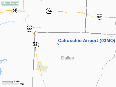
| Longitude/Latitude: | 093-07-53.6920W/37-53-04.1240N
-93.131581/37.884479 (Estimated) |
| Elevation: | 1010 ft / 307.85 m (Estimated) |
| Land: | 0 acres |
| From nearest city: | 3 nautical miles NE of Urbana, MO |
| Location: | Dallas County, MO |
| Magnetic Variation: | 04E (1985) |
Owner & Manager
| Ownership: | Privately owned |
| Owner: | Daryl D Schultz |
| Address: | Rt 2 Box 159
Urbana, MO 65767 |
| Phone number: | 417-993-5297 |
| Manager: | Daryl D Schultz |
| Address: | Rt 2 Box 159
Urbana, MO 65767 |
| Phone number: | 417-993-5297 |
Airport Operations and Facilities
| Airport Use: | Private |
| Wind indicator: | No |
| Segmented Circle: | No |
| Control Tower: | No |
| Landing fee charge: | No |
| Sectional chart: | Kansas City |
| Region: | ACE - Central |
| Boundary ARTCC: | ZKC - Kansas City |
| Tie-in FSS: | COU - Columbia |
| FSS on Airport: | No |
| FSS Toll Free: | 1-800-WX-BRIEF |
Runway Information
Runway 15/33
| Dimension: | 2200 x 50 ft / 670.6 x 15.2 m |
| Surface: | TURF, |
| |
Runway 15 |
Runway 33 |
| Traffic Pattern: | Left | Left |
| Obstruction: | 20 ft pline, 400.0 ft from runway | 5 ft fence, 100.0 ft from runway |
|
Radio Navigation Aids
| ID |
Type |
Name |
Ch |
Freq |
Var |
Dist |
| IEB | NDB | Lebanon | | 414.00 | 03E | 29.3 nm |
| AIZ | NDB | Kaiser | | 377.00 | 05E | 30.2 nm |
| ILJ | NDB | Willard | | 254.00 | 03E | 38.1 nm |
| GLY | NDB | Golden Valley | | 388.00 | 04E | 38.7 nm |
| DMO | NDB | Sedalia | | 281.00 | 03E | 49.3 nm |
| HCK | NDB | Hawks | | 296.00 | 04E | 49.3 nm |
| TBN | VOR | Forney | | 110.00 | 03E | 47.9 nm |
| SHY | VOR/DME | Sunshine | 021X | 108.40 | 05E | 26.8 nm |
| SGF | VORTAC | Springfield | 116X | 116.90 | 04E | 33.2 nm |
Remarks
- HELICOPTERS FROM WHITEMAN AFB WILL BE USING FIELD.
- PRVDD THE APCH TO EACH RWY IS MAINT FOR A MIN 20:1 GLIDE SLOPE AND THE TRSNL SFC MAINT 7:1 SLOPE.
Images and information placed above are from
http://www.airport-data.com/airport/03MO/
We thank them for the data!
| General Info
|
| Country |
United States
|
| State |
MISSOURI
|
| FAA ID |
03MO
|
| Latitude |
37-53-04.124N
|
| Longitude |
093-07-53.692W
|
| Elevation |
1010 feet
|
| Near City |
URBANA
|
We don't guarantee the information is fresh and accurate. The data may
be wrong or outdated.
For more up-to-date information please refer to other sources.
|
|


