 |
|
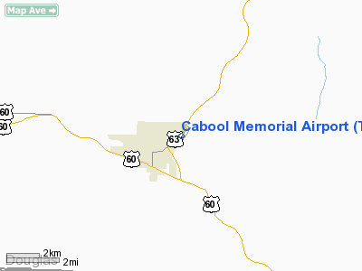
Location & QuickFacts
| FAA Information Effective: | 2008-09-25 |
| Airport Identifier: | TVB |
| Airport Status: | Operational |
| Longitude/Latitude: | 092-05-02.2620W/37-07-56.7870N
-92.083962/37.132441 (Estimated) |
| Elevation: | 1220 ft / 371.86 m (Surveyed) |
| Land: | 75 acres |
| From nearest city: | 1 nautical miles NE of Cabool, MO |
| Location: | Texas County, MO |
| Magnetic Variation: | 03E (1990) |
Owner & Manager
| Ownership: | Publicly owned |
| Owner: | City Of Cabool |
| Address: | Box 710-618 Main
Cabool, MO 65689 |
| Phone number: | 417-962-3136 |
| Manager: | Ron Sheets-city Of Cabool |
| Address: | Box 710-618 Main
Cabool, MO 65689 |
| Phone number: | 417-962-3136 |
Airport Operations and Facilities
| Airport Use: | Open to public |
| Wind indicator: | Yes |
| Segmented Circle: | No |
| Control Tower: | No |
| Lighting Schedule: | DUSK-DAWN
ACTVT MIRL RY 03/21 - CTAF. |
| Beacon Color: | Clear-Green (lighted land airport) |
| Landing fee charge: | No |
| Sectional chart: | Kansas City |
| Region: | ACE - Central |
| Boundary ARTCC: | ZKC - Kansas City |
| Tie-in FSS: | COU - Columbia |
| FSS on Airport: | No |
| FSS Toll Free: | 1-800-WX-BRIEF |
| NOTAMs Facility: | COU (NOTAM-d service avaliable) |
| Federal Agreements: | N1 |
Airport Communications
Airport Services
| Fuel available: | 100LLMOGAS
FOR FUEL CALL PHONE NRS POSTED AT TERMINAL. |
| Bottled Oxygen: | NONE |
| Bulk Oxygen: | NONE |
Runway Information
Runway 03/21
| Dimension: | 3002 x 50 ft / 915.0 x 15.2 m |
| Surface: | ASPH, Fair Condition |
| Surface Treatment: | Aggregate Friction Seal Coat |
| Weight Limit: | Single wheel: 4000 lbs. |
| Edge Lights: | Medium |
| |
Runway 03 |
Runway 21 |
| Longitude: | 092-05-12.3290W | 092-04-52.2520W |
| Latitude: | 37-07-44.2970N | 37-08-09.2530N |
| Elevation: | 1220.00 ft | 1206.00 ft |
| Alignment: | 33 | 127 |
| Traffic Pattern: | Right | Left |
| Markings: | Non-precision instrument, Good Condition | Non-precision instrument, Good Condition |
| Obstruction: | 10 ft road, 250.0 ft from runway, 5:1 slope to clear
RWY 03 +1-27 FT BRUSH & TREES, 120-200 FT FM RY END, 115-150 FT R; +68 FT TREES, 180-200 FT FM RY END 230-250 FT R. | 36 ft trees, 625.0 ft from runway, 252 ft left of centerline, 11:1 slope to clear
RWY 21 +28 FT TREES 160 FT FM RY END 230-250 FT L; +1-55 FT BRUSH; TREES & RR 0-200 FT FM RY END 190-250 FT R. |
|
Radio Navigation Aids
| ID |
Type |
Name |
Ch |
Freq |
Var |
Dist |
| UNO | NDB | Pomona | | 335.00 | 02E | 17.6 nm |
| MNF | NDB | Mountain View | | 365.00 | 03E | 19.7 nm |
| AOV | NDB | Bilmart | | 341.00 | 02E | 30.1 nm |
| BHN | NDB | Buckhorn | | 391.00 | 03E | 34.0 nm |
| IEB | NDB | Lebanon | | 414.00 | 03E | 38.1 nm |
| TBN | VOR | Forney | | 110.00 | 03E | 36.8 nm |
| HUW | VOR/DME | Hutton | 053X | 111.60 | 02E | 18.0 nm |
| MAP | VORTAC | Maples | 081X | 113.40 | 06E | 31.0 nm |
| DGD | VORTAC | Dogwood | 031X | 109.40 | 06E | 38.6 nm |
Remarks
- BIRDS INVOF RY.
- ULTRALIGHT ACTIVTY ON & INVOF ARPT.
- INSUF RY SAFETY AREA LENGTH BYD RY 21 END.
- BCN LOCATED .9 OF MI W/NW OF ARPT ON TOP OF WATER TWR.
- EXISTED PRIOR TO 1959.
Images and information placed above are from
http://www.airport-data.com/airport/TVB/
We thank them for the data!
| General Info
|
| Country |
United States
|
| State |
MISSOURI
|
| FAA ID |
TVB
|
| Latitude |
37-07-56.787N
|
| Longitude |
092-05-02.262W
|
| Elevation |
1220 feet
|
| Near City |
CABOOL
|
We don't guarantee the information is fresh and accurate. The data may
be wrong or outdated.
For more up-to-date information please refer to other sources.
|
|


