 |
|
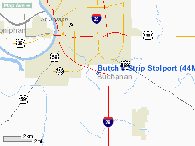
Location & QuickFacts
| FAA Information Effective: | 2008-09-25 |
| Airport Identifier: | 44MO |
| Airport Status: | Operational |
| Longitude/Latitude: | 094-48-07.8680W/39-42-34.9810N
-94.802186/39.709717 (Estimated) |
| Elevation: | 1000 ft / 304.80 m (Estimated) |
| Land: | 0 acres |
| From nearest city: | 1 nautical miles S of St Joseph, MO |
| Location: | Buchanan County, MO |
| Magnetic Variation: | 05E (1985) |
Owner & Manager
| Ownership: | Privately owned |
| Owner: | Merrill L. Ehlert |
| Address: | Rte 4 Box 8
St Joseph, MO 64507 |
| Address: |
|
Airport Operations and Facilities
| Airport Use: | Private |
| Wind indicator: | Yes |
| Segmented Circle: | No |
| Control Tower: | No |
| Landing fee charge: | No |
| Sectional chart: | Kansas City |
| Region: | ACE - Central |
| Boundary ARTCC: | ZKC - Kansas City |
| Tie-in FSS: | COU - Columbia |
| FSS on Airport: | No |
| FSS Toll Free: | 1-800-WX-BRIEF |
Runway Information
Runway 14/32
| Dimension: | 1200 x 45 ft / 365.8 x 13.7 m |
| Surface: | TURF, |
| |
Runway 14 |
Runway 32 |
| Traffic Pattern: | Left | Left |
|
Radio Navigation Aids
| ID |
Type |
Name |
Ch |
Freq |
Var |
Dist |
| AZN | NDB | Amazon | | 233.00 | 06E | 11.6 nm |
| EZZ | NDB | Cameron | | 394.00 | 03E | 24.5 nm |
| DO | NDB | Dotte | | 359.00 | 05E | 29.5 nm |
| GPH | NDB | Mosby | | 284.00 | 03E | 31.7 nm |
| EVU | NDB | Emville | | 317.00 | 05E | 38.7 nm |
| GQ | NDB | Norge | | 517.00 | 05E | 39.6 nm |
| GKB | NDB | Norge | | 517.00 | 05E | 39.6 nm |
| FNB | NDB | Brenner | | 404.00 | 05E | 42.4 nm |
| LXT | NDB | Lesumit | | 263.00 | 04E | 49.3 nm |
| RBA | VOR/DME | Robinson | 019X | 108.20 | 04E | 29.9 nm |
| RIS | VOR/DME | Riverside | 051X | 111.40 | 05E | 36.7 nm |
| BQS | VOR/DME | Braymer | 049X | 111.20 | 03E | 43.1 nm |
| STJ | VORTAC | St Joseph | 102X | 115.50 | 08E | 16.1 nm |
| MCI | VORTAC | Kansas City | 079Y | 113.25 | 05E | 25.7 nm |
| ANX | VORTAC | Napoleon | 087X | 114.00 | 07E | 48.4 nm |
| TOP | VORTAC | Topeka | 125X | 117.80 | 05E | 48.9 nm |
| MKC | VOT | Kansas City Downtown | | 108.60 | | 36.5 nm |
Remarks
- OWNER DESIRES ARPT NOT BE CHARTED.
- PRVDD APCH TO EA RWY IS MAINTD FOR A MIN 15:1 GLIDE SLOPE & TRANSITIONAL SFC BE MAINTD FOR A 4:1 SLOPE; LNDG AREA USED EXCLUSIVELY BY OWNER.
Images and information placed above are from
http://www.airport-data.com/airport/44MO/
We thank them for the data!
| General Info
|
| Country |
United States
|
| State |
MISSOURI
|
| FAA ID |
44MO
|
| Latitude |
39-42-34.981N
|
| Longitude |
094-48-07.868W
|
| Elevation |
1000 feet
|
| Near City |
ST JOSEPH
|
We don't guarantee the information is fresh and accurate. The data may
be wrong or outdated.
For more up-to-date information please refer to other sources.
|
|


