 |
|
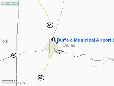
Buffalo Municipal Airport |
Location & QuickFacts
| FAA Information Effective: | 2008-09-25 |
| Airport Identifier: | H17 |
| Airport Status: | Operational |
| Longitude/Latitude: | 093-05-13.2000W/37-39-14.7000N
-93.087000/37.654083 (Estimated) |
| Elevation: | 1154 ft / 351.74 m (Estimated) |
| Land: | 67 acres |
| From nearest city: | 1 nautical miles N of Buffalo, MO |
| Location: | Dallas County, MO |
| Magnetic Variation: | 04E (1985) |
Owner & Manager
| Ownership: | Publicly owned |
| Owner: | City Of Buffalo |
| Address: | Po Box 410
Buffalo, MO 65622 |
| Phone number: | 417-345-2701 |
| Manager: | Bret Viets |
| Address: | P O Box 620
Buffalo, MO 65622 |
| Phone number: | 417-345-2233
ALT. PHONE 417-733-0030. |
Airport Operations and Facilities
| Airport Use: | Open to public |
| Wind indicator: | Yes |
| Segmented Circle: | Yes |
| Control Tower: | No |
| Lighting Schedule: | DUSK-DAWN
ACTVT LIRL RY 03/21 & PERIMETER LGTS - CTAF. |
| Beacon Color: | Clear-Green (lighted land airport) |
| Landing fee charge: | No |
| Sectional chart: | Kansas City |
| Region: | ACE - Central |
| Boundary ARTCC: | ZKC - Kansas City |
| Tie-in FSS: | COU - Columbia |
| FSS on Airport: | No |
| FSS Toll Free: | 1-800-WX-BRIEF |
| NOTAMs Facility: | COU (NOTAM-d service avaliable) |
| Federal Agreements: | 1 |
Airport Communications
Airport Services
| Bottled Oxygen: | NONE |
| Bulk Oxygen: | NONE |
Runway Information
Runway 03/21
| Dimension: | 3220 x 50 ft / 981.5 x 15.2 m
WIDTH VARIANCE 50-52 FT. |
| Surface: | ASPH, Good Condition
ISOLATED AREAS WITH GRASS GROWING IN CRACKS. |
| Edge Lights: | Low
5 LANDING DIRECTION LIGHTS EXTENDING NORTHEAST. |
| |
Runway 03 |
Runway 21 |
| Longitude: | 093-05-24.4800W | 093-05-01.9000W |
| Latitude: | 37-39-01.5400N | 37-39-27.8100N |
| Traffic Pattern: | Left | Left |
| Markings: | Basic, Good Condition | Basic, Good Condition |
| Displaced threshold: | 272.00 ft | 0.00 ft |
| Obstruction: | 53 ft trees, 340.0 ft from runway, 15 ft left of centerline, 2:1 slope to clear
RWY 03 APCH SLOPE 11:1 TO DSPLCD THLD; +1-60 FT TREES & TIED DOWN ACFT; 0-650 FT FM RY END, L & R; DSPLCD THLD 5 FT LOWER THAN RY END.
RWY 03 +1-53 FT TREES, FENCES, PART OF APRON, 35-200 FT FM RY END, L/R. | 55 ft tree, 264.0 ft from runway, 128 ft left of centerline, 1:1 slope to clear
RWY 21 +1-35 FT FENCES, HAY BALES, & BRUSH 0-200 FT FM RY END, L/R. |
|
Helipad H1
| Dimension: | 40 x 40 ft / 12.2 x 12.2 m
WIDTH VARIANCE 50-52 FT. |
| Surface: | ASPH, Good Condition
ISOLATED AREAS WITH GRASS GROWING IN CRACKS. |
| |
Runway H1 |
Runway |
| Traffic Pattern: | Left | Left |
| Markings: | Basic, Good Condition | , |
|
Radio Navigation Aids
| ID |
Type |
Name |
Ch |
Freq |
Var |
Dist |
| IEB | NDB | Lebanon | | 414.00 | 03E | 21.0 nm |
| ILJ | NDB | Willard | | 254.00 | 03E | 27.2 nm |
| AIZ | NDB | Kaiser | | 377.00 | 05E | 36.7 nm |
| AOV | NDB | Bilmart | | 341.00 | 02E | 45.6 nm |
| BHN | NDB | Buckhorn | | 391.00 | 03E | 46.8 nm |
| TBN | VOR | Forney | | 110.00 | 03E | 45.4 nm |
| SHY | VOR/DME | Sunshine | 021X | 108.40 | 05E | 32.7 nm |
| SGF | VORTAC | Springfield | 116X | 116.90 | 04E | 21.4 nm |
| DGD | VORTAC | Dogwood | 031X | 109.40 | 06E | 39.2 nm |
Remarks
- ULTRALIGHT ACFT ON & INVOF ARPT.
- WILDLIFE ON AND INVOF ARPT.
- INSUF RY SAFETY AREA LENGTH BYD EACH RY END; FENCES, BRUSH, TREES.
- APCH SLOPE 8 TO 1 TO HELIPAD FROM NORTHEAST; ARPT BEACON 260 FT SOUTH OF HELIPAD, 5 TO 1 APCH SLOPE.
Images and information placed above are from
http://www.airport-data.com/airport/H17/
We thank them for the data!
| General Info
|
| Country |
United States
|
| State |
MISSOURI
|
| FAA ID |
H17
|
| Latitude |
37-39-15.143N
|
| Longitude |
093-05-15.673W
|
| Elevation |
1154 feet
|
| Near City |
BUFFALO
|
We don't guarantee the information is fresh and accurate. The data may
be wrong or outdated.
For more up-to-date information please refer to other sources.
|
|


