 |
|
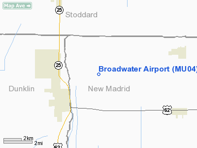
Location & QuickFacts
| FAA Information Effective: | 2008-09-25 |
| Airport Identifier: | MU04 |
| Airport Status: | Operational |
| Longitude/Latitude: | 089-55-12.3200W/36-35-23.2080N
-89.920089/36.589780 (Estimated) |
| Elevation: | 280 ft / 85.34 m (Estimated) |
| Land: | 0 acres |
| From nearest city: | 3 nautical miles NE of Malden, MO |
| Location: | New Madrid County, MO |
| Magnetic Variation: | 02E (1985) |
Owner & Manager
| Ownership: | Privately owned |
| Owner: | Paul Fisher |
| Address: | Po Box 280
Sikeston, MO 63801 |
| Phone number: | 314-471-1607 |
| Manager: | Paul Fisher |
| Address: | Po Box 280
Sikeston, MO 63801 |
| Phone number: | 314-471-1607 |
Airport Operations and Facilities
| Airport Use: | Private |
| Wind indicator: | No |
| Segmented Circle: | No |
| Control Tower: | No |
| Landing fee charge: | No |
| Sectional chart: | St Louis |
| Region: | ACE - Central |
| Boundary ARTCC: | ZME - Memphis |
| Tie-in FSS: | STL - Saint Louis |
| FSS on Airport: | No |
| FSS Toll Free: | 1-800-WX-BRIEF |
Runway Information
Runway 18/36
| Dimension: | 4000 x 100 ft / 1219.2 x 30.5 m |
| Surface: | TURF, |
| |
Runway 18 |
Runway 36 |
| Traffic Pattern: | Left | Right |
| Obstruction: | | 30 ft pline, 330.0 ft from runway |
|
Radio Navigation Aids
| ID |
Type |
Name |
Ch |
Freq |
Var |
Dist |
| DXE | NDB | Dexter | | 423.00 | 00E | 12.0 nm |
| FD | NDB | Earli | | 278.00 | 03E | 20.3 nm |
| TKX | NDB | Kennett | | 358.00 | 00E | 22.5 nm |
| CHQ | NDB | Charleston | | 208.00 | 01E | 31.2 nm |
| IUI | NDB | Hicks | | 350.00 | 01E | 39.4 nm |
| PGR | NDB | Paragould | | 383.00 | 01E | 42.7 nm |
| MXA | NDB | Manila | | 282.00 | 01E | 43.5 nm |
| DNT | NDB | Nally Dunston | | 343.00 | 01W | 43.6 nm |
| CIR | NDB | Cairo | | 397.00 | 00E | 43.9 nm |
| UC | NDB | Obion | | 212.00 | 00E | 48.1 nm |
| GOJ | VOR | Gosnell | | 111.80 | 01E | 38.4 nm |
| CGI | VOR/DME | Cape Girardeau | 076X | 112.90 | 01E | 41.8 nm |
| MAW | VORTAC | Malden | 049X | 111.20 | 03E | 2.1 nm |
| DYR | VORTAC | Dyersburg | 115X | 116.80 | 03E | 45.1 nm |
Remarks
- PRVDD THE OWNER/OPERATOR ENSURE ALL USERS OF THE BROADWATER ARPT MAINT NON-STD TFC PATS (RGT TFC) TO RWY 36. & ALL TFC PATS SHALL BE CONDUCTED ON EAST SIDE OF RWY & APCH TO EACH RWY IS MAINTD FOR A MIN 20:1 GS & THE TRSNL SFC MAINTD FOR A 7:1 SLOPE.
Images and information placed above are from
http://www.airport-data.com/airport/MU04/
We thank them for the data!
| General Info
|
| Country |
United States
|
| State |
MISSOURI
|
| FAA ID |
MU04
|
| Latitude |
36-35-23.208N
|
| Longitude |
089-55-12.320W
|
| Elevation |
280 feet
|
| Near City |
MALDEN
|
We don't guarantee the information is fresh and accurate. The data may
be wrong or outdated.
For more up-to-date information please refer to other sources.
|
|


