 |
|
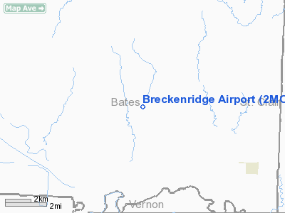
Location & QuickFacts
| FAA Information Effective: | 2008-09-25 |
| Airport Identifier: | 2MO4 |
| Airport Status: | Operational |
| Longitude/Latitude: | 094-10-36.0000W/38-06-52.0000N
-94.176667/38.114444 (Estimated) |
| Elevation: | 805 ft / 245.36 m (Estimated) |
| Land: | 40 acres |
| From nearest city: | 6 nautical miles NW of Rockville, MO |
| Location: | Bates County, MO |
| Magnetic Variation: | 04E (1990) |
Owner & Manager
| Ownership: | Privately owned |
| Owner: | Jim Breckenridge |
| Address: | Rt. 3
Appleton City, MO 64724 |
| Phone number: | 417-395-2397 |
| Manager: | Jim Breckenridge |
| Address: | Rt. 3
Appleton City, MO 64724 |
| Phone number: | 417-395-2397 |
Airport Operations and Facilities
| Airport Use: | Private |
| Wind indicator: | Yes |
| Segmented Circle: | No |
| Control Tower: | No |
| Landing fee charge: | No |
| Sectional chart: | Kansas City |
| Region: | ACE - Central |
| Boundary ARTCC: | ZKC - Kansas City |
| Tie-in FSS: | COU - Columbia |
| FSS Toll Free: | 1-800-WX-BRIEF |
Runway Information
Runway 18/36
| Dimension: | 2500 x 60 ft / 762.0 x 18.3 m |
| Surface: | TURF, |
| |
Runway 18 |
Runway 36 |
| Traffic Pattern: | Left | Right |
| Displaced threshold: | 100.00 ft | 0.00 ft |
| Obstruction: | 4 ft fence, 100.0 ft from runway | 20 ft plines, 1420.0 ft from runway |
|
Radio Navigation Aids
| ID |
Type |
Name |
Ch |
Freq |
Var |
Dist |
| EAD | NDB | Nevada | | 209.00 | 06E | 16.5 nm |
| GLY | NDB | Golden Valley | | 388.00 | 04E | 27.5 nm |
| FSK | NDB | Fort Scott | | 379.00 | 05E | 33.8 nm |
| LLU | NDB | Spring River | | 356.00 | 05E | 38.2 nm |
| HCK | NDB | Hawks | | 296.00 | 04E | 42.0 nm |
| PTS | NDB | Pittsburg | | 365.00 | 05E | 48.1 nm |
| SZL | TACAN | Whiteman | 035X | | 04E | 47.6 nm |
| BUM | VORTAC | Butler | 106X | 115.90 | 07E | 17.5 nm |
Remarks
- PRVDD THE APCH TO EACH RY IS MAINTD FOR MIN OF 20:1 GS & TRANSITIONAL SFC BE MAINTD FOR A 7:1 SLOPE. A WRITTEN AGMT IS MADE & ADHERED TO BTN BRECKENRIDGE & BAUER PGI ARPT, APPLETON CITY, MO. TFC PATS WILL BE MADE TO THE W OF BAUER PGI & BRECKENRIDGE ARPT WILL MAKE TFC PATS TO THE E.
Images and information placed above are from
http://www.airport-data.com/airport/2MO4/
We thank them for the data!
| General Info
|
| Country |
United States
|
| State |
MISSOURI
|
| FAA ID |
2MO4
|
| Latitude |
38-06-52.000N
|
| Longitude |
094-10-36.000W
|
| Elevation |
805 feet
|
| Near City |
ROCKVILLE
|
We don't guarantee the information is fresh and accurate. The data may
be wrong or outdated.
For more up-to-date information please refer to other sources.
|
|


