 |
|
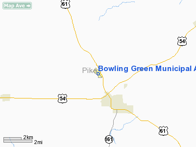
Bowling Green Municipal Airport |
Location & QuickFacts
| FAA Information Effective: | 2008-09-25 |
| Airport Identifier: | H19 |
| Airport Status: | Operational |
| Longitude/Latitude: | 091-13-09.3200W/39-22-11.7610N
-91.219256/39.369934 (Estimated) |
| Elevation: | 886 ft / 270.05 m (Surveyed) |
| Land: | 42 acres |
| From nearest city: | 2 nautical miles NW of Bowling Green, MO |
| Location: | Pike County, MO |
| Magnetic Variation: | 01E (2000) |
Owner & Manager
| Ownership: | Publicly owned |
| Owner: | City Of Bowling Green |
| Address: | 16 W Church St
Bowling Green, MO 63334 |
| Phone number: | 573-324-5451 |
| Manager: | Jim Saucier
AIRPORT BOARD CHAIRMAN. |
| Address: | 16 W Church St
Bowling Green, MO 63334 |
| Phone number: | 573-324-2278
AIRPORT PHONE (573) 324-3300 |
Airport Operations and Facilities
| Airport Use: | Open to public |
| Wind indicator: | Yes |
| Segmented Circle: | Yes |
| Control Tower: | No |
| Lighting Schedule: | DUSK-DAWN
ACTVT LIRL RY 13/31 AFT 2100 - CTAF. |
| Beacon Color: | Clear-Green (lighted land airport) |
| Landing fee charge: | No |
| Sectional chart: | Kansas City |
| Region: | ACE - Central |
| Boundary ARTCC: | ZKC - Kansas City |
| Tie-in FSS: | STL - Saint Louis |
| FSS on Airport: | No |
| FSS Toll Free: | 1-800-WX-BRIEF |
| NOTAMs Facility: | STL (NOTAM-d service avaliable) |
| Federal Agreements: | NY1 |
Airport Communications
| CTAF: | 122.800 |
| Unicom: | 122.800
UNICOM NOT MONITORED ON REGULAR BASIS. |
Airport Services
| Fuel available: | 100LL
FUEL AVAILABLE 24 HRS. |
| Airframe Repair: | MINOR |
| Power Plant Repair: | MINOR
ALL MAINTENANCE ON LIMITED BASIS. |
| Bottled Oxygen: | NONE |
| Bulk Oxygen: | NONE |
Runway Information
Runway 13/31
| Dimension: | 3204 x 50 ft / 976.6 x 15.2 m |
| Surface: | ASPH, Good Condition |
| Weight Limit: | Single wheel: 12500 lbs. |
| Edge Lights: | Non-standard lighting system
NTSD LIRL; INCORRECT NMBR OF THLD LGTS AT EACH RY END, AMBER/WHITE SPLIT LENS MISSING LAST 1,602 FT OF EACH RY, LGTS IN POOR CONDITION. |
| |
Runway 13 |
Runway 31 |
| Longitude: | 091-13-23.9200W | 091-12-54.8200W |
| Latitude: | 39-22-22.8400N | 39-22-00.6500N |
| Elevation: | 872.00 ft | 886.00 ft |
| Alignment: | 127 | 127 |
| Traffic Pattern: | Left | Left |
| Markings: | Non-precision instrument, Good Condition | Non-precision instrument, Good Condition |
| Obstruction: | 36 ft trees, 421.0 ft from runway, 178 ft right of centerline, 6:1 slope to clear
RWY 13 +1-64 FT BRUSH, TREES, FENCE, 0-200 FT FM RWY END, 120-250 FT L; +1-10 FT FENCE, BRUSH, & TREES, 0-200 FT FM RWY END, 42-207 FT R. | 20 ft trees, 219.0 ft from runway, 102 ft left of centerline, 1:1 slope to clear
RWY 31 +1-3 FT HI GND; 0-200 FT FROM RY END 35-250 FT LEFT; +1-4 FT HIGH GND, 0-100 FT FM RWY END, 78-250 FT L. |
|
Radio Navigation Aids
| ID |
Type |
Name |
Ch |
Freq |
Var |
Dist |
| HAE | NDB | Hannibal | | 411.00 | 03E | 24.0 nm |
| PPQ | NDB | Pittsfield | | 344.00 | 02E | 26.0 nm |
| UI | NDB | Quincy | | 293.00 | 02E | 31.1 nm |
| FTT | NDB | Guthrie | | 317.00 | 03E | 48.4 nm |
| LM | NDB | Oblio | | 338.00 | 00E | 48.8 nm |
| UIN | VORTAC | Quincy | 083X | 113.60 | 05E | 28.9 nm |
| FTZ | VORTAC | Foristell | 045X | 110.80 | 05E | 42.2 nm |
| HLV | VORTAC | Hallsville | 089X | 114.20 | 06E | 45.0 nm |
| STL | VORTAC | St Louis | 121X | 117.40 | 01E | 46.0 nm |
Remarks
- DO NOT OVERFLY PRISON AREA.
Images and information placed above are from
http://www.airport-data.com/airport/H19/
We thank them for the data!
| General Info
|
| Country |
United States
|
| State |
MISSOURI
|
| FAA ID |
H19
|
| Latitude |
39-22-11.761N
|
| Longitude |
091-13-09.320W
|
| Elevation |
886 feet
|
| Near City |
BOWLING GREEN
|
We don't guarantee the information is fresh and accurate. The data may
be wrong or outdated.
For more up-to-date information please refer to other sources.
|
|


