 |
|
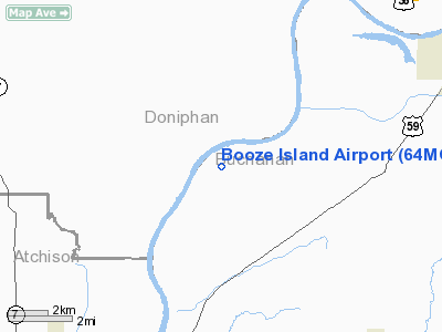
Location & QuickFacts
| FAA Information Effective: | 2008-09-25 |
| Airport Identifier: | 64MO |
| Airport Status: | Operational |
| Longitude/Latitude: | 095-00-47.8860W/39-39-54.9800N
-95.013302/39.665272 (Estimated) |
| Elevation: | 794 ft / 242.01 m (Estimated) |
| Land: | 0 acres |
| From nearest city: | 9 nautical miles SW of St Joseph, MO |
| Location: | Buchanan County, MO |
| Magnetic Variation: | 05E (1985) |
Owner & Manager
| Ownership: | Privately owned |
| Owner: | Jeffrey V Gaskill |
| Address: | 26160 Hiway Jj
Weston, MO 64098 |
| Phone number: | 816-386-5412 |
| Manager: | Jeffrey V Gaskill |
| Address: | 26160 Hiway Jj
Weston, MO 64098 |
| Phone number: | 816-386-5412 |
Airport Operations and Facilities
| Airport Use: | Private |
| Wind indicator: | Yes |
| Segmented Circle: | No |
| Control Tower: | No |
| Landing fee charge: | No |
| Sectional chart: | Kansas City |
| Region: | ACE - Central |
| Boundary ARTCC: | ZKC - Kansas City |
| Tie-in FSS: | COU - Columbia |
| FSS on Airport: | No |
| FSS Toll Free: | 1-800-WX-BRIEF |
Runway Information
Runway 03/21
| Dimension: | 3260 x 80 ft / 993.6 x 24.4 m |
| Surface: | TURF, |
| |
Runway 03 |
Runway 21 |
| Traffic Pattern: | Left | Left |
| Obstruction: | 7 ft levee, 100.0 ft from runway | 17 ft levee, 600.0 ft from runway |
|
Radio Navigation Aids
| ID |
Type |
Name |
Ch |
Freq |
Var |
Dist |
| AZN | NDB | Amazon | | 233.00 | 06E | 14.0 nm |
| DO | NDB | Dotte | | 359.00 | 05E | 29.4 nm |
| EZZ | NDB | Cameron | | 394.00 | 03E | 34.5 nm |
| FNB | NDB | Brenner | | 404.00 | 05E | 36.2 nm |
| GPH | NDB | Mosby | | 284.00 | 03E | 37.9 nm |
| GQ | NDB | Norge | | 517.00 | 05E | 39.9 nm |
| GKB | NDB | Norge | | 517.00 | 05E | 39.9 nm |
| EVU | NDB | Emville | | 317.00 | 05E | 41.3 nm |
| TO | NDB | Biloy | | 521.00 | 05E | 45.3 nm |
| RBA | VOR/DME | Robinson | 019X | 108.20 | 04E | 22.0 nm |
| RIS | VOR/DME | Riverside | 051X | 111.40 | 05E | 38.0 nm |
| STJ | VORTAC | St Joseph | 102X | 115.50 | 08E | 18.2 nm |
| MCI | VORTAC | Kansas City | 079Y | 113.25 | 05E | 26.2 nm |
| TOP | VORTAC | Topeka | 125X | 117.80 | 05E | 40.3 nm |
| MKC | VOT | Kansas City Downtown | | 108.60 | | 37.9 nm |
Remarks
- PROVIDED THE APPROACH TO EACH RWY IS MAINTAINED FOR A MINIMUM 20:1 GLIDE SLOPE AND THE TRANSITIONAL SURFACE BE MAINTAINED FOR A 7:1 SLOPE.
Images and information placed above are from
http://www.airport-data.com/airport/64MO/
We thank them for the data!
| General Info
|
| Country |
United States
|
| State |
MISSOURI
|
| FAA ID |
64MO
|
| Latitude |
39-39-54.980N
|
| Longitude |
095-00-47.886W
|
| Elevation |
794 feet
|
| Near City |
ST JOSEPH
|
We don't guarantee the information is fresh and accurate. The data may
be wrong or outdated.
For more up-to-date information please refer to other sources.
|
|


