 |
|
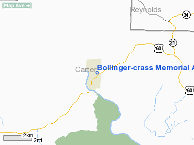
Bollinger - Crass Memorial Airport |
Location & QuickFacts
| FAA Information Effective: | 2008-09-25 |
| Airport Identifier: | MO5 |
| Airport Status: | Operational |
| Longitude/Latitude: | 091-00-24.8000W/37-00-33.8000N
-91.006889/37.009389 (Estimated) |
| Elevation: | 647 ft / 197.21 m (Estimated) |
| Land: | 102 acres |
| From nearest city: | 1 nautical miles N of Van Buren, MO |
| Location: | Carter County, MO |
| Magnetic Variation: | 03E (1985) |
Owner & Manager
| Ownership: | Publicly owned |
| Owner: | City Of Van Buren |
| Address: | 1301 Main St, Box 40
Van Buren, MO 63965 |
| Phone number: | 573-323-4335 |
| Manager: | Ron Keeney
PUBLIC WORKS DIRECTOR. |
| Address: | Hwy 60 E, Box 40
Van Buren, MO 63965 |
| Phone number: | 573-323-4335 |
Airport Operations and Facilities
| Airport Use: | Open to public |
| Wind indicator: | No |
| Segmented Circle: | Yes
POOR CONDITION |
| Control Tower: | No |
| Lighting Schedule: | DUSK-DAWN |
| Landing fee charge: | No |
| Sectional chart: | Kansas City |
| Region: | ACE - Central |
| Boundary ARTCC: | ZME - Memphis |
| Tie-in FSS: | STL - Saint Louis |
| FSS on Airport: | No |
| FSS Toll Free: | 1-800-WX-BRIEF |
| NOTAMs Facility: | STL (NOTAM-d service avaliable) |
Airport Communications
Airport Services
Runway Information
Runway 02/20
| Dimension: | 2600 x 50 ft / 792.5 x 15.2 m |
| Surface: | ASPH, Poor Condition
LARGE CRACKS WITH GRASS AND WEEDS GROWING IN THEM. ROUGH SURFACE. |
| Surface Treatment: | Rubberized Friction Seal Coat |
| Edge Lights: | Low
MANY EDGE AND THLD LIGHTS BROKEN AND MISSING. |
| |
Runway 02 |
Runway 20 |
| Longitude: | 091-00-32.3500W | 091-00-17.3000W |
| Latitude: | 37-00-22.4800N | 37-00-45.1900N |
| Traffic Pattern: | Left | Left |
| Markings: | Nonstandard, Fair Condition
INCORRECT WIDTH OF DESIGNATION NMBRS. | Nonstandard, Fair Condition
INCORRECT WIDTH OF DESIGNATION NMBRS. |
| Obstruction: | 13 ft brush, 278.0 ft from runway, 22 ft left of centerline, 6:1 slope to clear
RWY 02 1-17 FT BRUSH & TREES, TALL WEEDS & HIGH GND, 0-200 FT FM RY END, L&R. | 34 ft trees, 280.0 ft from runway, 34 ft left of centerline, 2:1 slope to clear
RWY 20 +1-33 FT BRUSH & TREES 0-75 FT FM RY END, 100-120 FT L. |
|
Radio Navigation Aids
| ID |
Type |
Name |
Ch |
Freq |
Var |
Dist |
| MNF | NDB | Mountain View | | 365.00 | 03E | 33.9 nm |
| FD | NDB | Earli | | 278.00 | 03E | 38.5 nm |
| UNO | NDB | Pomona | | 335.00 | 02E | 43.7 nm |
| TNZ | NDB | Lawrence County | | 227.00 | 01E | 48.5 nm |
| HUW | VOR/DME | Hutton | 053X | 111.60 | 02E | 43.7 nm |
Remarks
- DEER & WILDLIFE ON & INVOF ARPT.
- NIGHT OPERATIONS NOT RECOMMENDED.
- NTSD RY SAFETY AREA ALONG SIDES OF RY AND BYD RY 20 END. LARGE DROP-OFFS, INCORRECT TERRAIN GRADIENTS, BRUSH & TREES.
- RY 02/20 LIRL OTS INDEFLY.
Images and information placed above are from
http://www.airport-data.com/airport/MO5/
We thank them for the data!
| General Info
|
| Country |
United States
|
| State |
MISSOURI
|
| FAA ID |
MO5
|
| Latitude |
37-00-25.182N
|
| Longitude |
091-00-25.456W
|
| Elevation |
647 feet
|
| Near City |
VAN BUREN
|
We don't guarantee the information is fresh and accurate. The data may
be wrong or outdated.
For more up-to-date information please refer to other sources.
|
|


