 |
|
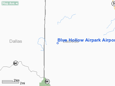
Blue Hollow Airpark Airport |
Location & QuickFacts
| FAA Information Effective: | 2008-09-25 |
| Airport Identifier: | MO13 |
| Airport Status: | Operational |
| Longitude/Latitude: | 092-49-45.0000W/37-47-51.4900N
-92.829167/37.797636 (Estimated) |
| Elevation: | 820 ft / 249.94 m (Estimated) |
| Land: | 30 acres |
| From nearest city: | 5 nautical miles NW of Eldridge, MO |
| Location: | Laclede County, MO |
| Magnetic Variation: | 03E (1995) |
Owner & Manager
| Ownership: | Privately owned |
| Owner: | Don Brand |
| Address: | 11653 Kinfolk Rd
Eldridge, MO 65463 |
| Phone number: | 417-426-5471 |
| Manager: | Don Brand |
| Address: | 11653 Kinfolk Rd
Eldridge, MO 65463 |
| Phone number: | 417-426-5471 |
Airport Operations and Facilities
| Airport Use: | Private |
| Wind indicator: | Yes |
| Segmented Circle: | No |
| Control Tower: | No |
| Region: | ACE - Central |
| Boundary ARTCC: | ZKC - Kansas City |
| Tie-in FSS: | COU - Columbia |
| FSS Toll Free: | 1-800-WX-BRIEF |
Runway Information
Runway 09/27
| Dimension: | 1500 x 100 ft / 457.2 x 30.5 m |
| Surface: | TURF, |
| |
Runway 09 |
Runway 27 |
| Traffic Pattern: | Left | Left |
| Obstruction: | 60 ft trees, 500.0 ft from runway | 60 ft trees, 500.0 ft from runway |
|
Radio Navigation Aids
| ID |
Type |
Name |
Ch |
Freq |
Var |
Dist |
| IEB | NDB | Lebanon | | 414.00 | 03E | 15.8 nm |
| AIZ | NDB | Kaiser | | 377.00 | 05E | 22.2 nm |
| BHN | NDB | Buckhorn | | 391.00 | 03E | 35.0 nm |
| ILJ | NDB | Willard | | 254.00 | 03E | 41.8 nm |
| TBN | VOR | Forney | | 110.00 | 03E | 33.0 nm |
| SHY | VOR/DME | Sunshine | 021X | 108.40 | 05E | 18.1 nm |
| SGF | VORTAC | Springfield | 116X | 116.90 | 04E | 35.8 nm |
| DGD | VORTAC | Dogwood | 031X | 109.40 | 06E | 46.6 nm |
Remarks
- PRVDD A CLEAR APCH TO EA RY FOR A 20:1 GLIDE SLOPE & A CLEAR TRANSITIONAL SFC FOR A 7:1 SLOPE.
Images and information placed above are from
http://www.airport-data.com/airport/MO13/
We thank them for the data!
| General Info
|
| Country |
United States
|
| State |
MISSOURI
|
| FAA ID |
MO13
|
| Latitude |
37-47-51.490N
|
| Longitude |
092-49-45.000W
|
| Elevation |
820 feet
|
| Near City |
ELDRIDGE
|
We don't guarantee the information is fresh and accurate. The data may
be wrong or outdated.
For more up-to-date information please refer to other sources.
|
|


