 |
|
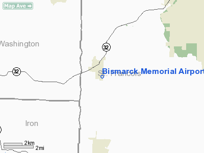
Bismarck Memorial Airport |
Location & QuickFacts
| FAA Information Effective: | 2008-09-25 |
| Airport Identifier: | H57 |
| Airport Status: | Operational |
| Longitude/Latitude: | 090-37-00.5000W/37-45-31.7000N
-90.616806/37.758806 (Estimated) |
| Elevation: | 1038 ft / 316.38 m (Estimated) |
| Land: | 56 acres |
| From nearest city: | 1 nautical miles SE of Bismarck, MO |
| Location: | St Francois County, MO |
| Magnetic Variation: | 02E (1985) |
Owner & Manager
| Ownership: | Publicly owned |
| Owner: | City Of Bismarck
LEASED TO DAN GOVERO. |
| Address: | 924 Center St Box 27
Bismarck, MO 63624 |
| Phone number: | 573-734-2125 |
| Manager: | Dan Govero |
| Address: | 4575 Davis Crossing Rd, Po Box 262
Park Hills, MO 63601 |
| Phone number: | 573-576-3319
ALTERNATE PHONE 573-631-7413. |
Airport Operations and Facilities
| Airport Use: | Open to public |
| Wind indicator: | Yes |
| Segmented Circle: | Yes |
| Control Tower: | No |
| Lighting Schedule: | DUSK-DAWN |
| Beacon Color: | Clear-Green (lighted land airport) |
| Landing fee charge: | No |
| Sectional chart: | St Louis |
| Region: | ACE - Central |
| Boundary ARTCC: | ZKC - Kansas City |
| Tie-in FSS: | STL - Saint Louis |
| FSS on Airport: | No |
| FSS Toll Free: | 1-800-WX-BRIEF |
| NOTAMs Facility: | STL (NOTAM-d service avaliable) |
| Federal Agreements: | 1 |
Airport Communications
Airport Services
Runway Information
Runway 17/35
| Dimension: | 2050 x 50 ft / 624.8 x 15.2 m |
| Surface: | ASPH, Good Condition |
| Edge Lights: | Non-standard lighting system
NSTD LIRL; 2 THLD LGTS 3-7 FT DOWN RY AT EACH THLD. |
| |
Runway 17 |
Runway 35 |
| Longitude: | 090-37-01.6100W | 090-36-59.4800W |
| Latitude: | 37-45-41.7700N | 37-45-21.5600N |
| Traffic Pattern: | Left | Right |
| Markings: | Basic, Fair Condition | Basic, Fair Condition |
| Obstruction: | 34 ft trees, 491.0 ft from runway, 141 ft left of centerline, 8:1 slope to clear | 12 ft tree, 259.0 ft from runway, 121 ft left of centerline, 4:1 slope to clear |
|
Radio Navigation Aids
| ID |
Type |
Name |
Ch |
Freq |
Var |
Dist |
| PRI | NDB | Perrine | | 367.00 | 02E | 8.9 nm |
| FES | NDB | Festus | | 269.00 | 01E | 28.4 nm |
| UUV | NDB | Sullivan | | 356.00 | 02E | 38.6 nm |
| UBX | NDB | Cuba | | 380.00 | 01E | 42.6 nm |
| SAR | NDB | Sparta | | 239.00 | 01E | 49.2 nm |
| FAM | VORTAC | Farmington | 104X | 115.70 | 01E | 18.9 nm |
Remarks
- WILDLIFE ON & INVOF ARPT.
- ESTABLISHED PRIOR TO 1959.
Images and information placed above are from
http://www.airport-data.com/airport/H57/
We thank them for the data!
| General Info
|
| Country |
United States
|
| State |
MISSOURI
|
| FAA ID |
H57
|
| Latitude |
37-45-15.180N
|
| Longitude |
090-37-00.452W
|
| Elevation |
1038 feet
|
| Near City |
BISMARCK
|
We don't guarantee the information is fresh and accurate. The data may
be wrong or outdated.
For more up-to-date information please refer to other sources.
|
|


