 |
|
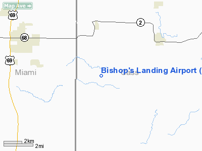
Location & QuickFacts
| FAA Information Effective: | 2008-09-25 |
| Airport Identifier: | 89MO |
| Airport Status: | Operational |
| Longitude/Latitude: | 094-34-46.8360W/38-35-00.0430N
-94.579677/38.583345 (Estimated) |
| Elevation: | 1000 ft / 304.80 m (Estimated) |
| Land: | 0 acres |
| From nearest city: | 4 nautical miles SE of Westline, MO |
| Location: | Cass County, MO |
| Magnetic Variation: | 05E (1985) |
Owner & Manager
| Ownership: | Privately owned |
| Owner: | Bishop's Lndg Home Owrs Assn |
| Address: | Rr 1
Cleveland, MO 64734 |
| Phone number: | 816-899-2952 |
| Manager: | Jeff Hargis |
| Address: | Rr 1, Box 50aa
Cleveland, MO 64734 |
| Phone number: | 816-560-4118 |
Airport Operations and Facilities
| Airport Use: | Private |
| Wind indicator: | Yes |
| Segmented Circle: | No |
| Control Tower: | No |
| Landing fee charge: | No |
| Sectional chart: | Kansas City |
| Region: | ACE - Central |
| Boundary ARTCC: | ZKC - Kansas City |
| Tie-in FSS: | COU - Columbia |
| FSS on Airport: | No |
| FSS Toll Free: | 1-800-WX-BRIEF |
Airport Services
Runway Information
Runway 17/35
| Dimension: | 2460 x 40 ft / 749.8 x 12.2 m |
| Surface: | TURF-DIRT, |
| |
Runway 17 |
Runway 35 |
| Traffic Pattern: | Left | Right |
| Displaced threshold: | 50.00 ft | 200.00 ft |
| Obstruction: | 4 ft fence, 50.0 ft from runway
BRUSH 50' FM APCH END (TRIMED HEDGE). | 4 ft fence, 50.0 ft from runway
ANT 200' FM APCH END 40' HIGH; +BLDG 200' FM APCH END. |
|
Radio Navigation Aids
| ID |
Type |
Name |
Ch |
Freq |
Var |
Dist |
| LXT | NDB | Lesumit | | 263.00 | 04E | 24.7 nm |
| GQ | NDB | Norge | | 517.00 | 05E | 28.9 nm |
| GKB | NDB | Norge | | 517.00 | 05E | 28.9 nm |
| DO | NDB | Dotte | | 359.00 | 05E | 39.1 nm |
| GLY | NDB | Golden Valley | | 388.00 | 04E | 44.2 nm |
| EAD | NDB | Nevada | | 209.00 | 06E | 45.5 nm |
| HCK | NDB | Hawks | | 296.00 | 04E | 47.4 nm |
| GPH | NDB | Mosby | | 284.00 | 03E | 47.6 nm |
| FSK | NDB | Fort Scott | | 379.00 | 05E | 48.1 nm |
| SZL | TACAN | Whiteman | 035X | | 04E | 49.2 nm |
| OJC | VOR/DME | Johnson County | 077X | 113.00 | 06E | 17.1 nm |
| RIS | VOR/DME | Riverside | 051X | 111.40 | 05E | 32.3 nm |
| BUM | VORTAC | Butler | 106X | 115.90 | 07E | 19.2 nm |
| ANX | VORTAC | Napoleon | 087X | 114.00 | 07E | 37.3 nm |
| MCI | VORTAC | Kansas City | 079Y | 113.25 | 05E | 42.8 nm |
| MKC | VOT | Kansas City Downtown | | 108.60 | | 32.5 nm |
Remarks
- RWY 17/35 IS ON TOP OF A HILL.
- CONDL: PRIVIDED APPROACH TO EACH RWY IS MAINTAINED FOR A MIN 20:1 GLIDE SLOPE & THE TRANSITIONAL SURFACE BE MAINTAINED FOR A 7:1 SLOPE.
Images and information placed above are from
http://www.airport-data.com/airport/89MO/
We thank them for the data!
| General Info
|
| Country |
United States
|
| State |
MISSOURI
|
| FAA ID |
89MO
|
| Latitude |
38-35-00.043N
|
| Longitude |
094-34-46.836W
|
| Elevation |
1000 feet
|
| Near City |
WESTLINE
|
We don't guarantee the information is fresh and accurate. The data may
be wrong or outdated.
For more up-to-date information please refer to other sources.
|
|


