 |
|
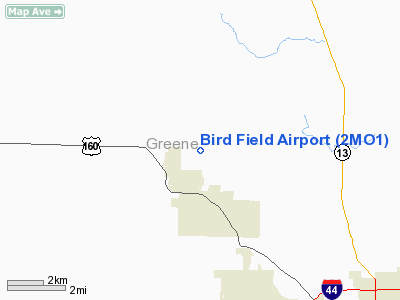
Location & QuickFacts
| FAA Information Effective: | 2008-09-25 |
| Airport Identifier: | 2MO1 |
| Airport Status: | Operational |
| Longitude/Latitude: | 093-25-11.6970W/37-19-12.1670N
-93.419916/37.320046 (Estimated) |
| Elevation: | 1250 ft / 381.00 m (Estimated) |
| Land: | 18 acres |
| From nearest city: | 1 nautical miles N of Willard, MO |
| Location: | Greene County, MO |
| Magnetic Variation: | 04E (1990) |
Owner & Manager
| Ownership: | Privately owned |
| Owner: | Jack Reynolds |
| Address: | 3540 Sheffield Way
Springfield, MO 65802 |
| Phone number: | 417-862-4468 |
| Manager: | Jack Reynolds |
| Address: | 3540 Sheffield Way
Springfield, MO 65802 |
| Phone number: | 417-872-9364 |
Airport Operations and Facilities
| Airport Use: | Private |
| Wind indicator: | Yes |
| Segmented Circle: | No |
| Control Tower: | No |
| Sectional chart: | Kansas City |
| Region: | ACE - Central |
| Boundary ARTCC: | ZKC - Kansas City |
| Tie-in FSS: | COU - Columbia |
| FSS Toll Free: | 1-800-WX-BRIEF |
Runway Information
Runway 18/36
| Dimension: | 1800 x 75 ft / 548.6 x 22.9 m |
| Surface: | TURF, |
| |
Runway 18 |
Runway 36 |
| Traffic Pattern: | Right | Right |
| Obstruction: | 75 ft plines, 500.0 ft from runway | 75 ft trees, 20.0 ft from runway |
|
Radio Navigation Aids
| ID |
Type |
Name |
Ch |
Freq |
Var |
Dist |
| ILJ | NDB | Willard | | 254.00 | 03E | 1.6 nm |
| IEB | NDB | Lebanon | | 414.00 | 03E | 39.4 nm |
| AOV | NDB | Bilmart | | 341.00 | 02E | 41.3 nm |
| PLK | NDB | Point Lookout/dcmsnd | | 204.00 | 03E | 42.6 nm |
| LLU | NDB | Spring River | | 356.00 | 05E | 43.7 nm |
| SGF | VORTAC | Springfield | 116X | 116.90 | 04E | 4.6 nm |
| DGD | VORTAC | Dogwood | 031X | 109.40 | 06E | 31.5 nm |
Remarks
- OWNER DESIRES ARPT NOT BE CHARTED.
- PRVDD APCH TO EACH RY IS MAINTAINED FOR A MINIMUM 20:1 GLIDE SLOPE AND THE TRANSITIONAL SFC MAINTAINED AT A 7:1 SLOPE.
Images and information placed above are from
http://www.airport-data.com/airport/2MO1/
We thank them for the data!
| General Info
|
| Country |
United States
|
| State |
MISSOURI
|
| FAA ID |
2MO1
|
| Latitude |
37-19-12.167N
|
| Longitude |
093-25-11.697W
|
| Elevation |
1250 feet
|
| Near City |
WILLARD
|
We don't guarantee the information is fresh and accurate. The data may
be wrong or outdated.
For more up-to-date information please refer to other sources.
|
|


