 |
|
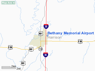
Location & QuickFacts
| FAA Information Effective: | 2008-09-25 |
| Airport Identifier: | 75K |
| Airport Status: | Operational |
| Longitude/Latitude: | 094-00-26.7000W/40-16-36.6000N
-94.007417/40.276833 (Estimated) |
| Elevation: | 1035 ft / 315.47 m (Estimated) |
| Land: | 25 acres |
| From nearest city: | 2 nautical miles NE of Bethany, MO |
| Location: | Harrison County, MO |
| Magnetic Variation: | 04E (1985) |
Owner & Manager
| Ownership: | Publicly owned |
| Owner: | City Of Bethany |
| Address: | 206 N 16th St - Box 344
Bethany, MO 64424 |
| Phone number: | 660-425-3511 |
| Manager: | Tony Stonecypher |
| Address: | 206 N 16th St - Box 344
Bethany, MO 64424 |
| Phone number: | 660-425-3511 |
Airport Operations and Facilities
| Airport Use: | Open to public |
| Wind indicator: | Yes |
| Segmented Circle: | Yes |
| Control Tower: | No |
| Lighting Schedule: | DUSK-DAWN |
| Beacon Color: | Clear-Green (lighted land airport) |
| Landing fee charge: | No |
| Sectional chart: | Omaha |
| Region: | ACE - Central |
| Boundary ARTCC: | ZKC - Kansas City |
| Tie-in FSS: | COU - Columbia |
| FSS on Airport: | No |
| FSS Toll Free: | 1-800-WX-BRIEF |
| NOTAMs Facility: | COU (NOTAM-d service avaliable) |
Airport Communications
Airport Services
| Bottled Oxygen: | NONE |
| Bulk Oxygen: | NONE |
Runway Information
Runway 03/21
| Dimension: | 2255 x 48 ft / 687.3 x 14.6 m |
| Surface: | ASPH, Poor Condition
RY HAS MULTIPLE OPEN CRACKS, PAVEMENT RAVELING AND PRODUCING FOD. |
| Edge Lights: | Non-standard lighting system
NSTD LIRL-THLD LGTS FOR RY 03 LOCATED 40 FT SW OF THLD; RY END LGTS FOR RY 21 LOCATED 15-18 FT NE OF RY END. |
| |
Runway 03 |
Runway 21 |
| Longitude: | 094-00-34.4800W | 094-00-18.9100W |
| Latitude: | 40-16-27.2000N | 40-16-46.0300N |
| Traffic Pattern: | Right | Left |
| Markings: | Nonstandard, Fair Condition
RWY 03 NSTD BSC MARKINGS; RY CNTRLN INCORRECT SPACING OF STRIPES & GAPS AT DESIGNATION MARKING. | Nonstandard, Fair Condition
RWY 21 NSTD BSC MARKINGS; RY CNTRLN INCORRECT SPACING OF STRIPES & GAPS AT DESIGNATION MARKING & INCORRECT LATERAL SPACING OF DESIGNATION NMBRS. |
| Displaced threshold: | 0.00 ft | 143.00 ft |
| Obstruction: | 1 ft gnd, 202.0 ft from runway, 2:1 slope to clear
RWY 03 +1'-3' GND 0'-200' FM RY END, L & R. | 51 ft trees, 245.0 ft from runway, 115 ft right of centerline
RWY 21 APCH SLOPE 0:1 TO DSPLCD THLD. +1-51 FT TREES; BRUSH; FENCES; UTILITY LINES; POLES; HIGH GND & CONSTRUCTION EQUIP; 0-300 FT FM DSPLCD THLD L/R OF CNTRLN 0:1 BASED ON DSPLCD THLD.
+1-51 FT BRUSH; TREES; FENCES; ROADS; UTILITY LINES &POLES 0-200 FT FM RY END L/R. |
|
Radio Navigation Aids
| ID |
Type |
Name |
Ch |
Freq |
Var |
Dist |
| TRX | NDB | Trenton | | 400.00 | 03E | 22.4 nm |
| EZZ | NDB | Cameron | | 394.00 | 03E | 35.1 nm |
| CHT | NDB | Chillicothe | | 375.00 | 03E | 38.2 nm |
| EVU | NDB | Emville | | 317.00 | 05E | 41.8 nm |
| UNE | NDB | Union County | | 379.00 | 04E | 43.7 nm |
| AZN | NDB | Amazon | | 233.00 | 06E | 47.7 nm |
| BQS | VOR/DME | Braymer | 049X | 111.20 | 03E | 39.3 nm |
| LMN | VORTAC | Lamoni | 114X | 116.70 | 07E | 19.3 nm |
| STJ | VORTAC | St Joseph | 102X | 115.50 | 08E | 46.3 nm |
Remarks
- NSTD RY SAFETY AREAS BYD EACH RY END; RY 03 INCORRECT TERRAIN GRADIENTS; RY 21 LARGE DROP OFF, BRUSH, SMALL TREES, FENCE AND ROAD.
Images and information placed above are from
http://www.airport-data.com/airport/75K/
We thank them for the data!
| General Info
|
| Country |
United States
|
| State |
MISSOURI
|
| FAA ID |
75K
|
| Latitude |
40-16-37.004N
|
| Longitude |
094-00-27.828W
|
| Elevation |
1035 feet
|
| Near City |
BETHANY
|
We don't guarantee the information is fresh and accurate. The data may
be wrong or outdated.
For more up-to-date information please refer to other sources.
|
|


