 |
|
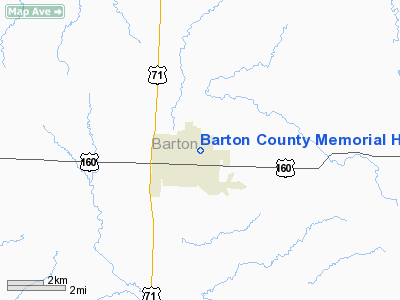
Barton County Memorial Hospital Heliport |
Location & QuickFacts
| FAA Information Effective: | 2008-09-25 |
| Airport Identifier: | MO06 |
| Airport Status: | Operational |
| Longitude/Latitude: | 094-16-07.8120W/37-30-00.5710N
-94.268837/37.500159 (Estimated) |
| Elevation: | 990 ft / 301.75 m (Estimated) |
| Land: | 0 acres |
| From nearest city: | 0 nautical miles N of Lamar, MO |
| Location: | Barton County, MO |
| Magnetic Variation: | 04E (1995) |
Owner & Manager
| Ownership: | Privately owned |
| Owner: | Barton County Memorial Hospital |
| Address: | 2nd & Gulf
Lamar, MO 64759 |
| Phone number: | 417-682-6081 |
| Manager: | Administrator |
| Address: | 2nd & Gulf
Lamar, MO 64759 |
| Phone number: | 417-682-6081 |
Airport Operations and Facilities
| Airport Use: | Private
MEDICAL USE. |
| Wind indicator: | Yes |
| Segmented Circle: | No |
| Control Tower: | No |
| Lighting Schedule: | DUSK-DAWN |
| Region: | ACE - Central |
| Boundary ARTCC: | ZKC - Kansas City |
| Tie-in FSS: | COU - Columbia |
| FSS Toll Free: | 1-800-WX-BRIEF |
Runway Information
Helipad H1
| Dimension: | 50 x 50 ft / 15.2 x 15.2 m |
| Surface: | CONC, |
| |
Runway H1 |
Runway |
| Traffic Pattern: | Left | Left |
|
Radio Navigation Aids
| ID |
Type |
Name |
Ch |
Freq |
Var |
Dist |
| LLU | NDB | Spring River | | 356.00 | 05E | 2.1 nm |
| EAD | NDB | Nevada | | 209.00 | 06E | 21.6 nm |
| PTS | NDB | Pittsburg | | 365.00 | 05E | 22.1 nm |
| FSK | NDB | Fort Scott | | 379.00 | 05E | 29.6 nm |
| ILJ | NDB | Willard | | 254.00 | 03E | 41.3 nm |
| EOS | VOR/DME | Neosho | 120X | 117.30 | 07E | 40.3 nm |
| SGF | VORTAC | Springfield | 116X | 116.90 | 04E | 45.5 nm |
| BUM | VORTAC | Butler | 106X | 115.90 | 07E | 47.6 nm |
| OSW | VORTAC | Oswego | 123X | 117.60 | 08E | 49.2 nm |
Remarks
- MULTI-ENGINE HELICOPTERS ONLY.
- OWNER DESIRES HELIPORT NOT BE CHARTED.
- SEE AIRSPACE LETTER DATED 3/13/98.
Images and information placed above are from
http://www.airport-data.com/airport/MO06/
We thank them for the data!
| General Info
|
| Country |
United States
|
| State |
MISSOURI
|
| FAA ID |
MO06
|
| Latitude |
37-30-00.571N
|
| Longitude |
094-16-07.812W
|
| Elevation |
990 feet
|
| Near City |
LAMAR
|
We don't guarantee the information is fresh and accurate. The data may
be wrong or outdated.
For more up-to-date information please refer to other sources.
|
|


