 |
|
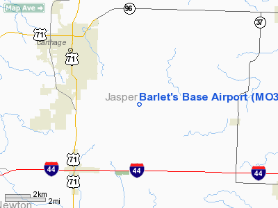
Location & QuickFacts
| FAA Information Effective: | 2008-09-25 |
| Airport Identifier: | MO33 |
| Airport Status: | Operational |
| Longitude/Latitude: | 094-15-13.7930W/37-07-45.2144N
-94.253831/37.129226 (Estimated) |
| Elevation: | 1068 ft / 325.53 m (Estimated) |
| Land: | 5 acres |
| From nearest city: | 3 nautical miles ES of Carthage, MO |
| Location: | Jasper County, MO |
| Magnetic Variation: | 04E (1995) |
Owner & Manager
| Ownership: | Privately owned |
| Owner: | Pam Barlet |
| Address: | 5276 Cr 110
Carthage, MO 64836 |
| Phone number: | 417-358-3399 |
| Manager: | Pam Barlet |
| Address: | 5276 Cr 110
Carthage, MO 64836 |
| Phone number: | 417-358-3399 |
Airport Operations and Facilities
| Airport Use: | Private |
| Wind indicator: | Yes |
| Segmented Circle: | No |
| Control Tower: | No |
| Region: | ACE - Central |
| Boundary ARTCC: | ZAU - Chicago |
| Tie-in FSS: | FOD - Fort Dodge |
| FSS Toll Free: | 1-800-WX-BRIEF |
Runway Information
Runway 01/19
| Dimension: | 2500 x 60 ft / 762.0 x 18.3 m |
| Surface: | TURF, |
| |
Runway 01 |
Runway 19 |
| Traffic Pattern: | Left | Left |
| Obstruction: | 30 ft pline, 1320.0 ft from runway | 50 ft pline, 1320.0 ft from runway |
|
Radio Navigation Aids
| ID |
Type |
Name |
Ch |
Freq |
Var |
Dist |
| LLU | NDB | Spring River | | 356.00 | 05E | 21.7 nm |
| PTS | NDB | Pittsburg | | 365.00 | 05E | 29.4 nm |
| ILJ | NDB | Willard | | 254.00 | 03E | 40.2 nm |
| EAD | NDB | Nevada | | 209.00 | 06E | 43.9 nm |
| FSK | NDB | Fort Scott | | 379.00 | 05E | 47.0 nm |
| EOS | VOR/DME | Neosho | 120X | 117.30 | 07E | 19.3 nm |
| OSW | VORTAC | Oswego | 123X | 117.60 | 08E | 45.5 nm |
| SGF | VORTAC | Springfield | 116X | 116.90 | 04E | 46.1 nm |
Remarks
- OWNER DESIRES ARPT NOT BE CHARTED.
- PRVDD A CLEAR APCH TO EA RY FOR A 20:1 GLIDE SLOPE & A CLEAR TRANSITIONAL SFC FOR A 7:1 SLOPE.
Images and information placed above are from
http://www.airport-data.com/airport/MO33/
We thank them for the data!
| General Info
|
| Country |
United States
|
| State |
MISSOURI
|
| FAA ID |
MO33
|
| Latitude |
37-07-45.214N
|
| Longitude |
094-15-13.793W
|
| Elevation |
1068 feet
|
| Near City |
CARTHAGE
|
We don't guarantee the information is fresh and accurate. The data may
be wrong or outdated.
For more up-to-date information please refer to other sources.
|
|


