 |
|
Location & QuickFacts
| FAA Information Effective: | 2008-09-25 |
| Airport Identifier: | 38MO |
| Airport Status: | Operational |
| Longitude/Latitude: | 090-51-20.4660W/39-15-20.1690N
-90.855685/39.255603 (Estimated) |
| Elevation: | 480 ft / 146.30 m (Estimated) |
| Land: | 0 acres |
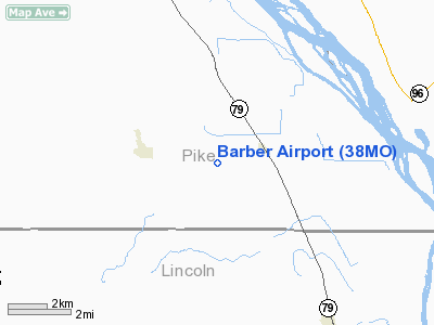
| From nearest city: | 1 nautical miles SW of Annada, MO |
| Location: | Pike County, MO |
| Magnetic Variation: | 02E (1985) |
Owner & Manager
| Ownership: | Privately owned |
| Owner: | Norman E. Barber |
| Address: | Rr 1
Annada, MO 63330 |
| Phone number: | 314-847-2141 |
| Manager: | Norman E. Barber |
| Address: | Rr 1
Annada, MO 63330 |
| Phone number: | 573-847-2369 |
Airport Operations and Facilities
| Airport Use: | Private |
| Wind indicator: | Yes |
| Segmented Circle: | No |
| Control Tower: | No |
| Landing fee charge: | No |
| Sectional chart: | St Louis |
| Region: | ACE - Central |
| Boundary ARTCC: | ZKC - Kansas City |
| Tie-in FSS: | STL - Saint Louis |
| FSS on Airport: | No |
| FSS Toll Free: | 1-800-WX-BRIEF |
Runway Information
Runway 18/36
| Dimension: | 2900 x 60 ft / 883.9 x 18.3 m |
| Surface: | TURF, |
| |
Runway 18 |
Runway 36 |
| Traffic Pattern: | Left | Left |
| Displaced threshold: | 1000.00 ft | 0.00 ft |
| Obstruction: | | 200 ft hill, 0.0 ft from runway |
|
Radio Navigation Aids
| ID |
Type |
Name |
Ch |
Freq |
Var |
Dist |
| PPQ | NDB | Pittsfield | | 344.00 | 02E | 23.4 nm |
| LM | NDB | Oblio | | 338.00 | 00E | 32.6 nm |
| HAE | NDB | Hannibal | | 411.00 | 03E | 39.5 nm |
| UI | NDB | Quincy | | 293.00 | 02E | 42.2 nm |
| CVM | NDB | Civic Memorial | | 263.00 | 02E | 43.2 nm |
| CSX | VOR/DME | Cardinal | 111Y | 116.45 | 00E | 38.1 nm |
| IJX | VOR/DME | Jacksonville | 023X | 108.60 | 02E | 42.4 nm |
| STL | VORTAC | St Louis | 121X | 117.40 | 01E | 29.4 nm |
| FTZ | VORTAC | Foristell | 045X | 110.80 | 05E | 34.2 nm |
| UIN | VORTAC | Quincy | 083X | 113.60 | 05E | 40.6 nm |
| SUS | VOT | Spirit Of St Louis | | 112.20 | | 36.9 nm |
| STL | VOT | St Louis Lambert | | 111.00 | | 38.2 nm |
Remarks
- TKOFF TO NORTH & LAND TO SOUTH.
- (13) EVENINGS CALL; 314-485-2009.
- PRVDD THAT THE APCH TO EA RWY IS MAINTD FOR A MIN 20:1 GLIDE SLOPE AND THAT THE TRSNL SFC BE MAINTD FOR A 7:1 SLOPE.
Images and information placed above are from
http://www.airport-data.com/airport/38MO/
We thank them for the data!
| General Info
|
| Country |
United States
|
| State |
MISSOURI
|
| FAA ID |
38MO
|
| Latitude |
39-15-20.169N
|
| Longitude |
090-51-20.466W
|
| Elevation |
480 feet
|
| Near City |
ANNADA
|
We don't guarantee the information is fresh and accurate. The data may
be wrong or outdated.
For more up-to-date information please refer to other sources.
|
|


