 |
|
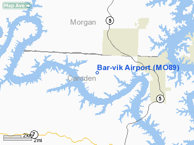
Location & QuickFacts
| FAA Information Effective: | 2008-09-25 |
| Airport Identifier: | MO89 |
| Airport Status: | Operational |
| Longitude/Latitude: | 092-51-30.6860W/38-10-27.1100N
-92.858524/38.174197 (Estimated) |
| Elevation: | 930 ft / 283.46 m (Estimated) |
| Land: | 3 acres |
| From nearest city: | 3 nautical miles SW of Laurie, MO |
| Location: | Camden County, MO |
| Magnetic Variation: | 04E (1985) |
Owner & Manager
| Ownership: | Privately owned |
| Owner: | William Morlan Sr |
| Address: | Rt. 4 Box 292
Gravois Mills, MO 65037 |
| Phone number: | 314-374-1733 |
| Manager: | William Morlan Sr |
| Address: | Rt. 4 Box 292
Gravois Mills, MO 65037 |
| Phone number: | 314-374-1733 |
Airport Operations and Facilities
| Airport Use: | Private |
| Wind indicator: | Yes |
| Segmented Circle: | No |
| Control Tower: | No |
| Sectional chart: | Kansas City |
| Region: | ACE - Central |
| Boundary ARTCC: | ZKC - Kansas City |
| Tie-in FSS: | COU - Columbia |
| FSS on Airport: | No |
| FSS Toll Free: | 1-800-WX-BRIEF |
Runway Information
Runway 14/32
| Dimension: | 2900 x 60 ft / 883.9 x 18.3 m |
| Surface: | TURF, Good Condition |
| |
Runway 14 |
Runway 32 |
| Traffic Pattern: | Left | Left |
| Obstruction: | 30 ft trees, 100.0 ft from runway | |
|
Radio Navigation Aids
| ID |
Type |
Name |
Ch |
Freq |
Var |
Dist |
| AIZ | NDB | Kaiser | | 377.00 | 05E | 15.2 nm |
| DMO | NDB | Sedalia | | 281.00 | 03E | 35.2 nm |
| IEB | NDB | Lebanon | | 414.00 | 03E | 37.5 nm |
| ONH | NDB | Noah | | 515.00 | 03E | 40.1 nm |
| GLY | NDB | Golden Valley | | 388.00 | 04E | 40.5 nm |
| HCK | NDB | Hawks | | 296.00 | 04E | 43.3 nm |
| JE | NDB | Algoa | | 397.00 | 03E | 43.4 nm |
| BHN | NDB | Buckhorn | | 391.00 | 03E | 45.8 nm |
| VER | NDB | Viertel | | 347.00 | 02E | 47.3 nm |
| SZL | TACAN | Whiteman | 035X | | 04E | 46.9 nm |
| TBN | VOR | Forney | | 110.00 | 03E | 42.9 nm |
| SHY | VOR/DME | Sunshine | 021X | 108.40 | 05E | 14.5 nm |
| COU | VOR/DME | Columbia | 039X | 110.20 | 03E | 48.7 nm |
| JEF | VOT | Jefferson City | | 112.00 | | 41.7 nm |
Remarks
- PROVIDED APPROACHES MAINTAINED FOR A 20:1 SLOPE AND TRANSITIONAL SFC FOR A 7:1 SLOPE.
Images and information placed above are from
http://www.airport-data.com/airport/MO89/
We thank them for the data!
| General Info
|
| Country |
United States
|
| State |
MISSOURI
|
| FAA ID |
MO89
|
| Latitude |
38-10-27.110N
|
| Longitude |
092-51-30.686W
|
| Elevation |
930 feet
|
| Near City |
LAURIE
|
We don't guarantee the information is fresh and accurate. The data may
be wrong or outdated.
For more up-to-date information please refer to other sources.
|
|


