 |
|
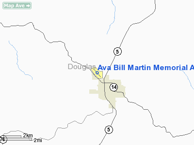
Ava Bill Martin Memorial Airport |
Location & QuickFacts
| FAA Information Effective: | 2008-09-25 |
| Airport Identifier: | AOV |
| Airport Status: | Operational |
| Longitude/Latitude: | 092-40-55.0050W/36-58-18.7940N
-92.681946/36.971887 (Estimated) |
| Elevation: | 1311 ft / 399.59 m (Surveyed) |
| Land: | 62 acres |
| From nearest city: | 2 nautical miles NW of Ava, MO |
| Location: | Douglas County, MO |
| Magnetic Variation: | 02E (2000) |
Owner & Manager
| Ownership: | Publicly owned |
| Owner: | City Of Ava |
| Address: | 127 Sw 2nd Ave
Ava, MO 65608 |
| Phone number: | 417-683-5516 |
| Manager: | Leon Harris |
| Address: | 127 Sw 2nd Ave
Ava, MO 65608 |
| Phone number: | 417-683-7820 |
Airport Operations and Facilities
| Airport Use: | Open to public |
| Wind indicator: | Yes |
| Segmented Circle: | No |
| Control Tower: | No |
| Lighting Schedule: | DUSK-DAWN
ACTVT MIRL RY 13/31 - CTAF. |
| Beacon Color: | Clear-Green (lighted land airport) |
| Landing fee charge: | No |
| Sectional chart: | Kansas City |
| Region: | ACE - Central |
| Boundary ARTCC: | ZKC - Kansas City |
| Tie-in FSS: | COU - Columbia |
| FSS on Airport: | No |
| FSS Toll Free: | 1-800-WX-BRIEF |
| NOTAMs Facility: | COU (NOTAM-d service avaliable) |
Airport Communications
| CTAF: | 122.700 |
| Unicom: | 122.700 |
Airport Services
| Bottled Oxygen: | NONE |
| Bulk Oxygen: | NONE |
Runway Information
Runway 13/31
| Dimension: | 3634 x 50 ft / 1107.6 x 15.2 m |
| Surface: | ASPH, Good Condition
NUMEROUS CRACKS WITH GRASS AND WEEDS GROWING. |
| Edge Lights: | Medium |
| |
Runway 13 |
Runway 31 |
| Longitude: | 092-41-10.1728W | 092-40-39.8334W |
| Latitude: | 36-58-32.0451N | 36-58-05.6189N |
| Elevation: | 1277.00 ft | 1311.00 ft |
| Alignment: | 127 | 127 |
| Traffic Pattern: | Left | Left |
| Markings: | Non-precision instrument, Good Condition
MARKINGS FADED. | Non-precision instrument, Good Condition
MARKINGS FADED. |
| Crossing Height: | 34.00 ft | 0.00 ft |
| VASI: | 2-box SAVASI on left side
VASI OTS INDEFLY. | |
| Visual Glide Angle: | 3.00° | 0.00° |
| Obstruction: | 50 ft trees, 235.0 ft from runway, 197 ft right of centerline | 28 ft trees, 253.0 ft from runway, 205 ft left of centerline, 1:1 slope to clear |
|
Radio Navigation Aids
| ID |
Type |
Name |
Ch |
Freq |
Var |
Dist |
| AOV | NDB | Bilmart | | 341.00 | 02E | 0.3 nm |
| PLK | NDB | Point Lookout/dcmsnd | | 204.00 | 03E | 33.5 nm |
| IEB | NDB | Lebanon | | 414.00 | 03E | 36.1 nm |
| UNO | NDB | Pomona | | 335.00 | 02E | 37.9 nm |
| ILJ | NDB | Willard | | 254.00 | 03E | 41.3 nm |
| MNF | NDB | Mountain View | | 365.00 | 03E | 46.6 nm |
| HUW | VOR/DME | Hutton | 053X | 111.60 | 02E | 38.1 nm |
| FLP | VOR/DME | Flippin | 075X | 112.80 | 03E | 41.8 nm |
| HRO | VOR/DME | Harrison | 072X | 112.50 | 04E | 46.9 nm |
| DGD | VORTAC | Dogwood | 031X | 109.40 | 06E | 9.9 nm |
| SGF | VORTAC | Springfield | 116X | 116.90 | 04E | 38.8 nm |
Remarks
- NTSD RY SAFETY AREA BYD RY 13 END, INSUF LENGTH AND LARGE DROP OFF.
Images and information placed above are from
http://www.airport-data.com/airport/AOV/
We thank them for the data!
| General Info
|
| Country |
United States
|
| State |
MISSOURI
|
| FAA ID |
AOV
|
| Latitude |
36-58-18.794N
|
| Longitude |
092-40-55.005W
|
| Elevation |
1311 feet
|
| Near City |
AVA
|
We don't guarantee the information is fresh and accurate. The data may
be wrong or outdated.
For more up-to-date information please refer to other sources.
|
|


